3D Models from Microdrones
The mdMapper3000DμoG 3D aaS and the mdMapper1000DG 3D aaS are fully integrated drone mapping systems that can be used for high wall mapping and 3D modeling.
These systems will capture all angles and surfaces of your subject with an integrated array of five cameras, seamlessly working together, and integrated into the processing workflow, all backed with the power of direct georeferencing.
To demonstrate the high-quality visualizations that can be captured with these 3D systems, Microdrones has created three sample 3D models showing all angles, roofs and sides of buildings, as well as the detailed texture of all surfaces. The projects flown were the Microdrones office in Vaudreuil-Dorion, Canada, an open-mine in Northern Canada and the High Point Rockers Baseball stadium in North Carolina.
The payload on the mdMapper3000DμoG 3D and mdMapper1000DG 3D consists of an array of 5 cameras all integrated into one oblique sensor system, oriented to collect data from all angles: nadir, front, back, left and right for a combined 120mp.
The Workflow
Each mission was conducted using the Microdrones workflow of Plan, Fly, Process and Visualize. Mission and flight preparation details, as well as the flight parameters and data acquisition will be reviewed for each 3D model. All flights were performed in a single day and the data was processed in the trajectory processing module of mdInfinity to improve the accuracy of the position and attitude of sensor collected during the flight and export the EO file with no IMU gaps for each flight. The final 3D mesh was output in a .3mx format visualized in the ContextCapture web viewer.
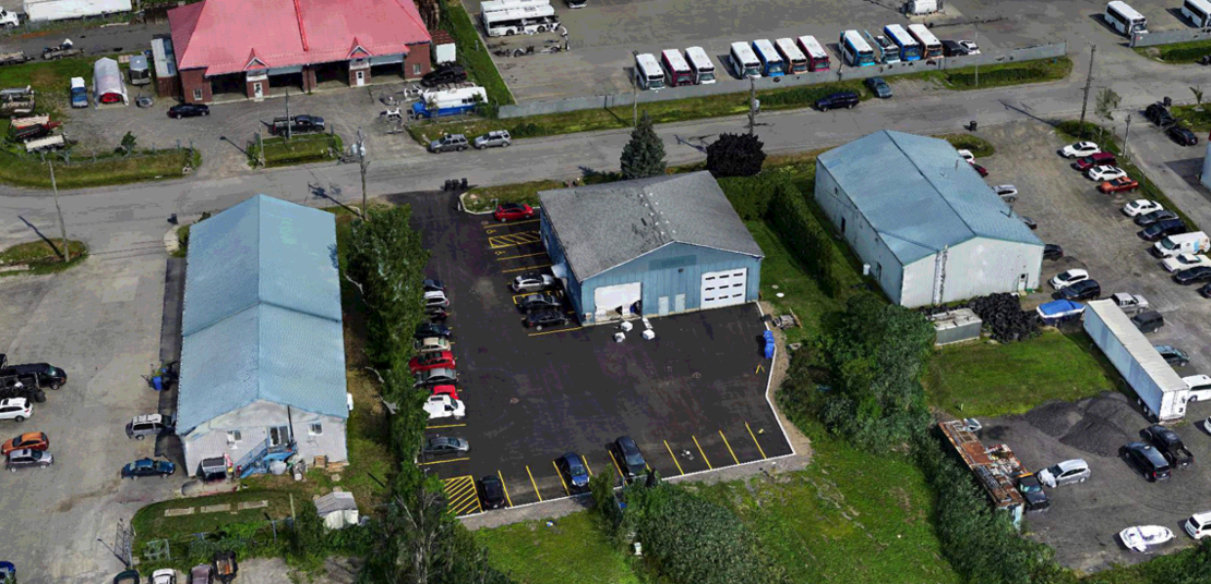
Microdrones Canada Office
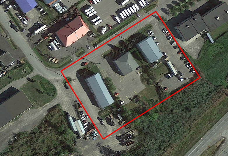
This 3D model shows the Microdrones office in Vaudreuil-Dorion, Canada. The total area of interest was 160m long by 120m wide over a flat terrain. The Data was collected in 1 flight of the mdMapper1000DG 3D, flying at a constant flight altitude of 80 meters at a speed of 3 meters per second. The duration of the flight was 20 minutes with 80x80 overlap. 2 GCP’s were used for quality control.
The 3D model precisely displays all angles, roofs and sides of buildings, as well as the detailed texture of all surfaces in the main area of interest. In a few areas of the model, shadow occurrence prevents some of the fine details and a disarray of linear angles.
Microdrones Canada 3D model
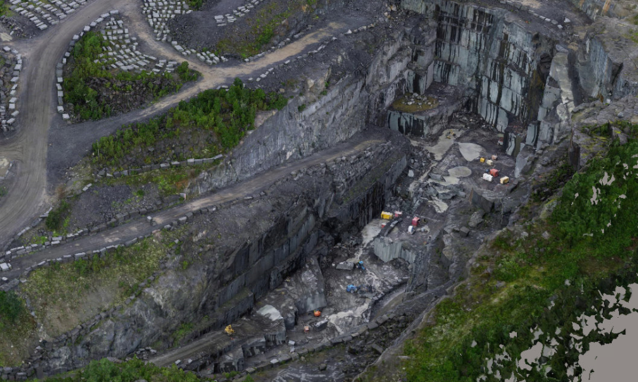
Mine in Northern Canada
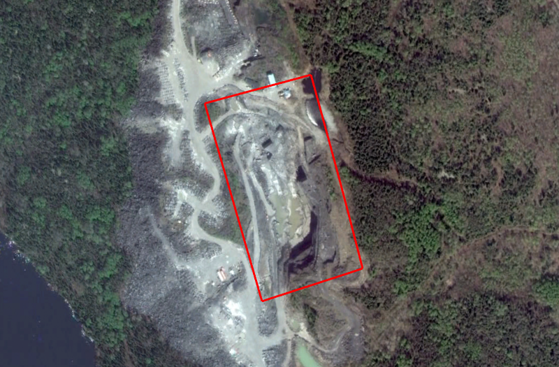
This 3D model displays a mine in northern Canada. The total area of interest was 320m long by 180m wide over an irregular slope of the mine. The data was collected in 2 flights of the mdMapper1000DG 3D, flying at a constant flight altitude of 45 meters at a speed of 4 meters per second. The duration of the 1st flight was 21 minutes and the 2nd flight was 14 minutes with 80x70 overlap. 2 GCP’s were used for quality control over.
The 3D model precisely displays all angles, roofs and sides of buildings, as well as the detailed texture of all surfaces in the main area of interest. In a few areas of the mine 3D model, shadow occurrence prevents some of the fine details and a disarray of linear angles. Some of the vegetation outside the main area of interest has gaps, since it was not included in the flight.
Mine in North Canada 3D Model
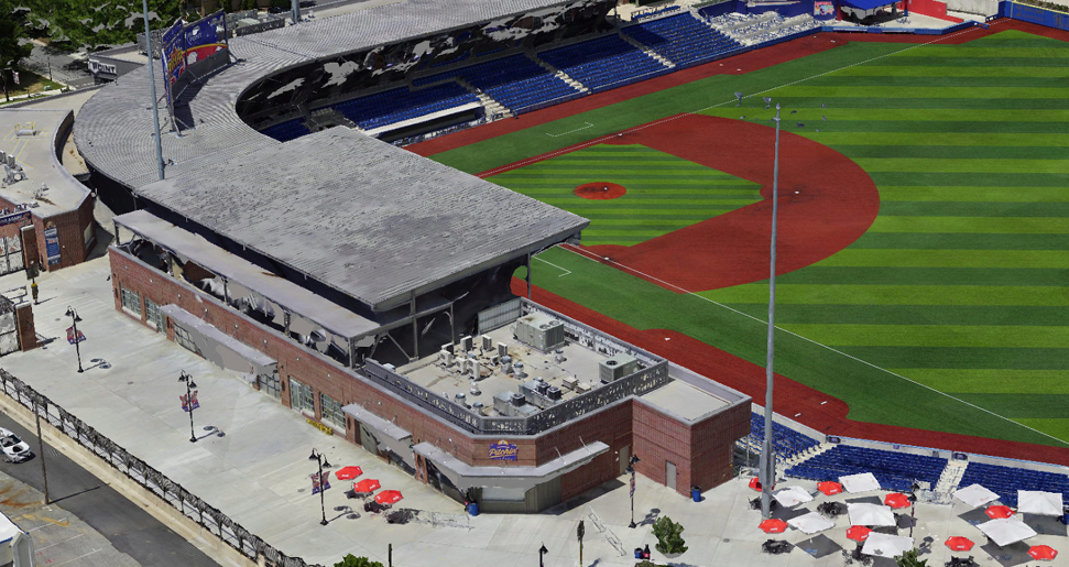
High Point Rockers Baseball Stadium
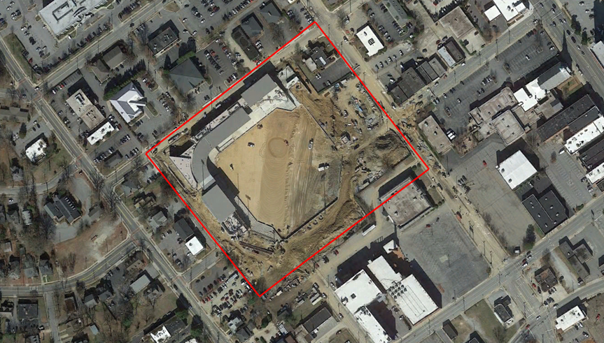
This 3D model displays the High Point Rockers Baseball Stadium in North Carolina. The total area of interest was 240m long by 200m wide over a flat slope. The data was collected in 1 flight of the mdMapper3000DμoG 3D, flying at a constant flight altitude of 60 meters at a speed of 4 meters per second. The duration of the flight was 25 minutes with 80x80 overlap. 12 GCP’s were used for quality control over.
The 3D model precisely displays all angles, roofs and sides of buildings, as well as the detailed texture of all surfaces in the main area of interest. In a few areas of the stadium 3D model, shadow occurrence prevents some of the fine details and a disarray of linear angles. Also, overhead roofing and canopies obstructed portions of the stadium.
High Point Rockers Baseball Stadium 3D Model
If you or your business would like to learn more about processing and visualizing 3D models for your surveying jobs, CLICK HERE to speak with one of our representatives.