The mdLiDAR1000HR is the next generation of industry leading drone Lidar survey equipment offered by Microdrones. The mdLiDAR1000HR uses the lifting power, resilience, and efficiency of the Microdrones aircraft platform to carry a perfectly integrated Velodyne VLP-16 PUCK LiDAR sensor for increased coverage and the ability to deliver high-resolution point clouds.
“The Microdrones mdLiDAR1000HR precision was analyzed by flights between 30 and 60 meters over a wide sample of surfaces (asphalt, gravel, roofs, natural ground) exhibiting different reflectance,” said Dr. Nicolas Seube, mdInfinity Chief Scientist Director R&D. “mdLidar1000HR with a 90 degree field of view for both scanned points and imagery, repeatedly provides a precision of 1.6 cm (.052 ft) at 1-σ when flown at 40 m (130 ft) at a speed of 8 m/s (18 mph). This was confirmed by a repeatability analysis.”
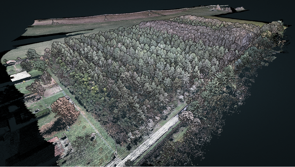
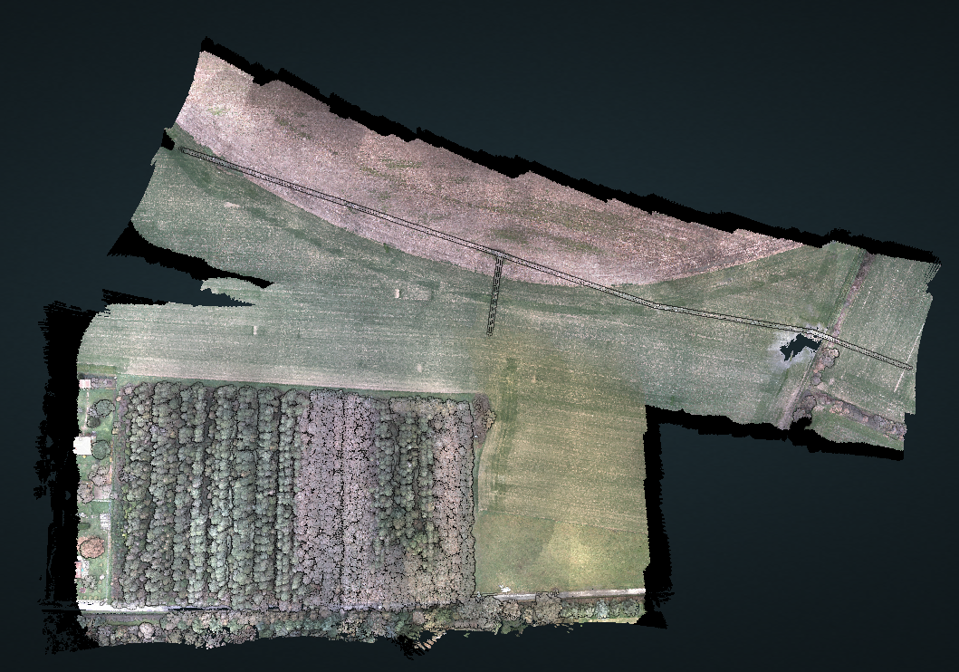
To demonstrate the high-resolution point clouds that can be created from data collected by the mdLiDAR1000HR, Microdrones has provided a dataset complete with some dense forest coverage along with a power line corridor. These point clouds demonstrate the vegetation penetration capabilities and the ability to provide ground classified data with mdInfinity. CLICK HERE to open the viewer.
The Workflow
Each project was conducted using the Microdrones workflow of Plan, Fly, Process and Visualize. Mission and flight preparation details, as well as the flight parameters and data acquisition will be reviewed for each flight.
Plan & Fly
Flight planning begins in mdCockpit and is then verified in the field upon closer inspection of the project. When flight planning is complete, the mission can then begin and the user can choose to autonomously fly the project.
The Data was collected in 1 flight of the mdLiDAR1000HR, flying a grid above the Forest at a constant flight altitude of 60 meters at a speed of 5 meters per second with 60% sidelap. The particular mission was planned with a grid pattern to ensure the needed resolution was captured to detail the individual trees.
To capture the data over the powerline corridor, the mdLiDAR1000HR flew at a height of 40 meters at a speed of 5 meters per second with 60% sidelap. By planning a flightpath parallel to the utility line, the 16 layers of data collected VLP-16 do a great job of capturing the small detail of the overhead utilities.
Process & Visualize
The point cloud was created and processed through the mdInfinity software suite using Trajectory Processing, Geocoding, Strip Adjustment, and Precision Enhancement to insure an accurate and precise point cloud. Using the mdInfinity ground classification routine, vegetation can be removed and the bare earth data can be further processed to develop digital terrain models. Finally using Point Cloud Colorization (without occlusion.) You can colorize the point cloud to visualize the data in its natural colors.
The Main Advantages
The mdLiDAR1000HR provides a higher level of detail and better canopy penetration thanks to the large horizontal and vertical LiDAR field of view. Due to this classification routines can be performed with better precision than with point clouds with a lower density. Note the power lines are captured in the point cloud and highly visible for further analysis.
Data processing modules applied in mdInfinity create a unique layer per layer calibration process to enhance point cloud precision along with the ability to filter LiDAR data for point cloud quality enhancement resulting in best-in-class point cloud accuracy and precision.
If you would like more information on the mdLiDAR1000HR and how to create High Resolution Point Clouds, CLICK HERE to speak with one of our friendly representatives.