The UAV just might be the most versatile tool for communicating critical project information in a socially distant, safe manner.

Olsson, a nationally recognized, employee-owned engineering and design firm, utilizes drone technology in their surveying projects. Microdrones would like to share their recent article on how they are utilizing UAV systems, like the mdLiDAR3000DL, to keep projects moving during the pandemic.
by Steve VanVoltenberg, Olsson Survey Practice Leader
Original article can be found HERE
The emergence of the COVID-19 pandemic has imposed corporate travel restrictions that prevent many of Olsson’s clients from flying to project sites.
So, we’ve come up with a way to fly project sites to our clients.
Our delivery method involves unmanned aerial vehicles (UAVs), precision lidar sensors, ultra-high-definition video technology, and a squadron of Olsson geospatial professionals who have logged thousands of hours safely piloting drones. The system combines quick mobilization, minimal person-to-person contact, and the ability to capture detailed site information from practically any location – at a reasonable cost.
It’s an effective combination for the times. Here is how it works:
Say a client needs to conduct a critical visual inspection of a site but travel restrictions prevent members of the project team from flying in. We can get our staff to a project over the road or on our corporate aircraft. What’s more, one of our senior surveyors is an experienced private pilot with access to a range of aircraft including a Cessna 182 Skylane, which allows him to access even the most remote airports.
We have also incorporated a series of COVID-19 guidelines into our company health and safety plan, including a daily pre-task health protocol designed to protect our staff while continuing to provide our full range of services.
Depending on project scope, members of our UAV team can often complete the work solo or in pairs. Sending no more than two people to a project location makes it much easier to manage worksite distancing and access requirements.
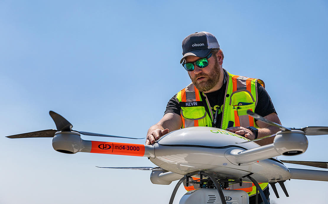
The pandemic has put a premium on minimizing physical time on a worksite, which plays to another strength of UAV systems. Once on site, most drone photography or video projects can be completed in less than a day. If what you need is a complete site video or catalog of 4K stills, our UAV teams can usually get in and out within a couple of hours and return to the home office to process the acquired digital assets.
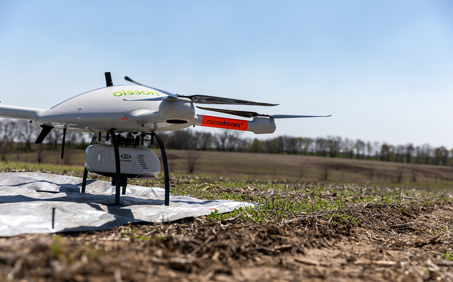
Olsson’s UAV fleet includes a Microdrones mdLiDAR3000DL outfitted with a Riegl lidar (light detection and ranging) sensor. Don’t let the name fool you, this drone measures nearly 6 feet across with a payload capacity of 45 pounds. This state-of-the-art system can produce the most accurate 3D survey point clouds in the industry.
Lidar produces data-rich point clouds where every point represents a real measurement accurate within a couple of hundredths of a foot on hard surface features. Once processed, these point clouds create a virtual site allowing survey and design professionals to generate traditional deliverables remotely.

Combining a versatile UAV platform with a lidar sensor gives us the ability to penetrate tiny gaps in dense ground vegetation and overhead tree canopies. Such capability is tailored for creating detailed digital landscape models of sites marked by steep terrain, heavy vegetation, and other challenging features.
UAV services are ideal for topography surveys, site evaluations, project monitoring, land development investigations, product inventory, earthwork quantities, vegetation surveys, American Land Title Association (ALTA) surveys, utility corridor and roadway mapping, inspection reporting, public safety, and emergency/disaster responses.
We have recently assisted a telecommunications partner in Kansas with an 85-mile fiberoptic cable installation to improve education and telemedicine communications in rural areas. We are also working on other critical infrastructure projects that include rail, highway, natural gas, electrical, and water resources.
Next to remote videoconferencing applications, the UAV just might be the most versatile tool for communicating critical project information in a socially distant, safe manner. Olsson’s UAV team can keep your project moving forward no matter the size or location.
To learn how your team can benefit from adding UAV surveying into your workflow, CLICK HERE to speak with a representative from Microdrones.