NOW AVAILABLE ON
YOUTUBE AND MDTV
DOWN TO EARTH PROJECT 15: Urban Drain
Down to Earth, a surveying reality series, shows how real surveyors collect data and turn it into real deliverables, despite challenging conditions, rugged terrain and lurking dangers.
PennDOT Teams Up with T3 Global Strategies for Its First Drone LiDAR Road Drainage Project
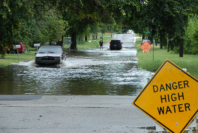
PennDOT recently tackled a project in an urban area, aiming to alleviate standing water and drainage issues. In their pursuit of an innovative solution, they joined forces with the experts at T3 Global Strategies. Faced with a smaller project area, dense tree vegetation, and a need for a quick solution, T3 Global Strategies proposed drone LiDAR surveying with TrueView 3D Imaging Systems from GeoCue, a departure from traditional manned flights.
In a first for PennDOT, they approved the use of drone technology to provide topographic planimetric mapping data and high-resolution orthophotography. In turn, engineers from PennDOT will use the data to implement better drainage.
Watch Episode 1 below:
In the first episode, the team from T3 plan and fly the road drainage project. Dan Hruska, Director of Unmanned Aerial Services for T3, sets the parameters for the flight and pilots the drone. Joining him are Matt Brownlee, Commercial Production Manager, and Justin Brownlee, an Aerial Mapping Technician, who will each act as visual observers and help ensure mission safety while Hruska flies the drone.
“The task at hand is complex, with airports, helipads, vehicles, and bustling downtown areas to contend with,” explains Hruska. “We're looking at two distinct urban regions, one stretching 2.5 miles, the other spanning 50 acres, calling for a total of eight flights today. It's a high-stress, high-stakes day, but I'm thrilled about the challenge. Our goal is clear: employing drone LiDAR and photogrammetry to address the drainage issues.”
Watch the 2nd Episode below:
Martin Sedilko, a Principal for T3 Global Strategies, was instrumental in working with the Pennsylvania Department of Transportation. According to Sedilko "PennDOT's decision to choose T3 Global Strategies for this road drainage project is rooted in our longstanding relationship. We've been in partnership with them since 2013. Last year marked a significant turning point as they approached us for the first time, recognizing our expertise in drone technology. They sought our assistance for a high-density LIDAR project, originally planned with a manned aircraft. However, the unique parameters of the area they wanted to survey made it clear that drones were the more cost-effective choice.”
About T3 Global Strategies, Inc.
T3 Global Strategies, Inc. is a state and federally-recognized small business established in 2000 as a Pennsylvania Corporation. For more than two decades, we have made it our mission to provide Mapping, Engineering, Survey, and GIS services and products of the highest quality to our valued clients in both the public and private sectors.
We’re passionate about developing close partnerships with our clients, who include government agencies, public and private utilities, and firms in the engineering, energy, transportation, environmental, and land development communities, and we’re laser-focused on exceeding industry standards and delivering client satisfaction in everything that we do.
If you'd like more information about using drone surveying equipment, please schedule a meeting with one of our helpful representatives today.