
mdInfinity offers high value software to improve geospatial data workflows and the quality of deliverables. In this web paper, Direct colorization of LiDAR point clouds with occlusion management, mdInfinity presents their point cloud direct colorization (PCDC) tool. This will enable a user to colorize a point cloud without referring to a full photogrammetric process by managing occlusions.
DIRECT COLORIZATION OF LIDAR POINT CLOUDS WITH OCCLUSION MANAGEMENT

The use of Drone LiDAR systems, like the mdLiDAR3000LR aaS, has become much more widespread in the surveying community due to their ability to provide highly accurate and precise 3D geometric representations. However, unlike cameras, LiDAR does not provide color information.
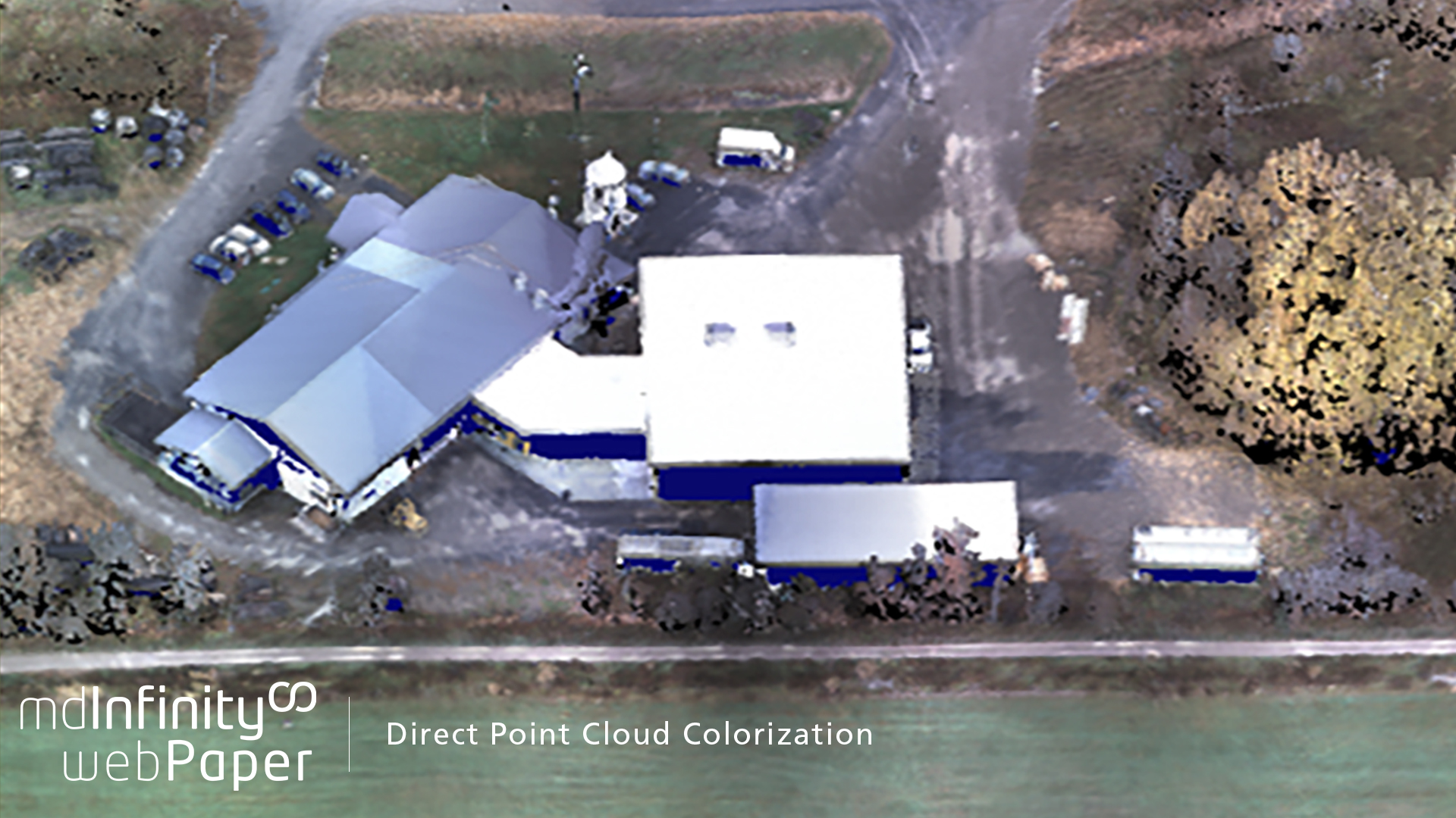
Direct point cloud colorization from mdInfinity fuses the data from both the Lidar and the camera. Microdrones point cloud colorization is done after the LiDAR point cloud generation, without the need of a full prior photogrammetric process. Occlusions in the point cloud are colorized by considering only the relevant part of the point cloud.
Most colorization tools consider indirect colorizations requiring an orthophoto to colorize any point cloud. Generating orthophotos is not only a time-consuming process but can also incur double mapping problems leading to less accurate results.
The mdInfinity point cloud direct colorization does not require orthophotos for the colorization making the tool faster compared to indirect approaches. Furthermore, colorization results are not affected by double mapping effects.
In this web paper mdInfinity will present the findings and results for:
- The mdInfinity point cloud direct colorization method
- Point visibility
- Single color assignment
- Results
- Comparisons with other colorization tools
- Conclusion
Learn how the mdInfinity point cloud direct colorization tool provides accurate results and is faster than other traditional methods. These colorized point clouds can be used to visualize geological structures and provide high definition 3D visual maps for the end-users.
For more information on Direct Point Cloud Colorization or to speak with a Microdrones representative CLICK HERE.
Download Paper