

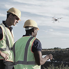
Drones can Lead to Better Worker Safety
Easily tackle projects in areas that are difficult, dirty or dangerous to access – such as challenging terrain, crumbling structures, high elevations, and areas impacted by natural disasters.
من الذين ينبغي لهم أن يفكروا في استخدام هذا النظام:
يجب على المحترفين المسؤولين عن جمع البيانات الجغرافية المكانية التفكير في استخدام نظام mdLiDAR1000 للمهام التالية.
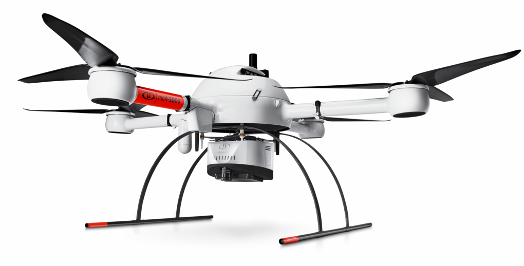
Dr. Mohamed MostafaThe Microdrones mdLiDAR1000, flying 2 flight lines over 600 meters of a segment of German autobahn were accurate along the lines of 6 centimeters. This confirmed prior analysis that was also done over Griffiss International airport in the United States. We’ve repeatedly seen the same accuracy that confirms the mdLiDAR1000 system is consistently delivering the same quality no matter where it flies.
Director mdSolutions
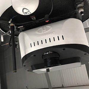
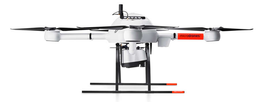
يُعد mdLiDAR1000 نظامًا متكاملاً تمامًا لإنتاج سحب نقاط ثلاثية الأبعاد محسنة للاستخدام في تطبيقات مسح الأراضي والإنشاء والنفط والغاز والتعدين.
ويوفر نظام mdLiDAR1000 باستمرار دقة تبلغ 6 سم (0.2 قدم) عند الطيران على مسافة 40 مترًا (130 قدمًا) بسرعة 3 م/ث (6.7 أميال في الساعة).
طورت شركة Microdrones حل ليدار شاملاً يجمع بين طائرة مسيرة وحمولة ليدار وسير عمل للبرامج متكامل تمامًا ودعم على مستوى عالمي لتوفير منجزات عالية الجودة باستمرار.
إليكم ما يُقال في القطاع عن mdLiDAR1000.
The mdLiDAR1000 aaS can help streamline your current workflows to become more efficient, while helping you to complete more projects.
Learn more about the benefits and challenges of investing in drone based LiDAR. Click here to review one of our FREE educational UAV LiDAR webinars. In this edition, you can learn how one of Microdrones customers saved over 50% compared to conventional survey methods by implementing a UAV with LiDAR.
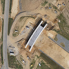
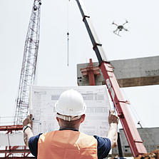
From surveying to mining and construction, professionals are using the power of the mdLiDAR1000 aaS to streamline their workflow. This new technology is helping them to complete more surveys, optimize mining volume analysis and maximize construction monitoring.

Matt RosenbalmFlying LiDAR to create a 3-D pointcloud model before beginning a construction project provides advantages. It can tell workers how much dirt needs to be moved on a site before they get started, for example, enabling them to bring the right amount of resources to the job.
Microdrones Sales Manager for the Southern US
يعد نظام mdInfinity نظامًا اقتصاديا قويًا يُمكنك من معالجة البيانات الجغرافية المكانية بسرعة وكفاءة، مع خيارات دفع ملائمة.
نظام mdInfinity متاح في نسخة تعمل عبر شبكة الإنترنت ونسخة تعمل على أجهزة الحاسبات الشخصية المكتبية.
تعرف على مزيد من المعلومات عن وحدات معالجة البيانات الخاصة بنا.
تلتزم شركة Microdrones بإجراء التطوير المستمر الذي يركز على تلبية احتياجات العملاء. ولذلك نعمل على تطوير أحدث التقنيات المتكاملة التي تتطور بشكلٍ سريع.
بالنسبة إلى طائراتك التي تستخدم نظامًا أقدم، نحن متحمسون لمساعدتك على ترقية نظام Microdrones السابق لديك وفقًا لأحدث المعايير حتى يتسنى لك الاستفادة من الميزات والوظائف الجديدة.
Customers are curious about UAV surveying technology – so providing it demonstrates that a business is an industry leader at the helm. Faster, more efficient data collection differentiates you from competitors and positions you as a subject matter expert in an emerging technology.
| ارتفاع الطيران فوق مستوى سطح البحر (1) (متر/ قدم) | 30/100 | 40/130 | 50/165 |
|---|---|---|---|
| السرعة (م/ث) | كثافة النقطة ( مركز الرقعة // الحافة) نقطة/م 2(2) | ||
| 2 | 160 | 120 | 95 |
| 3 | 105 | 80 | 65 |
| 4 | 80 | 60 | 50 |
| 5 | 65 | 50 | 40 |
| مسافة العينة األرضية GSD( مم) | 12.9 | 17.2 | 21.4 |
| عرض الرقعة (متر/قدم) في مجال (متر) | 55 | 75 | 95 |
| زمن الرحلة ( دقيقة ) (3) | 25 | 25 | 25 |
| عدد عائدات الليزر | 3 | 3 | 3 |