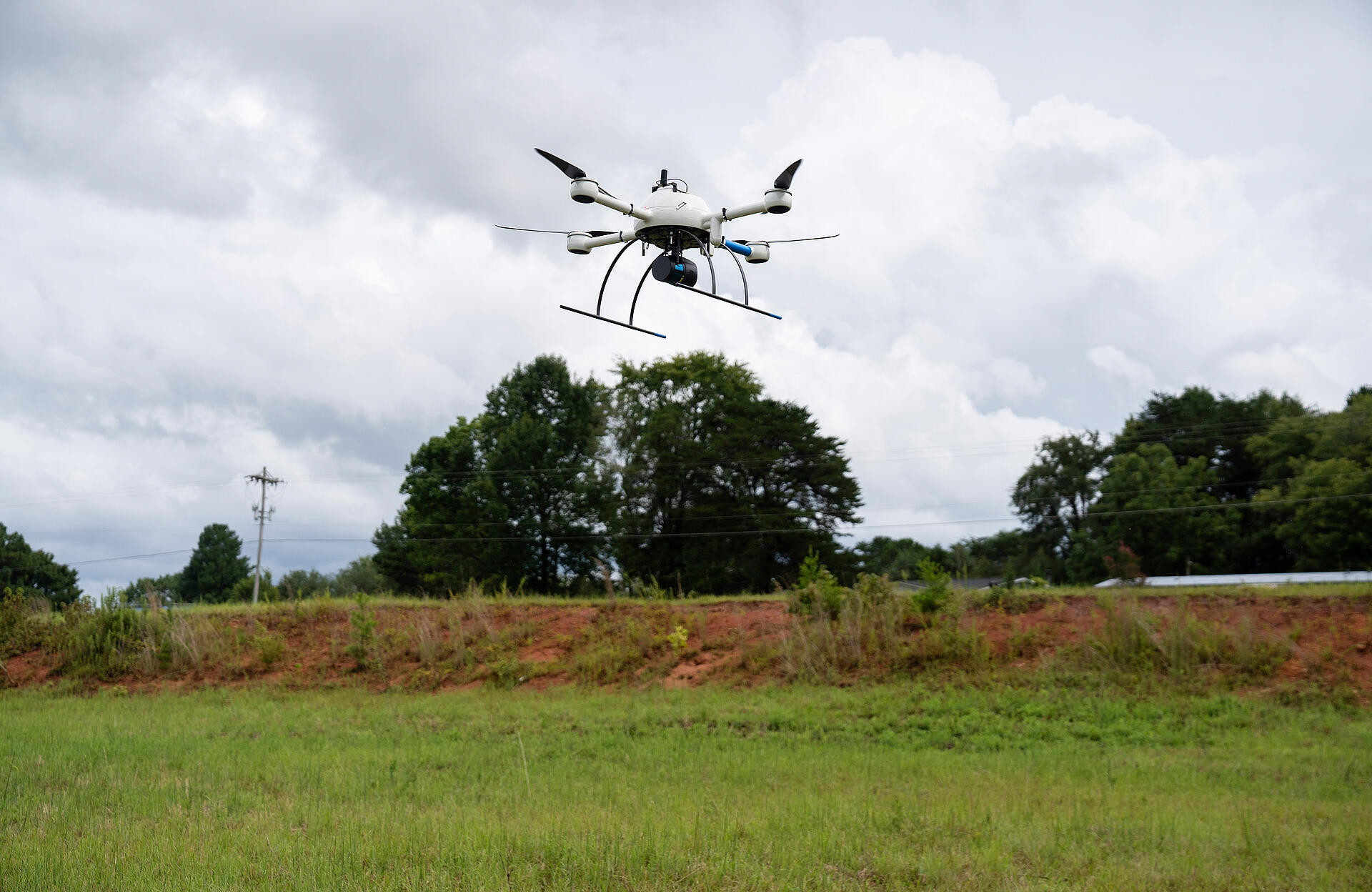
MP Design Group deploys Drone LiDAR from Microdrones for surveying, mapping, and many other applications.
MP Design Group is a multi-disciplined architecture & engineering firm headquartered in Biloxi, Mississippi with projects across the Southeast. The company recently added the mdLiDAR1000LR to their toolbox to take advantage of all the benefits of using drone LiDAR for surveying and mapping, which is showcased in the video below.
Not your typical drone
David Machado P.E., of MP Design Group is excited to introduce their cutting edge, highly advanced, drone LiDAR system to their customers throughout the South and beyond.
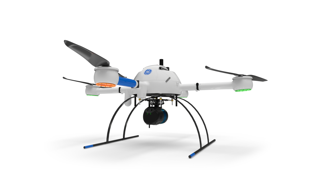
In the video, Machado explains how they are now using LiDAR technology from Microdrones, the mdLiDAR1000LR, to gather and processes detailed boundary and topographical data and mapping within days of performing an aerial survey.
Deploying drone surveying equipment allows MP Design Group to become much more efficient. “Manual groundwork and intense data crunching that used to take weeks can be turned around in days,” Machado explains. They’ve created a turn-key operation, where a one man crew can quickly perform large surveys and provide more analysis than ever before.
“Our team underwent intense training, similar to flight school, to become FAA certified to bring these services to you and we can’t wait for you to experience the difference,” Machado said.
Advanced applications
The mdLiDAR1000LR integrates advanced sensors and software to enable a more accurate and detailed assessment of projects for MP customers. Some of the applications they are using the drone LiDAR surveying equipment forinclude:
- Surveying large tracts of land and quickly analyzing their feasibility to build a sub-division.
- Surveying an existing site and evaluating it for further development potential.
- Surveying a site under construction to assess the volume of earth moving or materials needed to balance it out.
The mdLiDAR1000LR has a number of benefits including the ability to use the LiDAR toto filter out trees and grass or remove high vegetation to view the ground underneath, with never before seen clarity. Other features such as Georeferencing and terrain follow allow the drone to account for trees, heights of river or lake banks in any other difficult terrain situations.
With the mdLiDAR1000LR, the team at MP Design Group can assess the challenges and bring their customer’s vision to life faster. “Data certainty and accuracy put MP Design Group well ahead of our competition and can put you well ahead of schedule on your project,” said Machado “We’re on stand-by, ready for lift-off, to deploy a mission to survey your project.”
To learn more about products like the mdLiDAR1000LR, talk to one of our sales representatives today.