
Drone LiDAR ENABLES DUPLANTIS DESIGN GROUP TO GET MORE DONE
The team at Duplantis Design Group (DDG), a multidisciplinary regional engineering, architecture, and surveying firm, used drone LiDAR technology to survey a multi-use area more efficiently in Houma, Louisiana. The entire job site was 1,200 acres and the area of interest for this portion of the project was a 200-acre area situated between a bayou, the Intercoastal Waterway, and a large floating marsh.
The floating marshes, known regionally as “trembling prairie,” can present hazardous obstacles. They look like they can be stepped on, but in reality, walking on them can leave you neck-deep, stuck in the marsh. These conditions make drone LiDAR one of the safer and efficient methods to survey this project. Otherwise, DDG would use airboats and walk the areas, adding significant time and expense.
However, this project isn’t cut and dry. Drone LiDAR still comes with its challenges. In this case, the survey area is also in close proximity to the Houma-Terrebonne Airport, meaning additional air clearance must be obtained to operate the drone. And weather conditions threaten to derail the mission. Here’s how DDG managed these challenges and delivered a successful project on time using drone LiDAR.

Cory MacMenamin, Survey Business Unit Leader, DDGSurveys that took two to three weeks now take two to three days.
How Drone Technology Has Revolutionized DDG’s Workflow
DDG has been in business since 1997 in Thibodeau, Louisiana. They began as a civil engineering firm and later expanded to include architecture, landscape architecture, and surveying as a part of their offerings.
Like most surveyors, Cory MacMenamin began his career using traditional surveying methods. Technology has always expediated conventional methods and drone LiDAR has transformed the way DDG completes surveys.
“Surveys that took two to three weeks now take two to three days,” MacMenamin said.
Justin Schech, the UAV drone pilot, got in on the ground floor of DDG’s drone LiDAR program and immediately seized the opportunity to learn a new skill set. Of course, he’s not content to stop there. He is currently working on putting in the hours for his captain’s license to pilot a Marine One watercraft for other surveying jobs.
DDG is known for adopting cutting-edge solutions to make surveying tough jobs easier and more efficient. They can gather four days’ worth of data from traditional surveying methods in one day with drone LiDAR.
DDG was introduced to integrated LiDAR systems from Microdrones by Ross Kenney, sales specialist for Navigation Electronics (NEI). DDG has a long-standing relationship with NEI and has used them for a variety of equipment.
“In the process of doing the hands-on work, Ross sold me on the mdLiDAR1000,” MacMenamin said. “Then, after I saw the data set, I was so impressed that I decided to buy the Microdrones product.”
DDG’s time and cost savings using drone LiDAR are significant. Kenney estimates that customers who use drone lidar complete projects in one-tenth of the time with about one-seventh or one-eighth of the cost when compared to conventional survey methods.
NEI’s support for Microdrones products didn’t stop after the purchase. They offer fully integrated solutions to their customers: a drone, sensors, software, workflow, training, and ongoing support.
“Ross has been a phone call away throughout the whole process with any questions I have,” Schech said. “Being a new pilot, I did have some questions here and there about recommended speeds, overlap, and stuff like that. Even when we did a software update on the drone, Ross was right there on a Zoom meeting, making sure everything went smoothly.”
NEI’s competency was recognized by Microdrones as they received the 2020 Best Performance Award, an award that recognizes a single independent distributor that has set the standard for performance, sales growth, and superior customer service and support.

How to Prepare for a Drone LiDAR Project
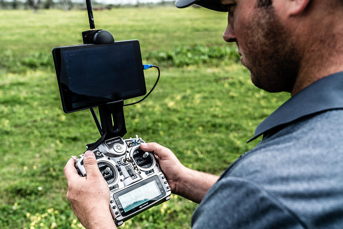
To plan the project, Schech begins with Google Earth. He divides the area into large sections and identifies the base for each flight and how much area needs to be covered. This pre-planning allows him to conserve battery life and make sure he keeps the drone within line of sight — a must for Drone LiDAR.
“It creates a good workflow. There’s no question of what you’ve done and what you have left,” Schech says.
This project presented another unique challenge. The site is within the airspace of the nearby Houma-Terrebonne Airport. Therefore, Schech obtained additional clearance from air traffic control to operate the drone at a flight ceiling to avoid any air traffic.
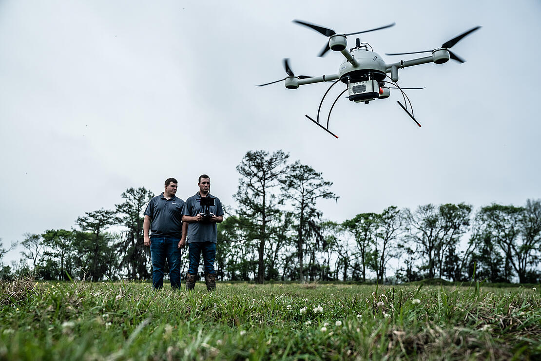
In addition, DDG brought in Zachary Fox as a visual observer to have another set of eyes on the drone to monitor conditions, air space around the drone, and any other air traffic. With Fox’s help, Schech had a successful flight and gathered the data needed to complete the project.
What Drone LiDAR Technology Brings to the Table
DDG has successfully completed over 3,000 projects across the Gulf Coast Region. Their portfolio is vastly diverse in project types – from industrial, commercial and retail, to single-family and multifamily subdivisions and much more. Their vast experience relies on a stellar team to bring their projects together.
Drones are a key part of the surveying work at DDG, but each expert brings their own special set of skills to deliver a superior project. Technology is an important asset, but it’s no substitute for deep knowledge, professionalism, and experience.
Dennis Gowan, DDG project manager, laid the groundwork for this project by poring over records of the area to complete the boundary survey. Gowan is a professional land surveyor with years of experience under his belt. He mentored MacMenamin and assisted him on his journey to becoming a surveyor.
Gowan isn’t alone in his skills. Even with the supplement of technology, surveying is as much an art form as it is a science. Surveying projects often become an important part of the historical record. Professionals like Gowan use a variety of traditional and digital tools to get the job done. In this project, Gowan identified iron rails in the bayou that surveyors located and included in their maps.
When strategizing about how to include technology into their already impressive offerings, MacMenamin started small. They wanted to develop their experience and ensure that they could deliver the same level of quality their customers came to expect from them. DDG and the team practiced with hobby drones to understand flight capabilities and techniques before getting fully trained on using the mdLiDAR1000.
To keep in touch with the process, MacMenamin flew missions alongside Schech. The two received their certification at the same time. Since then, Schech has begun to truly take the reins on the drone missions from planning to processing.
“As we grew and decided it was time to really let the Microdrones equipment do its job, I started to let Justin go out on his own,” MacMenamin said.
MacMenamin now hands off the projects to his team with full confidence that they will consistently deliver a quality product.
From Drone Flights to Finished Products
With Schech’s data from the field, DDG’s draftsman, Brad Villemeur, is ready to take over and do the post-processing work. Villemeur begins by referencing the flight data Schech gathered against known satellites and geodetic systems. This is a double and triple check to ensure that the data they’ve gathered is accurate and truthful.
After the geo-referencing is finished, Villemeur can combine the smaller point cloud data sets into one large dataset using mdInfinity. This dataset is used to create deliverables for the client in several different programs, including AutoDesk Civil 3-D. Each of these software packages works seamlessly and easily with Microdrones to create the final deliverable.
The amount of data gathered makes it easy for engineers to get a macro and micro view of any area they have questions about during the project. The deliverables for this project include a 3-D surface for the engineers and paper deliverables in the size and scale requested by the client. These are professionally signed and stamped by the licensed surveyor and sent.
How DDG Delivers for Clients
DDG is known for providing quality deliverables. Microdrones elevates their offerings by enabling them to complete projects faster and deliver data-rich projects. Drone LiDAR technology allows them to pass along cost and time savings to their clients. But one of the biggest benefits to DDG’s clients is the quality of the product produced by Microdrones surveying as a service.
“When it comes down to it, the difference between what we bring to the table today and what we were capable of doing 25 years ago is night and day,” MacMenamin said. “The quality of the product, the density of data, it changes the way we do things. Without a product like this, the deliverables that we were putting out were lackluster. They lacked the depth that this product allows us to provide to our clients.”
For more information on how you can increase efficiencies for your surveying projects with drone LiDAR, talk with one of our sales people today.