
Propelling: The Spanish Drone Market is set to Boom
with Irene Jimenez
Presented in Spanish
2020 was a good year for the drone surveying and LiDAR market in Spain.
“Like all technology, it’s becoming more accessible to users. As we’ve seen, it's the same with drone surveying equipment,” Jimenez said. “I think we’re starting to see the drone LiDAR market is ready to explode. And it’s going develop even stronger, both Microdrones and the general market are growing, the prices are becoming more attractive and so I think it’s a technology that is democratizing. More end users have access to it, it’s more well-known. It’s growing strong.”
Part of that growth is thanks to drones losing some of their novelty, with users no longer awed by drones but beginning to think of them as things they actually need to perform their jobs well and keep up with the competition.
“Before we saw them as something, like, ‘Wow!’ But now they’re almost starting to be seen as a necessity for customers, really,” she said. “Businesses that aren’t including drones within their technology they utilize day-to-day are seeing the need and importance these tools have because it allows them to access better technology, to collect better information and to be more efficient and do more projects.”
With Microdrones as a Service model and the ability to use a drone for just one project rather than buying the device outright, that growth in Southern Europe seems only likely to increase. Listen to Propelling as Irene explains how the market is set to boom or read the summary below. Please note- this podcast is spoken in Spanish.

The drone surveying market is taking off in Spain.
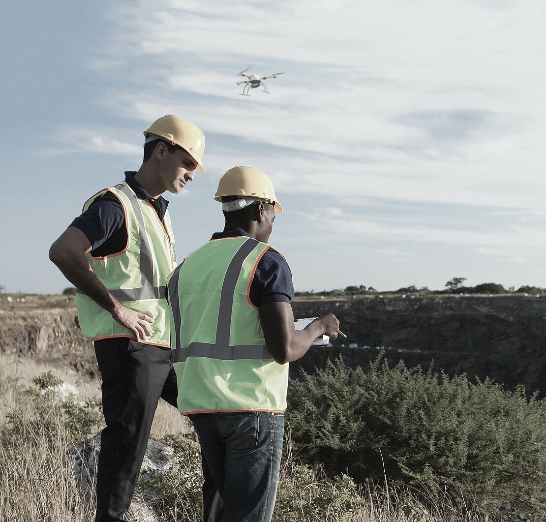
Demand grew in industries from construction to retail in 2020, fueled in part by companies needing to adjust to health and safety protocols. Drone Surveying Equipment helped firms to stay on schedule on tasks such as surveying and conducting inspections.
“Definitely, the shutdowns changed the rules of the game,” said Irene Jimenez, sales manager for Microdrones in Southern Europe.
Some companies that were already familiar with drones had easier transitions to pandemic-altered workflows. For others, 2020 provided the first test of incorporating a new technology.
The launch of the new Microdrones as a Service last year also offered a way for novices to ease into using drone surveying equipment since it allows integrated systems from Microdrones to be more accessible at an affordable rate.
“More companies are seeing the need to incorporate drones into their workflow and having these tools allows them to access better technology, collect better data and be more efficient,” Jimenez said. “And that, in turn, allows them to complete more projects.”
LiDAR benefits
Drones first started being implemented for professional applications in southern Europe about 10 to 15 years ago, with the frequency of usage growing over the last five years especially by surveyors and engineers.
“There are so many advantages that we can see when using this technology, such as access to risk areas, gaining efficiency and gaining time,” Jimenez said. “At the end of the day, people want high-quality results in less time from drones and a complete solution.”
Irene Jimenez joined Microdrones in the Spanish market about a year ago, just as interest was taking off especially in LiDAR, which stands for Light Detection and Ranging. It’s a method of remote sensing known for its accuracy that uses light in laser form to measure distances to the earth.
LiDAR is becoming popular for a range of applications, including surveying, mapping, and engineering, and Microdrones is widely recognized for its state-of-the-art products in this area with its mdLiDAR line.
“And what’s really exciting with LiDAR is how the final result, a georeferenced point cloud, makes work easier. That gives us an excellent result to create highly accurate deliverable for professional applications,” Jimenez said.
“I think we are starting to see that the drone market with LiDAR is going to explode this year.”
One client in Spain turned to Microdrones to survey a site ahead of a road-building project. The company used to rely on a crew of about six workers for more than a week, moving to different locations to take measurements. Now with the use of drone LiDAR, like the mdLiDAR1000 aaS from Microdrones, the firm can get the survey completed in two or three days with just one or two crew members and still get precise results, Jimenez said.
UAVs have been valuable in mines, helping to keep workers from doing what can be a risky task in person. Another new and innovative use has been developed by utility companies that are turning to LiDAR to inspect power lines, which can be tricky sometimes because they can be covered by trees or other vegetation. Urban planning is another area in which drone usage is growing.
“One of the limitations that we used to have in the market was that LiDAR solutions were thought to be expensive. A company might say, ‘Wow, that’s high-quality technology, but how can I integrate it?’” Jimenez said.
Microdrones offers a comprehensive, customer-focused solution.
Irene Jimenez, sales manager for Microdrones in Southern EuropeThe real goal of Microdrones as a Service is to make drone solutions with LiDAR accessible to everyone. Customizable packages allow more people to have access to a high-quality LiDAR solution.
A good starting point
The new Microdrones as a Service program gives the customer more choices over how to acquire and configure both the hardware and software. It’s an easy and affordable option especially for clients looking to get started with drone surveying equipment.
Jimenez said that Microdrones as a Service has opened new markets and helped customers to create new applications.
“The real goal of this new model is to make drone solutions with LiDAR accessible to everyone,” she said. “Customizable packages allow more people to have access to a high-quality LiDAR solution.”
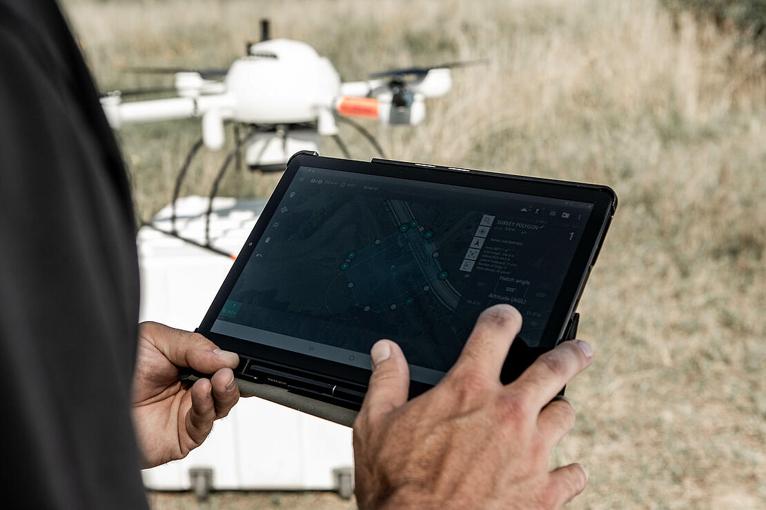
Take for example the flexibility that Microdrones as a Service offers with using mdInfinity, the data processing software from Microdrones. If desired, the customer can pay per use, foregoing the need to purchase a license but still getting access to all the modules needed.
This might be the best option for some clients if they know that demand will fluctuate through the year.
“This is something that adjusts well to the needs of each client,” Jimenez said. “This platform evolves. Right now, we have seven modules, and the goal is to continue to evolve. Through Microdrones as a Service, clients always have access to these modules and they can choose to pay per use or go with an unlimited plan.”
“There is no need to keep jumping from one software to another. mdInfinity can do it all on the same platform,” Jimenez said.
Soil classification is another module used by many Spanish customers, she said. The goal is to expand to other types of classifications such as power lines and vegetation.
“We have vegetation, but need to make a digital model of the surface,” Jimenez said. “The Microdrones team has done a good job with developing the algorithm to create a very good representation or classification of the soil.”
The Microdrones as a Service model launched in May of 2020, and the array of offerings have appealed to a wide range of clients.
Some larger companies just getting started with drone surveying equipment are turning to the rental option to avoid high capital expenditures and maintenance costs while always having up-to-date systems. Other firms with the means to invest prefer to buy and manage their own drone and software.
Others might choose to purchase the drone but go with a pay-per-use option for software. Jimenez described it as a “mix-and-match” type of menu, though a complete solution is available no matter what the customer buys or rents.
“The idea with Microdrones as a Service is to work with the customer and understand their needs, what projects and what formula works best for them,” she said.
Flying into the future
The rise of drone usage in Spain has a trickle-down effect on the job market.
Pilot schools in the country are drawing renewed interest as more students view drone piloting as a profession. Some larger companies are developing their own pilots for internal projects, while some surveying firms are creating and staffing drone departments.
Others going to drone school are adding piloting to their portfolio of related tasks, which might include permitting and project planning.
The increase in interest in piloting is just another example of the efficiencies that clients can achieve by incorporating drones into their workflow, as well as how the technology has become more accessible.
“Prices as becoming more attractive. More end-users have access. We are going to start seeing different sensors and different applications, not only at the hardware level but also at the software level,” Jimenez said.
It’s also an exciting time for Microdrones to be able to help make drone surveying technology available to more people. The ultimate goal for Microdrones is to develop solutions to make even the most difficult jobs accessible to professionals through state-of-the-art technology, allowing customers to generate more business.
“It is a world of opportunities that is beginning to develop now,” Jimenez said. “There’s a lot of creativity from everyone in the industry.”
To learn more about Microdrones as a Service CLICK HERE to speak with a representative from Microdrones.