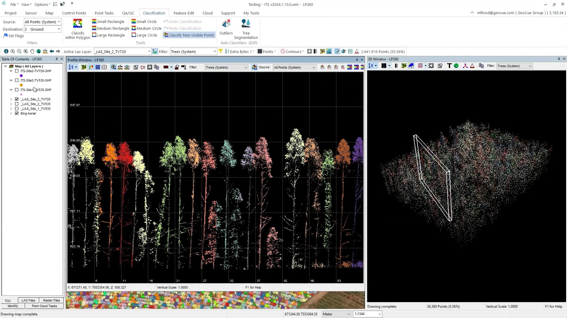
LP360 Drone's Individual Tree Segmentation (ITS) tool is a new addition to the Business Intelligence Add-on, designed specifically for forestry management and environmental monitoring. Leveraging...
In this episode of Geospatial Genius, see how Felipe Alfaya, from Alvaz in Brazil, uses LP360 software to process drone survey data for agricultural applications
In this study, drone surveying equipment from Microdrones was used for plant water status determination and, as a consequence, for irrigation management. The research used a Microdrones UAV to...
In this video, Nora Sophie Eichhorn, from KWS Phenotyping Technology, investigates new varieties of winter rapeseed. Her team has planted 45 varieties of the seed in a field where they will measure...
Agricultural analysis from Microdrones Surveying Equipment help confirm Alan Turing’s theory for Australian Fairy Circles. An international research team led by Göttingen University shows patterned...
Hanno Truter kept busy in the month August attending the Advances in Geomatics Research Conference in Kampala, Ugunda and the the Association of Mine Surveyors of Zimbabwe’s Annual Conference Harare,...