Drones can Lead to Better Worker Safety
Easily tackle projects in areas that are difficult, dirty or dangerous to access – such as challenging terrain, crumbling structures, high elevations, and areas impacted by natural disasters.
This is the UAV, hardware, software, workflow, training and support that surveying professionals need now with convenient mdaaS plans!
Who Should Consider This System:
Professionals responsible for geospatial data collection should consider mdLiDAR1000 for the following tasks.
Drone LiDAR is making a serious impact for specialists across many professions, both in terms of efficiency of data collection and generation of geospatial deliverables.
Dr. Mohamed MostafaThe Microdrones mdLiDAR1000, flying 2 flight lines over 600 meters of a segment of German autobahn were accurate along the lines of 6 centimeters. This confirmed prior analysis that was also done over Griffiss International airport in the United States. We’ve repeatedly seen the same accuracy that confirms the mdLiDAR1000 system is consistently delivering the same quality no matter where it flies.
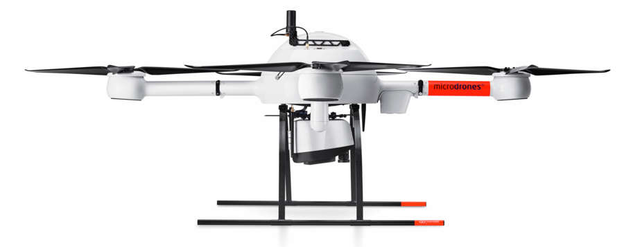
mdLiDAR1000 aaS is a fully integrated system for producing 3D point clouds optimized for land surveying, construction, oil & gas, and mining applications.
mdLiDAR1000 aaS consistently provides an accuracy of 6 cm (0.2 ft) when flown at 40 m (130 ft) at a speed of 3 m/s (6.7 mph).
Microdrones has developed an end-to-end LiDAR solution combining a drone, a LiDAR payload, a fully integrated software workflow, and world class support to consistently provide quality deliverables.
Here’s what the industry is saying about this survey equipment.
The mdLiDAR1000 aaS can help streamline your current workflows to become more efficient, while helping you to complete more projects.
Learn more about the benefits and challenges of investing in drone based LiDAR. Click here to review one of our FREE educational UAV LiDAR webinars. In this edition, you can learn how one of Microdrones customers saved over 50% compared to conventional survey methods by implementing a UAV with LiDAR.


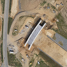
From surveying to mining and construction, professionals are using the power of the mdLiDAR1000 aaS to streamline their workflow. This new technology is helping them to complete more surveys, optimize mining volume analysis and maximize construction monitoring.

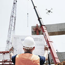
Matt RosenbalmFlying LiDAR to create a 3-D pointcloud model before beginning a construction project provides advantages. It can tell workers how much dirt needs to be moved on a site before they get started, for example, enabling them to bring the right amount of resources to the job.
Microdrones Sales Manager for the Southern US

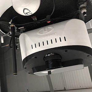
PLATFORM
COMMUNICATIONS
PAYLOAD
SURVEY EQUIPMENT SOFTWARE
LP360 Drone is a powerful ecosystem that will enable you to quickly and efficiently process geospatial data, with convenient payment options.
Microdrones is committed to constant, customer focused improvement. As such we are developing cutting edge, integrated technology that evolves rapidly.
For those of you with an older system, we are always eager to help you upgrade your previous Microdrones system to the latest standards so you can take advantage of new features and functionality.
Simply click this button to schedule a meeting with a member of our sales team, and they will assist you in collecting your current system information so they can prepare a price estimate to upgrade.
Easily tackle projects in areas that are difficult, dirty or dangerous to access – such as challenging terrain, crumbling structures, high elevations, and areas impacted by natural disasters.
Collecting data previously required extensive groundwork or very expensive manned aircraft. Using a drone allows quick and affordable data collection; that’s one of the most important benefits for geospatial professionals.
Survey live construction or mining sites without interrupting people, plans or machinery. You’ll no longer have to stop work and equipment to collect the data you need, making you more valuable to your customers.
Customers are curious about UAV surveying technology – so providing it demonstrates that a business is an industry leader at the helm. Faster, more efficient data collection differentiates you from competitors and positions you as a subject matter expert in an emerging technology.
Our professional UAV pilots offer complete onsite Microdrones UAV training to both dealers and end-user customers to ensure they are fully capable of deploying their drone packages in the field, ready to achieve immediate results.
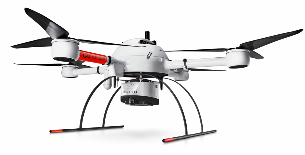
Platform
md4-1000
Payload
Software
Takeoff Weight (TOW)
6650g
System Operation Temperature
-10 °C up to 50 °C
System Accuracy
| Flight Altitude AGL (1) (m/ft) | 30/100 | 40/130 | 50/165 |
|---|---|---|---|
| Speed (m/s) | Average Point Density in pts/m2(2) | ||
| 2 | 197 | 147 | 118 |
| 3 | 131 | 98 | 78 |
| 4 | 98 | 74 | 59 |
| 5 | 78 | 59 | 47 |
| GSD (mm) | 12.9 | 17.2 | 21.4 |
| Swath width (m/ft) (m) | 55 | 75 | 95 |
| Flight Time (minutes)(3) | 25 | 25 | 25 |
| Number of Laser Returns | 3 | 3 | 3 |
| Area Coverage at 30% Overlap (ha) | 14.7 | 18.6 | 23.6 |
(1) Flight Altitude Above Ground Level (AGL)
(2) Average density calculated with 30% overlap on 5 lines
(3) Flight time is calculated under standard flight conditions (using new Microdrones batteries)