In this Webinar replay, learn about the entire Microdrones workflow of Plan, Fly, Process & Visualize and how Microdrones Integrated Systems help you to collect data efficiently and safely while cutting costs, saving time, and converting data into useful information. Please note, this webinar is presented in German.
In this webinar, get to know the benefits of drone-based surveying, from take-off to landing, and from capturing data to processing the deliverables!
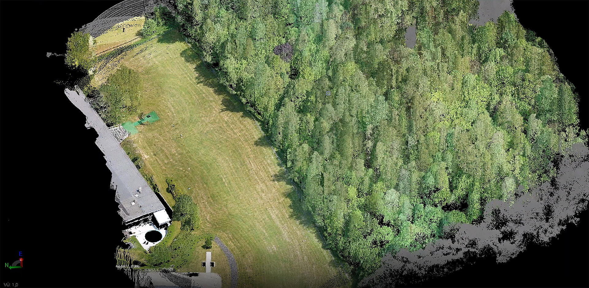
Using a concrete example, Microdrones and Herzog demonstrate what has to be taken into account in drone-supported surveying and how the data obtained is evaluated in the Trimble Business Center.
In this one-hour webinar we will review:
- Process from landing to the corrected point cloud
- Speed of processing
- Data also in vegetation
- Software like POSPac UAV, mdLiDAR, Trimble Business Center
- Import of the LiDAR point cloud
- Automatic classification of the data (according to intelligent algorithms)
- Creation of a 3D terrain model
- Volume calculation
- Creation of CAD objects (for further processing in the drawing software)
CLICK HERE to watch the replay or copy and paste this link into your browser: https://lp.microdrones.com/webinar-replay-von-der-landung-zum-dgm
If you would like to speak with a representative from Microdrones to learn more about adding drone-based LiDAR to your workflow, CLICK HERE
About Herzog:
A company with decades of experience
The company Herzog was founded in 1960 by Siegfried Herzog. Over the years, the company expanded further and was transformed into the Herzog GmbH. Sebastian Herzog has been managing the company since 1990. For more than 50 years, Herzog has been a reliable and sought-after partner for specialists in engineering and construction surveying.