Flick Ingenieurgemeinschaft and Microdrones: UAV-based surveying in open pit mining
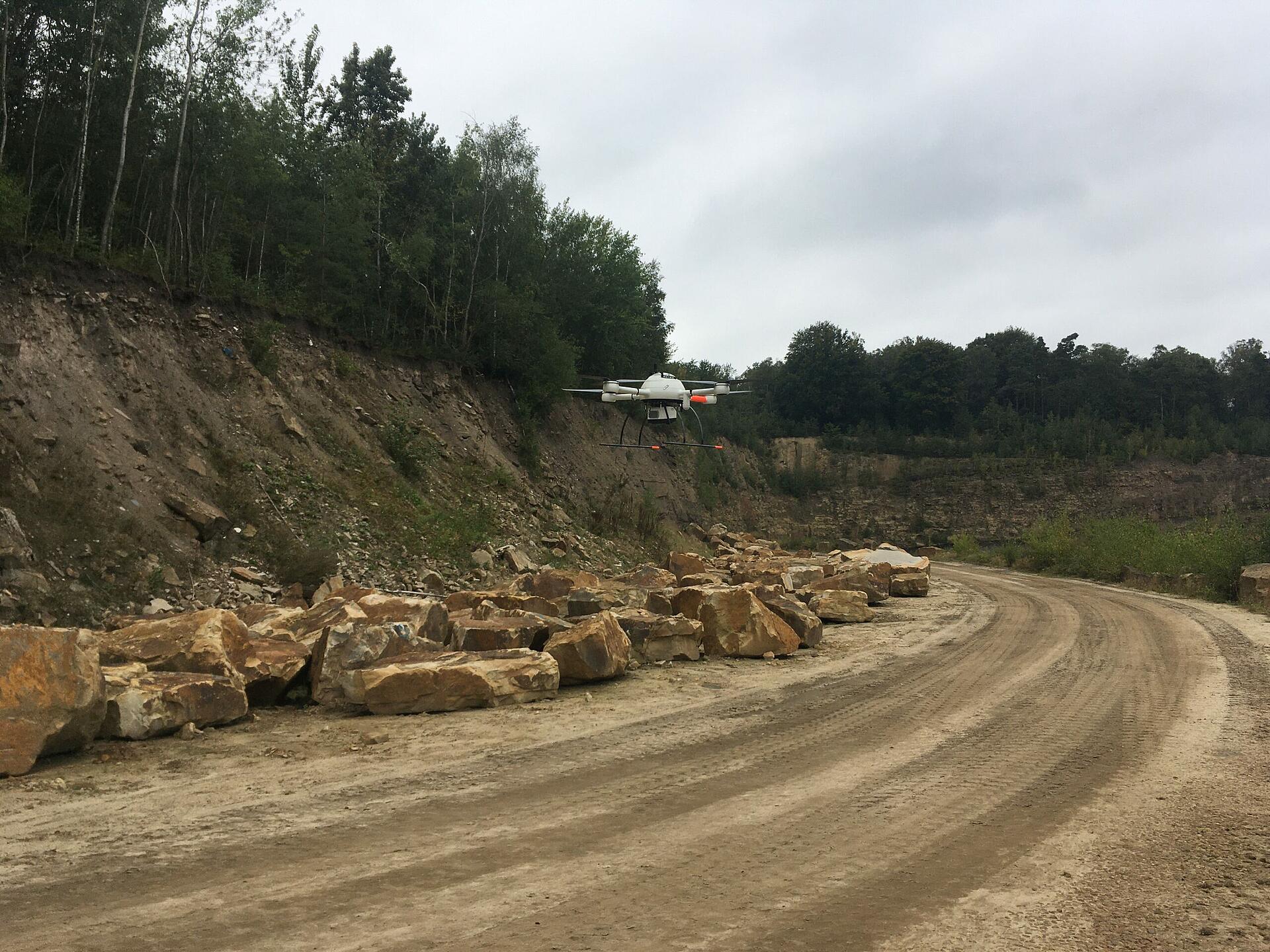
The Flick Ingenieurgemeinschaft in Ibbenbüren in North Rhine-Westphalia has been using a Microdrones mdLiDAR1000 Classic since the beginning of 2020, among other tools for the non-contact measurement of open pit mines and excavations. The use of drone surveying equipment has increased safety and efficiency at the mine.
The use of drones is becoming increasingly popular in the world of surveying. This is also the case with the Flick Ingenieurgemeinschaft in Ibbenbüren, which has been using a Microdrones mdLiDAR1000 Classic since the beginning of 2020, among other tools to fly over roads, infrastructure, facilities, planning areas and in particular open pit mines and excavations and to collect precise data on them.
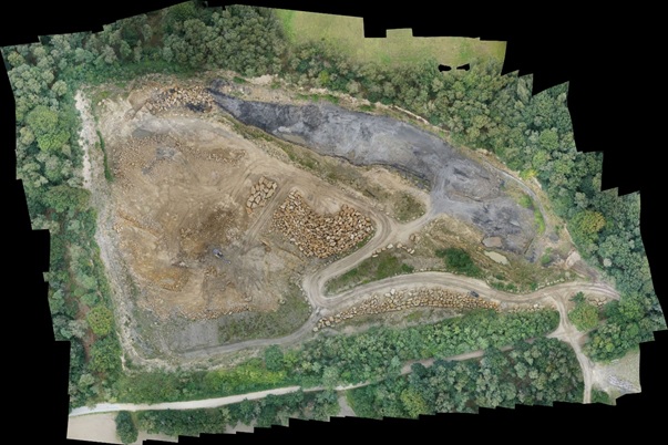
“By using the mdLiDAR1000 Classic from Microdrones to measure, for example, dumps, gravel and sand excavations, open pit mines and quarries, we can not only increase the safety of all persons and staff involved, but also significantly increase the efficiency of the work processes,” explains Niels Flick from the Engineering Association on the use of the Microdrones survey equipment. “In addition, we can create the basis for an exact volume and mass calculation for documentation purposes and visualize through the 3D acquisition and document the areas overflown for a variety of applications. Precise variance analyses are also possible after two consecutive flights.”

Automation through GPS waypoint mode
The mdLiDAR1000 Classic from Microdrones, used by the Flick Ingenieurgemeinschaft, was specially developed for use in built-up areas and/or areas that are difficult-to-access and can be equipped with various sensors, each perfectly integrated into the drone. In addition, brushless electric motors are used to precisely compensate for the movements of the UAV and thus achieve the most stable recordings possible. “We can use it to reliably generate the accuracy we need,” relates Flick.
The aircraft, which weighs only 2.5 kilograms and can transport a maximum load of 1.2 kilograms, may also be fully controlled automatically during the flight using the GPS waypoint navigation system. “The drone then flies precisely to the GPS points that we are able to plan in the mdCockpit application. This enables us to precisely fly an exact flight route several times - for example, to identify changes in the landscape,” states Flick. “In addition, our employees no longer have to hike through impassable and dangerous terrain in order to be able to perform reliable measurements using ordinary methods.”
Overall, Flick is very satisfied with the Microdrones solution. “In terms of performance, the mdLiDAR1000 Classic is clearly a part of the high-end segment - which of course has its price. However, the comparatively high investment costs for drones, including sensors, have paid off for us, especially because of the quality of the recordings and the support we get from Microdrones,” Flick staunchly states.
Increase in safety, efficiency and economy
In addition to the safety of the employees associated with the use of drones, it also increases the profitability of open pit surveying. “In mining and open pit mining, the collection of ground data has been an extremely cost-intensive factor. UAV flights make it possible to generate geographical information economically and quickly, which then allow exact and precise further processing,” Flick explains. “The great advantage of surveying from the air lies in the contactless data acquisition. The production of the data does not have to be slowed down or interrupted - not even if inaccessible areas are recorded.”
But why is the data from open pit mines even recorded and used at all? A look at the Federal Mining Act provides an answer, Flick reveals. “In Germany, mine surveying documentation (mine plans) consisting of true-to-scale maps, plans and other documents must be kept. In addition, technical exploration, security and safekeeping measures are required in old open pit mines. These are central components of the engineering and surveying processing.” In order to be able to guarantee these requirements, the surveyors must have knowledge of the exact position and height of the open pit mine as well as their consequences or effects on the environment – for example on the groundwater and the surface.
“On the basis of this geotechnical data, for example, a risk assessment of possible future damaging events may be derived,” describes Flick. In addition, the data captured with the drone may be used for inventory and accounting, to provide a wide variety of evidence or to submit applications – for example in relation to renaturation measures or expansion of the dismantling and storage area. “For this purpose, highly precise 3D volume models must be processed using 3D meshing on the basis of a scatter plot,” relates Flick. With this, the transfer of the raw data for external evaluation is also possible. (jr)
mdaaS Rental drone solutions
Microdrones introduced a new sales program to make acquiring their drone surveying equipment available to the entire market.. With Microdrones-as-a-Service (mdaaS) customers have maximum flexibility - not only with the cost model, but also with the use of the technology. The offer is valid for all three product lines, mdLiDAR, mdMapper and mdTector, including the fully integrated technology. Vincent Legrand, Vice President of Global Sales for Microdrones: “The user still has the choice of buying the solutions as a lump sum or using the subscription model with monthly payments”.
New customers may obtain a high-end surveying solution for as little as 950 euros per month instead of having to spend a single lump sum in the mid five-digit range that is standard in market. At the same time, there is also the option of purchasing the drone solution for a significantly reduced amount and then paying a fee for each use within flight projects. The full support package is also included.
For more information about Microdrones as a Service, CLICK HERE to meet with a representative from Microdrones.