Drones can Lead to Better Worker Safety
Easily tackle projects in areas that are difficult, dirty or dangerous to access – such as challenging terrain, crumbling structures, high elevations, and areas impacted by natural disasters.
mdLiDAR1000LR means longer range. You'll cover more ground from above. This translates to more efficiency than ever - the survey equipment, software, workflow, training and support that you need to be productive in the field - with convenient mdaaS plans.
Who Should Consider This System:
Professionals responsible for geospatial data collection should consider mdLiDAR1000LR to support the following tasks.
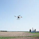
Drone LiDAR is making a serious impact for specialists across many professions, both in terms of efficiency of data collection and generation of geospatial deliverables.

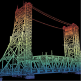
Frank DarmayanThe mdLiDAR1000LR increases the distance from which details can be captured. It can capture powerline details at 75m for distribution and 90m for transmission, effectively doubling the range of our mdLiDAR1000HR system. Flying at 70m from the powerlines, at 8m/s allows for efficient location of the powerlines with roughly 10 points per linear meter and capturing great detail of the towers.
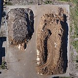
The mdLiDAR1000LR is also a great tool for scanning large mines and measuring stockpile volumes. Flying at 100m AGL with 20% sidelap, the LR can cover over 1.2 square kilometers in a 30 minute flight, capturing a point density of 150 points per square meter.
Chief Operations Officer
Microdrones has developed an end-to-end LiDAR solution combining a drone, a LiDAR payload, a fully integrated LiDAR processing and photogrammetry software workflow, and world class support to consistently provide quality deliverables.
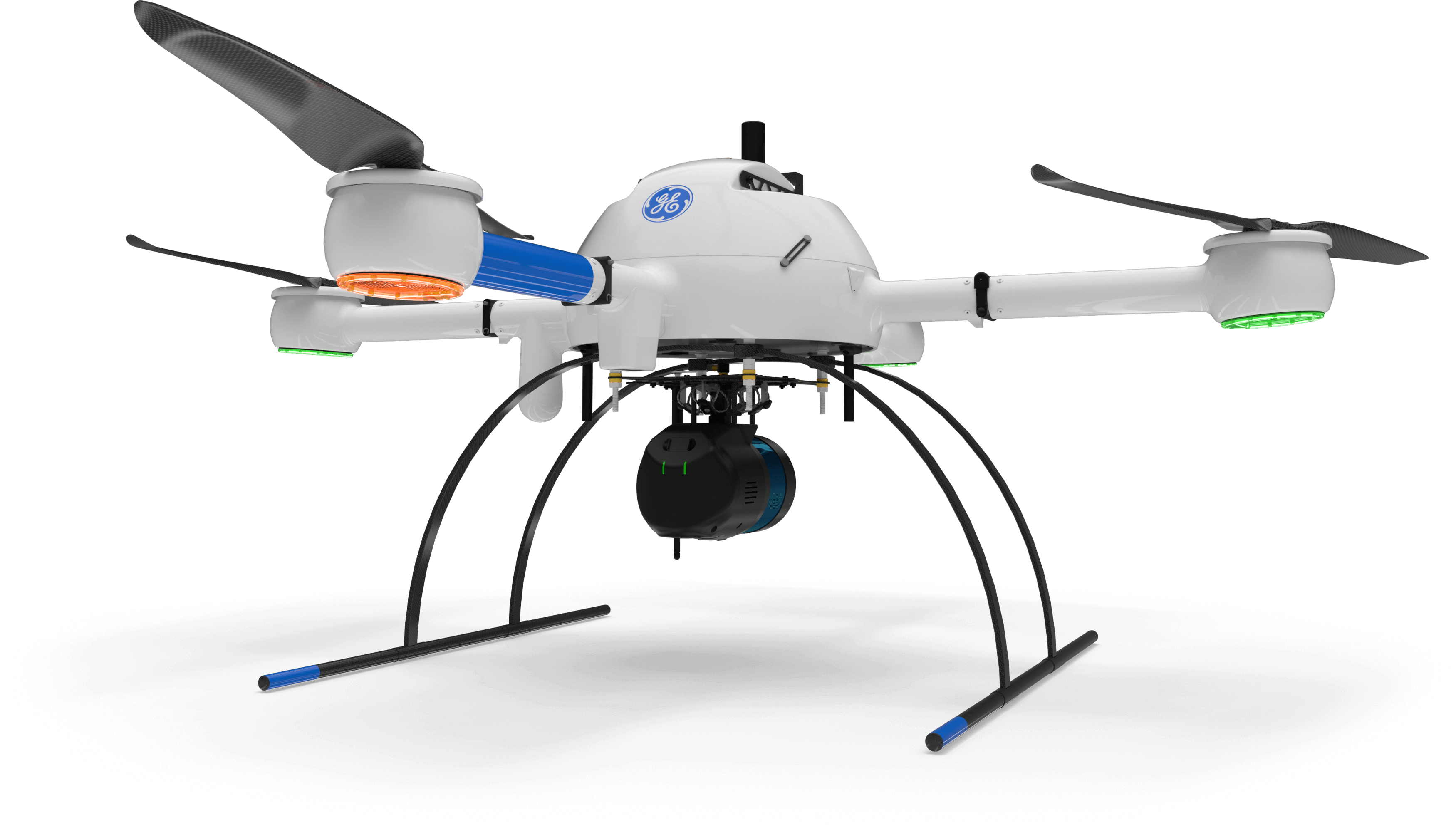
mdLiDAR1000LR is a fully integrated system for producing 3D pointclouds optimized for land surveying, construction, oil & gas and mining applications.
Improved image acquisition precisely configured to match the laser scanner field of view enables compatibility with streamlined pointcloud colorization and FORMap data processing modules within the mdInfinity platform.
Each LiDAR channel of the mdLiDAR1000LR is boresight calibrated to improve the data consistency, therefore providing a reduced Standard Measurement Uncertainty.
Improved image acquisition precisely configured to match the laser scanner field of view enables compatibility with streamlined pointcloud colorization and FORMap data processing modules within the mdInfinity platform.
The mdLiDAR1000LR can help streamline your current workflow to become more efficient, while helping you to complete more projects.
Learn more about the benefits and challenges of investing in drone based LiDAR. Click here to review one of our FREE educational UAV LiDAR webinars. In this edition, you can learn how one of Microdrones customers saved over 50% compared to conventional survey methods by implementing a UAV with LiDAR.


From surveying to mining and construction, professionals are using the power of the mdLiDAR1000LR to streamline their workflow. This new technology is helping them to complete more surveys, see more detail, optimize mining volume analysis and maximize construction monitoring.

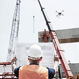
Matt RosenbalmFlying LiDAR to create a 3D pointcloud model before beginning a construction project provides advantages. It can tell workers how much dirt needs to be moved on a site before they get started, for example, enabling them to bring the right amount of resources to the job.
Microdrones Sales Manager for the Eastern US


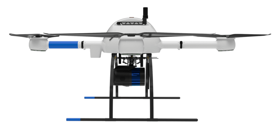
PLATFORM
COMMUNICATIONS
PAYLOAD
SURVEY EQUIPMENT SOFTWARE
LP360 Drone is a powerful ecosystem that will enable you to quickly and efficiently process geospatial data, with convenient payment options.
Microdrones is committed to constant, customer focused improvement. As such we are developing cutting edge, integrated technology that evolves rapidly.
For those of you with an older system, we are always eager to help you upgrade your previous Microdrones system to the latest standards so you can take advantage of new features and functionality.
Simply click this button to schedule a meeting with a member of our sales team, and they will assist you in collecting your current system information so they can prepare a price estimate to upgrade.
Easily tackle projects in areas that are difficult, dirty or dangerous to access – such as challenging terrain, crumbling structures, high elevations, and areas impacted by natural disasters.
Collecting data previously required extensive groundwork or very expensive manned aircraft. Using a drone allows quick and affordable data collection; that’s one of the most important benefits for geospatial professionals.
Survey live construction or mining sites without interrupting people, plans or machinery. You’ll no longer have to stop work and equipment to collect the data you need, making you more valuable to your customers.
Customers are curious about UAV surveying technology – so providing it demonstrates that a business is an industry leader at the helm. Faster, more efficient data collection differentiates you from competitors and positions you as a subject matter expert in an emerging technology.
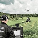
Our professional UAV pilots offer complete onsite Microdrones UAV training to both dealers and end-user customers to ensure they are fully capable of deploying their drone packages in the field, ready to achieve immediate results.
Platform
md4-1000
Payload
Software
Takeoff Weight (TOW)
6400g
System Operation Temperature
-10 °C to 40 °C
14 °F to 104 °F
System Accuracy:
| Flight Altitude AGL (1,2) (m/ft) | 60/200 | 90/300 | 120/400 |
|---|---|---|---|
| Speed (m/s) | Covered square area at 30% sidelap (ha/ac) | ||
| 4 | 38/94 | 47/116 | 51/126 |
| 6 | 52/128 | 63/155 | 90/222 |
| 8 | 64/158 | 95/235 | 120/297 |
| Speed (m/s) | Average Point Density in pts/m2 (2,3) (square area / 1 scan line) | ||
| 4 | 368/313 | 245/208 | 184/156 |
| 6 | 245/208 | 163/139 | 123/104 |
| 8 | 184/156 | 123/104 | 92/78 |
| Camera GSD (mm) | 9 | 13.5 | 18 |
| Swath width (m/ft) | 120/400 | 180/600 | 240/800 |
| Number of Laser Returns | 2 | 2 | 2 |
(1) Flight Altitude Above Ground Level (AGL)
(2)Coverage estimated for approximately 25 minutes of flight time.
(3) Average density calculated with 30% overlap on 5 lines… average density will depend on surface type.