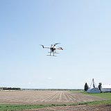
Industrial drone line
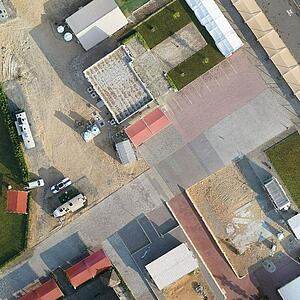
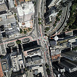
Collect data and create 3D models of structures, buildings and neighborhoods
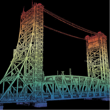
Model fine details, texture and all sides of structures in 3 dimensions.
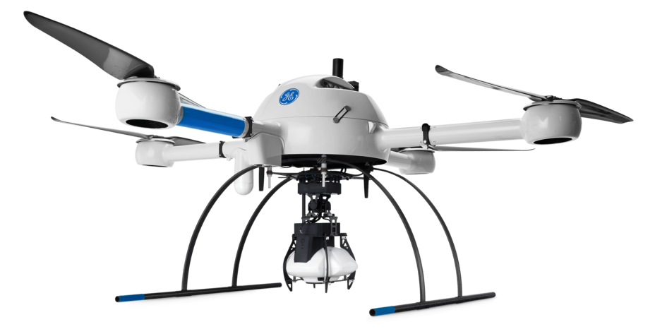
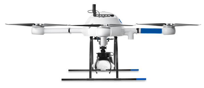
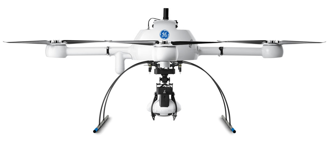
mdMapper1000DG 3D is a fully integrated drone mapping system that can be used for high wall mapping and 3D modeling.
You will capture all angles and surfaces of your subject with an integrated array of five cameras, seamlessly working together, and integrated into the processing workflow, all backed with the power of direct georeferencing.
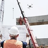
This system gives you everything you need to Plan, Fly, Process and Visualize your architecture, remodeling, maintenance, mining and construction projects.
The time tested Microdrones md4-1000 aircraft is perfectly integrated with direct georeferencing an incredibly powerful oblique camera, as well as mdInfinity data processing modules, workflow, training and support.
Five sensors capture data from multiple angles, to ensure high quality artifact-free imaging.
DIRECT GEOREFERENCING OR PPK DRONE SURVEYING:
mdMapper1000DG 3D WILL RISE TO THE OCCASION.
Today, direct georeferencing (DG) is the most advanced technology available. But that doesn’t make it a luxury option. Direct georeferencing makes sense for pretty much any customer because it will pay for itself quickly and provide your business with dramatic cost savings over time.
With DG, you won’t need to install any ground control points (unless you want to install 1 or 2 to check your work later for quality control). You’ll collect your images and post-process in a fraction of the time. Your projects will require less people and equipment. You’ll safely tackle mapping jobs in dangerous locations.
Most important, you’ll deliver the best possible accuracy on projects where human safety and your reputation is on the line. Best of all, DG is selectable, AFTER data collection, as a post processing option... so you are only paying for it when your client or project needs it.
Don't need DG? Process with PPK; it's all selectable by project need within mdInfinity!
Microdrones customers asked for a workflow that could deliver excellent results with a handful of ground control points. We listened.
mdMapper1000DG 3D fills an important niche for customers who may not be ready for DG, and are willing to set up 1 – 3 ground control points for their projects; simply post process data in PPK within the flexible mdInfinity cloud or desktop software.
And when your business, projects or services expand to require DG, you simply choose to process your data with DG in the mdInfinity suite.
Click here to learn more about mdInfinity.
Why Choose mdMapper1000DG 3D?
Your job will be quicker and easier when post processing data from five sensors.
You will capture all angles and surfaces of your subject with an array of five cameras, seamlessly working together, and integrated into the processing workflow, all backed with the power of direct georeferencing.
You will collect a massive amount of photogrammetry data and the software does the hard work for you.
As you can imagine, with five cameras collecting thousands of images during each flight, post processing could be a challenge. But with the fully integrated, smart workflow of mdInfinity, the job of producing a complete data set that is georeferenced, geotagged and ready for importation into popular photogrammetry software is easy.
Eliminates your need to install GCPs
while meeting the most precise data requirements.
Allows you to perform corridor mapping
thanks to an on-board IMU that measures orientation angles. RTK, PPK, and conventional aerial surveying methods do not measure these angles so corridor mapping becomes a major operational and logistical challenge.
Drastically reduces time spent
on post-processing and data collection, thanks to an impressively decreased side lap and many other elements.
Further improves your efficiency
with industry-leading flight times and resilience against harsh environmental conditions.
Reduces overlap and sidelap
With other methods, 80 x 80 is a must. With DG, you can achieve 80 x 40 overlap. Translation: it slashes the time you spend on projects.
Allows you to measure
the 6 parameters necessary for image georeferencing, whereas conventional surveying methods (RTK and PPK) rely on computing all or some of these values. DG reduces time, effort, human error and cost, while improving accuracy.
Lets you complete your projects with less
people, time and equipment.
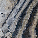
Can cover up to 200 ac
(80 ha) in one flight.
Allows you to confidently bid on international projects.
With international projects, there are bound to be challenging unforeseen constraints that impact access. DG lets you rise above and protect your investment in the project.
Lets you check your work for quality control purposes,
which isn’t possible with RTK and conventional surveying methods.
What Can You Do With It?
From the real world to your laptop, you’ll see 3D models showing all angles, roofs and sides of buildings, as well as the detailed texture of all surfaces.
THE mdMAPPER1000DG 3D PACKAGE INCLUDES:
SURVEY EQUIPMENT
PLATFORM
COMMUNICATIONS
PAYLOAD
SURVEY EQUIPMENT SOFTWARE
Data Processing Software Included
LP360 Drone is a powerful ecosystem that will enable you to quickly and efficiently process geospatial data, with convenient payment options.
***IMPORTANT NOTE TO CUSTOMERS WITH LEGACY SYSTEMS***
Microdrones is committed to constant, customer focused improvement. As such we are developing cutting edge, integrated technology that evolves rapidly.
For those of you with an older system, we are always eager to help you upgrade your previous Microdrones system to the latest standards so you can take advantage of new features and functionality.
Simply click this button to schedule a meeting with a member of our sales team, and they will assist you in collecting your current system information so they can prepare a price estimate to upgrade.
mdMAPPER1000DG 3D SPECS
SOLUTION COMPONENTS
Platform
md4-1000
Payload
- Camera: 5 (Sony APS-C Sensor)
- Georeferencing: APX-15 EI UAV
Software
- mdCockpit
- mdInfinity
TECHNICAL SPECIFICATIONS
Takeoff Weight (TOW)
6070 grams
System Operation Temperature
-10° C to 40 °C
System Accuracy
- Photogrammetry:
- Horizontal: 2 – 3 pixels
- Vertical: 3 – 5 pixels
| mdMapper1000DG 3D | ||
|---|---|---|
| Flight Parameters | Area Covered (@120 m) (1) | 80 ha / 200 ac |
| Camera model (2) | 5 (Sony APS-C Sensor) | |
| Imagery format | RAW + JPEG | |
| Resolution | 120 MP Combined | |
| Field of View | 130° Symetrical | |
| G.S.D. cm/pixel (@120 m) | 1.7 | |
| G.C.P. | No | |
| Overlaps (front/side) | 80% / 40% | |
| Post-Processing (3) | Method | Optimized Aerial Triangulation / GNSS-Inertial Solution |
| Orientation | High precision Sensor (INS) | |
| Position | High precision Sensor (GNSS) | |
| Accuracy | 2 – 3 GSD (X,Y) and 3 – 5 GSD (Z) | |
| Advantages |
|
(1) Typical project benchmark comparisons based on missions completed in Canada in 2016
(2) The current camera models are listed. These may be replaced by equivalent or better cameras depending on availability from the manufacturer.
(3) Using DG single base processing