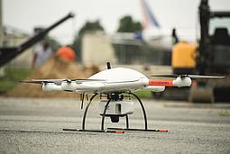
For much of the 20th century, drones were largely used by the military for reconnaissance and combat missions. (www.businessinsider.com/a-history-of-commercial-drones-2016-12) As these unmanned flying vehicles (UAVs) became more affordable, researchers and filmmakers leveraged the technology to capture aerial footage, eliminating the need to hire helicopters. Now drones have exploded in popularity, and are used to improve workflows in a range of industries including natural gas, energy, mining, construction, transportation, and agriculture. Combining the agility and operability of UAVs with the power of LiDAR sensors enables drones to deliver superior performance in a number of applications.
What is LiDAR?
Everyone has heard of RADAR technology, but what about LiDAR? The two are similar, but RADAR uses radio waves, while LiDAR (Light Detection and Ranging) relies on light in the form of a pulsed laser to measure variable distances. LiDAR is particularly useful in surveying operations to perform ‘laser scanning’ and generate 3D point cloud images.
Here are 5 applications for deploying LiDAR technology:
1. Land Surveying
LiDAR sensors can be attached to drones to quickly, accurately, and cost-effectively generate 3D digital terrain models (DTM) of remote or rough areas. UAVs are the right fit tools for covering specific land areas in situations where a manned aircraft is overkill. Drones are easier and faster to deploy than airplanes or helicopters, reducing costs and risk.
2. Power Line Inspection for Maintenance
Regular maintenance of power lines presents huge safety hazards. LiDAR technology is capable of identifying issues in power lines before they become a problem. Through the use of UAVs, utility companies can quickly assess damage to devise a solution that has the lowest level of risk.
3. Forestry and Farming
LiDAR-equipped drones can be deployed to survey large farms to help determine how resources might be used to increase productivity. They can also be used over forest areas to create 3D models that show the impact of human activity. A key advantage of LiDAR is that it is able to penetrate tree cover.
4. Mining Applications
LiDAR proves to be an excellent instrument for calculating volumes of material in open pit mines without disrupting work on the ground. Integrating drones into mining workflows cuts time, costs, and risk exposure.
5. Transportation Expansion
City planners looking for a powerful tool to help expand mass transit systems and rail stations need look no further than LiDAR technology. UAVs with LiDAR sensors can scan wide areas and generate useful data to help determine plans for future transportation infrastructure.
The mdLiDAR1000 package from Microdrones includes all the hardware and software necessary for generating fast, accurate, and budget-friendly 3D point clouds, maps and models. Want to discuss the possibilities of aerial LiDAR by drone for your business. Our friendly professionals are eager to help you!