The architecture, engineering, and construction industry (AEC) is leading the way in the use of unmanned aerial vehicles, or UAVs. In fact, some large firms already employ full-time flight crews to collect drone data during every step of the process. Let’s take a look at how UAVs are helping to make construction faster, safer, and simpler, while saving money.
Drones are Used in Each Step of the Building Process
To do their jobs, architects, engineers, and construction personnel all require reliable data at each stage of the process; from design, planning, and surveying, to building, marketing, and inspections. Drones are helping to transform the industry by supplying high-quality data more quickly than previous methods, and at a lower cost. Best of all, they do this in real time, without shutting down equipment or pausing work, allowing personnel to plan and monitor progress safely on an ongoing basis without impacting the schedule.
Surveying and Mapping: Where UAVs Truly Shine
Drones offer innovative capabilities in surveying and mapping that simply weren’t available just a few years ago. UAVs may be used by construction firms to capture images of the site and precisely map roads, canals, pipelines, and other infrastructure. In addition, drones create a wealth of highly accurate 2D and 3D data that can be fed into powerful software to easily create 3D models and maps. In this way, drones shouldn’t be viewed as a replacement for surveying, but rather as a new tool in the surveyor’s toolbox.
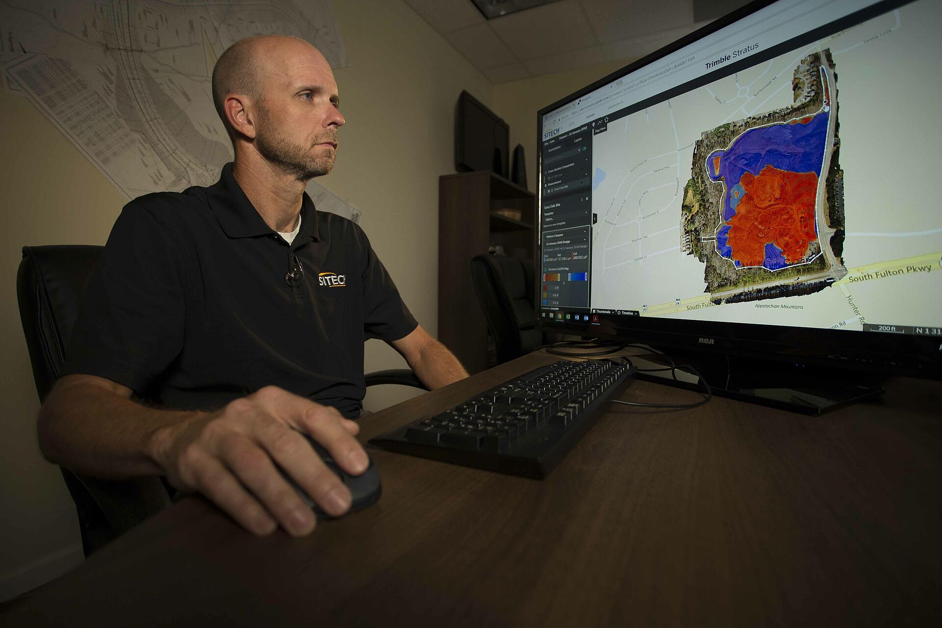
Drones Have Proven Invaluable ON Construction ProjectS
Brent Scarbrough & Company provides site development services to the State of Georgia including erosion control, clearing, and grading. One major project the company is working on is Hadley Park, a green space where families can come together. The firm has found that drones are an indispensable tool when measuring how much cut and fill a site will need to make the ground level and sound enough to build upon.
UAVs have helped measure the topography of the land quickly. Alex Lowry, Drone Operator at Brent Scarbrough & Company, says, “We are using the drone for topo to be done out here, the cuts and fills, and for the grading to be done, as well.” Sitech, a construction technology supplier offering support on the project, recommends Microdrones mdMapper1000DG for aerial surveying as an innovative, yet easy-to-use solution for its customers. EJ Herron, Regional Sales Manager of SiTech, says, “Instead of doing topography by hand or actually walking the field, we’re able to fly that same construction site in 10 to 15 minutes.
The Construction Industry Chooses Microdrones
Microdrones’ fully integrated systems offer complete UAV solutions for construction firms. This powerful tool allows architecture, engineering, and construction firms to create highly accurate data, maps, and models quickly, safely, and accurately, reducing costs in the process. With its mdMapper and mdLiDAR systems, Microdrones offers everything construction companies need to get started quickly and easily.