The industry-leading mdCockpit app from Microdrones provides ultimate function, flexibility and flight, all at your fingertips – and it just got even better.
mdCockpit’s latest update brings a variety of beneficial features, all aimed at one key vision to deliver the premier solution for planning, monitoring, adjusting, analyzing and controlling professional drone flight missions right from your Android tablet. Learn about the updates in the video below.
mdCockpit Version 2020.3 Key Features
mdCockpit is designed to help you expect the unexpected, and these new features make that goal simpler than ever.
In mdCockpit version 2020.3, you’ll find key improvements to the app’s Terrain Follow functionality, including:
- Support for user's digital surface/elevation model in the following formats: GeoTIFF, SRTM1 and SRTM3
- Topography map overlay
- Improved Terrain follow management in Mission Dashboard
- NASA SRTM1 Data available now (US TERRITORIES ONLY)
This flexibility provides more options than ever, helping your mission succeed.
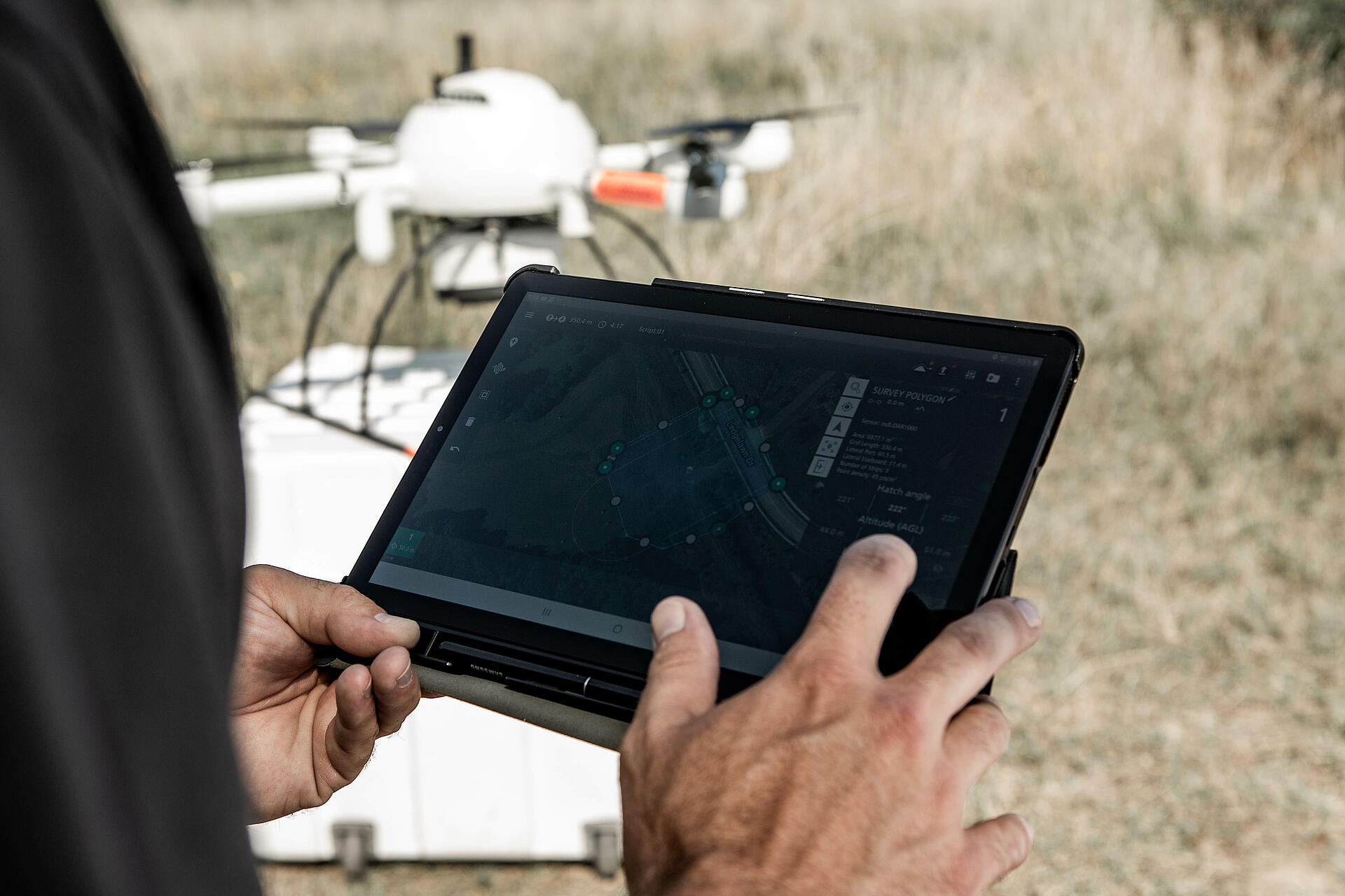
How It Works
Let’s explore how to make the most of mdCockpit’s improved Terrain Follow feature.
- You’ll now find Terrain Follow status and settings in an updated mission planning dashboard for increased visibility and ease of use.
- To enable the feature, simply toggle Terrain Follow on with the slider.
- From there, the feature will default to SRTM3 elevation maps. For U.S. territories, SRTM1 maps can allow for more precise mission planning.
- You can also add your own elevation sources for even greater accuracy – user manual section 15.2 contains more specifications about custom DSMs.
- GEOTIFF: Internal Storage/mdCockpit/ElevationData/Userdata
- Custom SRTM1: Internal Storage/mdCockpit/ElevationData/Userdata/SRTM1
- Custom SRTM3: Internal Storage/mdCockpit/ElevationData/Userdata/SRTM3
Note: Elevation source Coordinate Reference System must be in WGS84 or WGS84/UTM.
Select your own elevation sources for more accurate mission planning with Terrain Follow.
- Use the new elevation map view for a better understanding of your mission’s topography.
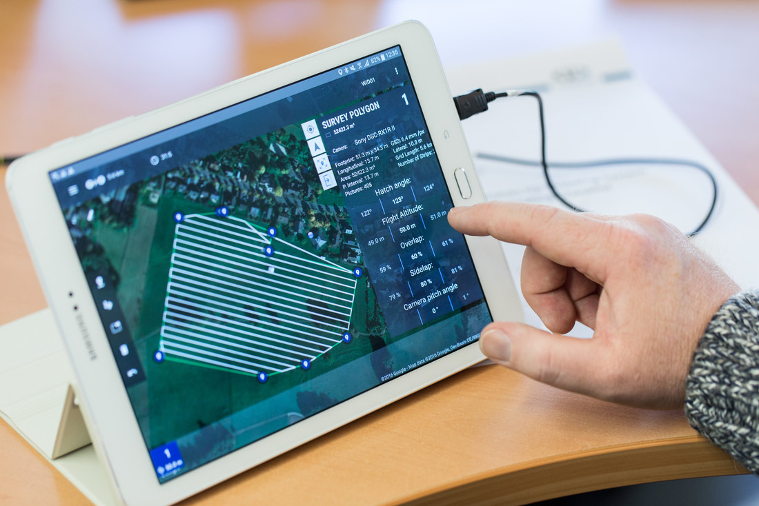
- Save your mission in CSV format to validate your waypoints elevation
An Exciting Future with mdCockpit
At Microdrones, we’re committed to constantly elevating the ability of professional drone pilots to approach critical missions in the field with the flexibility needed to overcome changes and challenges as they arise, and the improved mdCockpit app is another step in that journey.
Downloading the mdCockpit app onto your Android tablet is easy. Click the image above or visit our page in the Google Play store.
To learn more CLICK HERE to speak with a Microdrones sales representative.