Plan, Fly, Process, and Visualize in Microdrones Workflow Videos, Featuring RIB
Microdrones created their latest videos demonstrating Plan, Fly, Process, and Visualize - the Microdrones end-to-end workflow with RIB. You can watch the Plan and Fly video below:
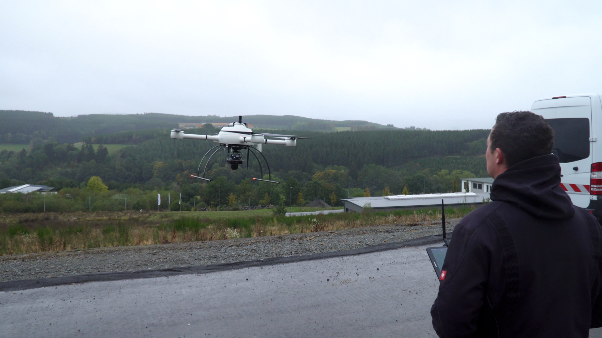
The first video demonstrates the Plan & Fly portion of the Microdrones workflow using the mdMapper1000PPK photogrammetry system. Lars Bitzer, Sales Executive iTWO Civil, RIB, recognizes the benefits of the Microdrones workflow and what the system can deliver to their road construction and surveying customers. He says, “The most exciting part of this work is the time savings compared to traditional methods.”
In the video, Markus Schulte, Owner/Founder of Markus Schulte Surveying Office, a customer of RIB, says, “The desired outcome of this project is to plan reliable earth movements throughout the construction and deliver them to our client.”
There are some challenges the team took into consideration on this project. “We have an area of approximately six hectares,” explains Samuel Flick, Sales Manager for Central Europe at Microdrones. “We’ll be flying at the same time as people are working and where the construction is ongoing. Therefore, we need to plan appropriately, safely, and be very mindful of our flight path and surroundings.”
“We chose to work with Microdrones as we were looking for partners that sell a rule solution and an end-to-end workflow that supports us completely,” explains Schulte. “Especially when beginning to work with such a system, it needs to be easy to integrate into our processes. We wanted to call someone when needed, and this is what convinced us at Microdrones.”
In the next video, the team demonstrates how data collected from the flight is used to create the final deliverables in the Process & Visualize portion of the workflow. “We are more than satisfied with the quality of the data,” said Schulte. “We received high-resolution data in a short amount of time.”
Using traditional methods, it would take the RIB team 40 hours to complete their survey. Using the Microdrones system allowed them to complete it ten times faster. “With the Microdrones system, the whole mission took four hours, and the data is processed quickly in our office. An additional trip to the field is not necessary because we can view every detail in the images,” says Schulte.
Once the data is processed, the final visualization is created. “Additionally, we use orthophotos to ensure the high quality of the point clouds,” Bitzer explains. “Cobblestone can be digitalized with millimeter precision. You digitalize directly in the orthophoto and the precise 3D coordinates come out of the point cloud.”
If you’re interested in putting the Microdrones workflow to use for your drone surveying needs, CLICK HERE to speak with a representative.