
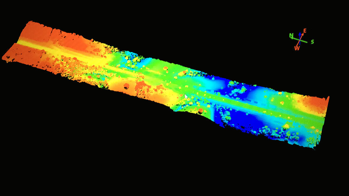
Measure, a Microdrones distributor who specializing in conventional topography, laser scanning, aero photogrammetry, drone Lidar, georeferencing, drilling and geospatial data, was tasked with surveying a 108km corridor of new railroad construction in Goias, Brazil, within a four-week time table. To meet the needs of their customer they used both the mdLiDAR1000 aaS and mdMapper1000DG aaS to efficiently and safely perform their corridor mapping mission and meet the project deadlines. Click the image below to view the point cloud in our Drone LiDAR Datasets.
Planning the Mission
The team at Measure planned 125 flights with multiple take-off and landing locations to complete the project—75 with the mdLiDAR1000 aaS and 50 with the mdMapper1000DG aaS. Most of the initial planning was completed in their office before the team moved on to building flight blocks in the mdCockpit tablet application. The ability to simulate the entire mission, and plan flight blocks of 10 to 12km, before setting foot in the field, helped to optimize their workflow and maintain operational security for the entire project. Pre-processing in the mdInfinity environment made it possible to produce the final products effortlessly.
Flying the Systems
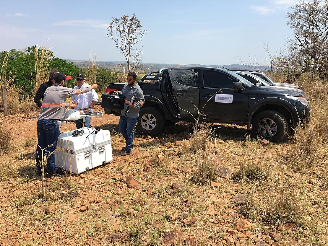
Once on site, the two-person team flew automated missions with the mdLiDAR1000 at an altitude of 70m with 55% lateral overlap. They used the same take-off and landing locations for each flight, generally completing multiple flights from the same spot so the crew could monitor the drone surveying equipment without having to move around. Alignment way points were also used at the beginning and end of each flight block to make sure trajectory and orientation are accurate during post-processing.
The terrain follow feature was used to ensure the mdLiDAR1000 stayed at a consistent height above the terrain throughout the flight, which was critical to making sure the data stayed consistent when outputting point cloud or imagery and creating the deliverables.
The mdMapper1000DG workflow was the same for the flights that collected the ortho imagery, except the drone flew bigger flight blocks at a higher altitude of 120m with overlap of 80/40% (front/lateral), which is key when it comes to top wind extraction for imagery.
Processing & Visualizing the Data
Using the data gathered in the field from the Microdrones Integrated Systems, Measure was able to provide their client with a topographic survey, a classified point cloud, and up to date ortho imagery to create a high-resolution surface model that could be used for quantity verification. The trajectory processing and georeferencing data modules in mdInfinity were used to process the data.

Another important component of the solution was the training and support services throughout the project, ensuring the full use of the entire Microdrones integrated system. Using conventional methods, this project would have taken about 80 working days in the field. With the Microdrones surveying equipment, they completed the surveying portion of the project in just five days. Measure estimates they saved the client 74% in field work costs by using the drone surveying technology from Microdrones.
“We are pleased to hear of the success of this corridor mapping project,” say Robson Augusto, Sales Manager for Latin America at Microdrones. “We love to see our distributors taking advantage of the Microdrones workflow and using our drone surveying equipment to not only save time, but create efficiencies and save their customers money as well.”
Measure has been distributing Microdrones systems to Brazil since July 2020. They frequently operate in the main mines of the State of Minas Gerais, already completing more than 100 hours of surveying with Microdrones systems.
For more information on using Microdrones to make quick work of your Corridor Mapping projects, CLICK HERE to speak with one of our professional representatives.