
It's drone vs. marsh in this 3-minute drone surveying case study. Watch the video below for details on how Morris P. Hebert Inc. (MPH) used drone LiDAR to verify fill levels in a marsh restoration project.
Coastal Louisiana faces some of the highest land loss rates in the world due to both natural and manmade factors. To help prevent further land erosion, extensive coastal protection and restoration plans are underway. Part of these efforts include marsh creation projects, to quickly restore wetlands, expand habitats and help prevent future land loss. MPH was tasked with surveying over 200 acres of a marsh restoration project to analyze pre and post conditions, with minimal disturbance to the environment.
See how they plan their mission, collect data, and navigate the remote and isolated conditions of working in the marsh.
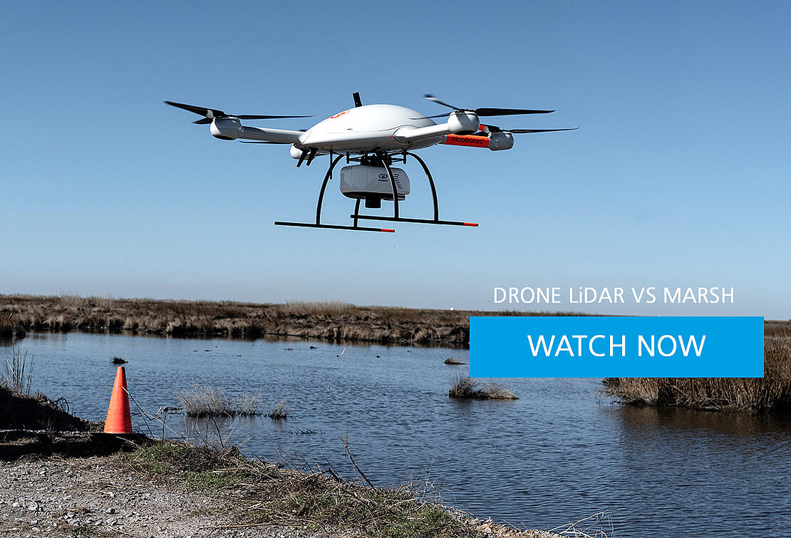
The Marsh 3-Minute Case Study: Drone vs Marsh
Limited Access. Wetlands in every direction. And 200 acres of newly created Marsh to be surveyed. This is a perfect job for drone LiDAR.
The wetlands of Southern Louisiana suffer some of the highest land loss rates in the world. Actions are underway to prevent further erosion and restore the marsh- but progress needs to be monitored and measured.
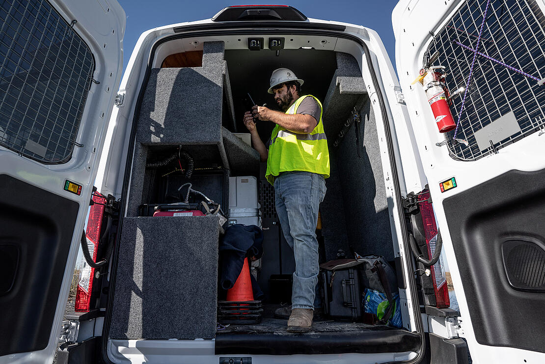
Enter, the surveying and engineering firm Morris P. Hebert, Inc., or MPH for short. The MPH team includes Environmental Regulatory Specialist and UAV Pilot Dakota Dagenhardt, Remote Sensing Tech Kiley Cressionie, and Project Manager Stuart Babin.
The team is deploying their mdLiDAR3000DL from Microdrones across a 200-acre area of restored marsh, to determine whether quantities of fill material meet design specifications. Getting in and out is the first problem to be solved, as roads are spare and often inaccessible. Dakota parks the van, sets up a GNSS base station, and assesses the project area. After finding a likely take-off point, flight operations can begin.
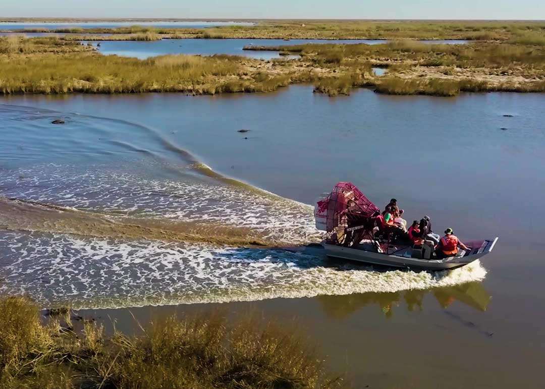
There’s a slight breeze in the air, but that’s not necessarily a bad thing. With winds below 10mph, the mdLiDAR3000DL, with its advanced aerodynamic design, actually gains lift, saving battery power. The conditions on day one are perfect. On day two, the area to be surveyed is even further away from the access road, so Airboat Freedom 2 is enlisted to serve as an observation platform, allowing Kiley to keep an eye on the drone for extended line-of-sight operations, at 1000 meters from the take-off point.
Navigating an airboat in a marshy environment is not a piece of cake, as the vehicle can get hung up on mud banks or dry patches of vegetation. Kiley and crew manage to keep free and the drone flights proceed as planned, successfully capturing all the data.
Back at the office, Research & Development and Training Coordinator Lee Drennan processes the data captured from the mdLiDAR3000DL to confirm measurements and analysis. When post-processing is complete, among the final deliverables are an impressive LiDAR point cloud data set and a highly detailed orthomosaic photo of the project area. Thanks to drone LiDAR the job has come in on time, under budget, and with minimal environmental disturbance.
For more information on adding drone LiDAR to your surveying workflow, talk with our sales team.
You can also watch more episodes about the drone LiDAR project in the wetlands of Louisiana.