OPTRON & MicroDrones mdLiDAR1000 Demo Flight
In October of 2018, Microdrones Africa Sales Manager, Hanno Truter, in conjunction with OPTRON, the leading provider of industry leading geospatial technologies for South Africa as well as sub-Saharan Africa, demonstrated the Microdrones mdLiDAR1000 to EPA (Eugene Pretorius and Associates) Surveys at the Wild Fontein Mine, in Mpumalanga, South Africa.
Check out a video of the demonstration, provided by Optron below.
Implementing the Microdrones Workflow
EPA Surveys was looking at expanding their toolbox of advanced geospatial and surveying equipment, and is in the market for a UAV/drone solution with LiDAR capabilities.
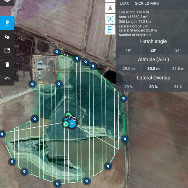
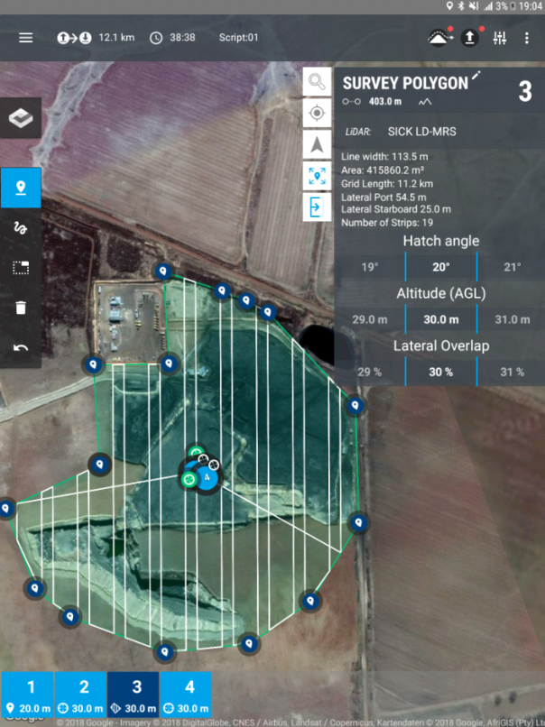
Microdrones helped conduct the mission that consisted of flying and surveying an area of about 46 Hectares at the Wild Fontein Mine, a coal colliery, in Mpumalanga, South Africa close to Middelburg.
Kevin Holighaus, a UAV Training Pilot for Microdrones, facilitated the demonstration of the Microdrones workflow of Plan, Fly, Process and Visualize.
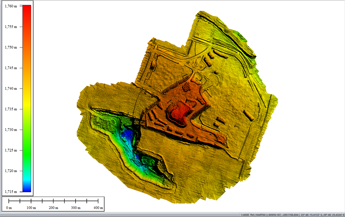
Process & Visualize
The main purpose of using LiDAR scanning technology on a colliery site, would be to calculate and determine the volumes of coal material stockpiles. Upon completion of the demonstration, Microdrones provided a colorized digital terrain model for further analysis.
Microdrones serves markets around the globe. Interested in making drones a part of your business? Start a conversation with our team of professionals now.