
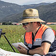
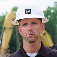
Ross KenneyAfter reviewing this data from the mdLiDAR1000HR, I can tell you this system is a game-changer. In the pointcloud you can clearly see that the entire park area, all the individual homes, and how well defined the creek is. In the parking lot, even all the striping is defined. Furthermore, you can see a high level of detail over the homes and property adjacent to the park, even though I did not fly over them, but because the scanner was such a wide field of view. You could see swimming pools. You could see the lounge chairs. You could see the umbrellas. You could see the Palm trees, all the landscaping, everything.
UAS Sales and Support Lead, Navigation Electronics
Nuno SantosI remember one very demanding quarry, about 30 hectares in area, with numerous embankments and a lot of variations in altitude. We had to set up 14 different total station bases and it took us three weeks to finish the job. Today, with our Microdrones system, we can do that same job in one day, and we get immensely superior results, with a level of detail impossible to achieve with traditional methods.
Founder and CEO, Aerisurvey

Johan LarssonIt’s a fully integrated system, so you get both the UAV and the LiDAR. With other manufacturers, you can buy a good laser scanner, but you don’t get the UAV. You have to buy that separately. Now, we have one integrated system, and if we have an issue with the LiDAR or the UAV, full support is available from Microdrones. That’s a really good value for us.
Surveying Engineer, SWECO
Aaron ThomasonThe only way that we could’ve met this timeline was to literally employ the Microdrone system’s LiDAR capabilities and collect the topo data that we needed to generate the boundary work. Being able to use this system allowed us to exceed our client’s expectations.
Vice President, Carlson, Brigance & Doering, Inc.

Andrew SchmittWe found in excess of a 40% discrepancy based on the design drawings we were given with existing conditions compared to what our drone was able to capture… compared to other bidders. What we were able to do is sit down with that developer, and that owner, roll out that data, make them understand that your project will cost this… help us help you eliminate change orders. The data certainly puts us ahead of the competition.”
President, Cougar Companies

Anders EdlundI like the Microdrones solutions… they are easy to work with regarding planning of the missions and flying the drones and seeing the product… in the end.
Drone Pilot, 5D Konsulterna AB
Dakota Dagenhardt…the mission went really well. We got the data that we were looking to get. The way that the software works is that we… set it to enable our waypoint missions so that when we come back tomorrow, the drone will remember exactly where we ended and it will pick back up right where we left off.
Environmental Regulatory Specialist, Morris P. Hebert, Inc.

William JudyckiWe’ve helped out… uncountable local industries with applications and I can’t think of a better product for education. It’s simple to use, it’s easy to teach, it’s very user friendly, and it provides the highest resolution product that industry can ask for.
Professor, Mohawk Valley Community College

Randall VanWagonerOur remotely piloted aircraft system program here at the college was an exciting venture for us because it got us into a new field that was emerging. We were able to partner with Microdrones to be one of the first to procure one of their systems that provided cutting edge technology for our students.
President, Mohawk Valley Community College

Jeff DavisWe knew that terrain was going to be an issue on this one, so we had to really make sure that our terrain follow was working correctly. The terrain follow quad uses a surface model or terrain model to follow existing terrain. So, we were really able to monitor it and make sure it was doing what it was supposed to be doing.
Survey Coordinator/UAV Pilot, Crafton Tull
Chad BolebruchCon el mdLiDAR3000, podemos topografiar unas 1,6 ha (4 acres) en unos 18 minutos, y hacerlo de forma general puede tomar un día completo de una cuadrilla de prospección, un equipo de 2 personas. El resultado es que reunimos más datos en menos tiempo y con menos personal y, en definitiva, ahorramos dinero.
Jefe de cuadrilla de prospección, ESP Associates

Nick Tucker P.S.Typically with a project like this, we would deploy one to two crews, and they would go out and shoot GPS break lines on the roads on the tops and a project of this magnitude would probably take somewhere in the neighborhood of two weeks. With the Microdrones mdLiDAR1000 we were able to capture the imagery and LiDAR to produce the deliverables in twodays field time. We’re saving that time in the field, saving that time in the office, and getting the same set of deliverables plus imagery and things of that nature that you wouldn’t normally be able to capture.
Vice President, Energy Services, Crafton Tull

Mark SchallMicrodrones destaca realmente sobre el resto del sector en su equipo de desarrollo, un equipo que conoce a fondo lo que hace. Su atención al detalle y su nivel de soporte y capacidad de respuesta son, sin duda, sus mejores atributos. Estamos entusiasmados y esperamos trabajar con Microdrones en el futuro.
CP, PLS, PPS, SP, Oficial en jefe, SDC


Mike MinickLos VANT de Microdrones ayudan a las empresas a mejorar la forma de llevar a cabo los trabajos y agregan nuevos servicios a sus carteras. Nuestros clientes demandan servicios de VANT y un paquete mdMapper es una opción perfecta para empezar. Los sistemas aéreos no tripulados de Microdrones ofrecen tiempos de vuelo prolongados, excelente estabilidad, flexibilidad en el campo, resistencia a condiciones climáticas adversas y resultan sencillos de aprender y operar.
Vicepresidente, Martin Instrument
Carlos EscuderoMicrodrones tiene una excelente línea de productos. Hemos investigado diversas marcas y creemos que es la mejor opción del mercado para nuestros clientes. Los cuadrirrotores de Microdrones son fáciles de controlar, altamente maniobrables, pueden volar durante un tiempo prolongado y son muy robustos y resistentes a la intemperie. Las condiciones medioambientales no los dejará en tierra.
Director General, GEOCOM
Brian HolleyEstamos muy satisfechos de ofrecer a nuestros clientes estos excepcionales sistemas aéreos no tripulados. Son sistemas preparados para la prospección; de hecho, si se examinan con atención, la ingeniería y la calidad resultan evidentes. Esta tecnología proporciona valor real y ayudará a nuestros clientes a ejecutar sus trabajos de manera más segura, eficiente y económica.
Cuando vimos el anuncio de Trimble en octubre, contactamos de inmediato con Microdrones. Después de hablar con ellos, quedamos impresionados tanto por sus sistemas mdMapper como por sus conocimientos y disposición para ayudar. Hicimos un pedido el día siguiente.
Director General, SITECH South

Joe HuttonDurante más de 10 años, Microdrones ha definido el estándar para la producción de soluciones VANT profesionales con rendimiento y fiabilidad sobresalientes. La incorporación de la tecnología de georreferenciación directa de Applanix en sus plataformas ha creado soluciones de prospección y mapeo muy precisas y fiables, que se sitúan a la vanguardia del sector. Microdrones está definiendo realmente el estándar de referencia en soluciones VANT profesionales.
Director de Airborne Products Applanix Corporation


Dr. Dalibor JerinicEl md4-1000 es el sistema multicóptero más productivo para la inspección de aerogeneradores que hemos usado hasta el momento. Debido especialmente a los prolongados tiempos de vuelo, este dron es una herramienta muy eficaz en nuestras áreas de aplicación.
Director de Innovación – Unidad de Negocios de Servicios Industriales, TÜV NORD GROUP