State of the UAV
Ever since Unmanned Aerial Vehicles (UAVs), better known as drones, became commercially available in the early 1980s, their ever-increasing capabilities have led to new applications across a variety of industries.
In just the past couple of years drone technology has advanced past the point of novelty. Drones are now a wise investment option, delivering valuable payback on initial cost. Seeing this, the Federal Aviation Administration (FAA) has also relaxed some of its earlier regulations on registering and operating drones. The effect of these factors can be readily seen; the total addressable value of drone-powered solutions in all applicable industries tops $127 billion.
The Future of Agriculture: Precision
Aided by recent evolutions in both drone technology and FAA regulations, one area that is quickly becoming revolutionized by drone technology is agriculture. As a result, drones have now been mainstreamed for farming, and these developments could not be more timely. With global population projected to reach over 9 billion by 2050, agricultural consumption is expected to increase by a massive 70%, a figure complicated by unpredictable weather patterns and natural disasters.
Drones can be a large part of the critical solution to this exponential increase in demand, along with closer collaboration between governments, tech leaders, and industry. Drones can assist famers in a range of tasks from analysis and planning, to the actual planting of crops, and the subsequent monitoring of fields to ascertain health and growth. As farms become larger and more efficient to meet this escalating demand, drones will prove invaluable in precisely managing a farm’s vital operations.
Specific Applications
With advances such as automation and GPS guidance that have already changed the farming industry, drones are now poised to modernize it once again. Here are a few ways in which drones can fulfill a number of roles to assist farmers throughout the crop cycle.
• Soil and Field Analysis
Drones are able to produce precise maps for soil analysis at the beginning of the crop cycle, which helps to direct seed planting patterns. After planting, this data helps determine irrigation and nitrogen-level management.
• Crop Monitoring
Currently, the agricultural industry’s largest obstacle is the low efficiency in crop monitoring resulting from the massive scale of industrial farming, exacerbated by increasingly unstable weather conditions that intensify risk and maintenance costs. Drones allow real-time monitoring at a far more accurate and cost-effective level than previously used satellite imagery. The Microdrones +m accessory kit is specifically tailored to this purpose, offering users an aerial imaging package designed to monitor nutrients, moisture levels, and overall cop vigor in order to help keep crops healthy and estimate yields.
• Irrigation
Drones equipped with hyper-spectral, multispectral, or thermal sensors are able to identify areas that require changes in irrigation. Once crops have started growing, these sensors are able to calculate their vegetation index, and indicator of health, by measuring the crop’s heat signature. Microdrones’ +m kit uses the acclaimed Micasense Rededge sensor to capture images on five spectral bands, allowing farmers a faster and more accurate method of assessing their crop and irrigation conditions.
• Health Assessment
Scanning crops with visible and Infrared (IR) light, drones can identify which plants may be infected by bacteria or fungus, helping to prevent disease from spreading to other crops. With Multispectral images, you can detect diseases and/or sickness before its even possible to detect it with a human eye. (This means you can see a lot more!) Microdrones’ +m accessory kit focuses on multi-spectral imaging, with crop health monitoring being the key application. With the +m kit, users are able to identify and measure crop issues like disease, pest problems, weeds, and water-stress, with all data being processed into indices tailored for specific agricultural applications.
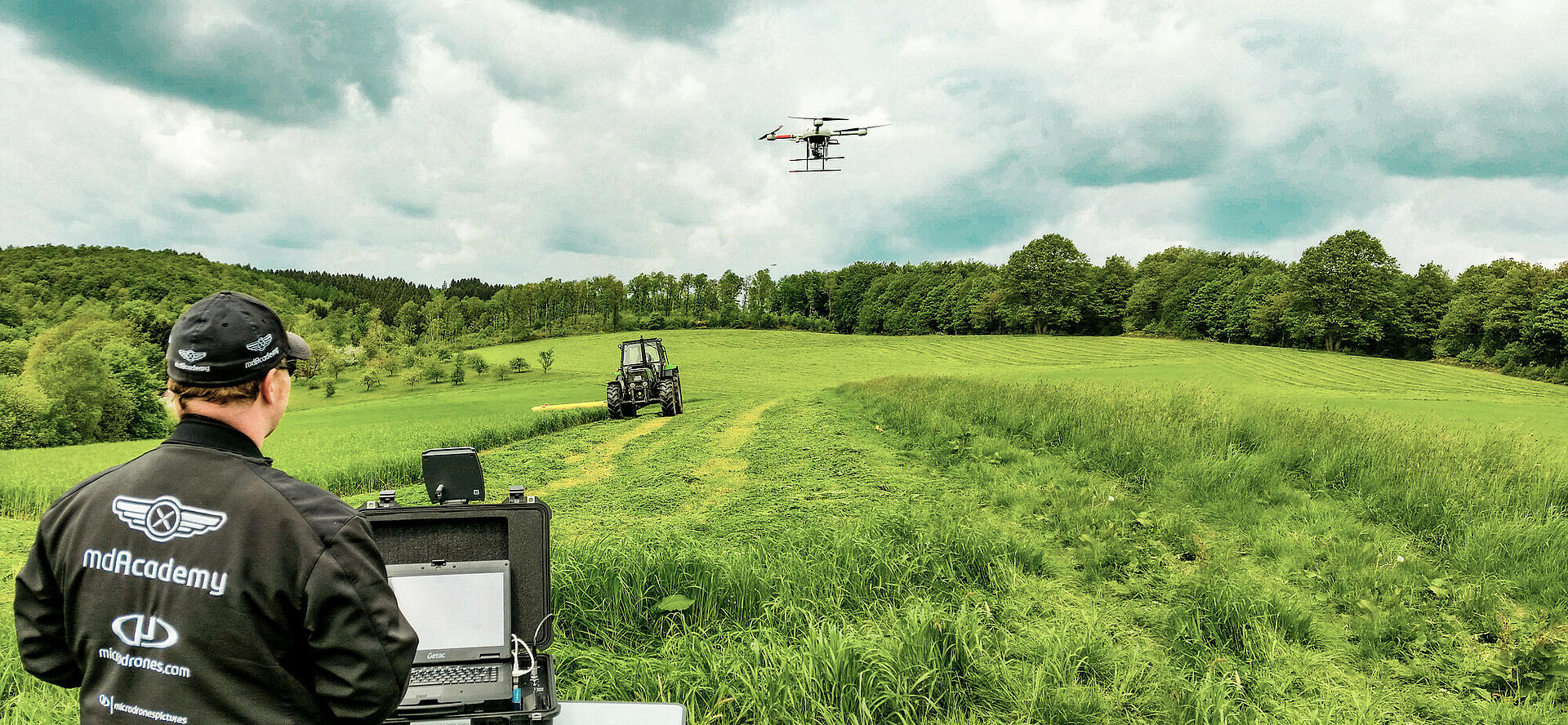
Microdrones’ Aerial Advantage
Engineered to accomplish all of these farming applications, Microdrones UAVs not only offer farmers the longest flight times on the market, they are particularly resilient in harsh, unpredictable weather. The mdCockpit app simplifies flight planning, monitoring, and analysis, allowing farmers to survey their fields precisely and consistently. Modular payloads also make Microdrones systems versatile and efficient in a wide variety of applications including crop-monitoring, where multi-spectral imaging and thermal mapping are needed, or field analysis. Microdrones is also working diligently on its LiDAR solutions for mapping, and this technology should also prove useful in areas of precision agriculture.
To learn more about how Microdrones is moving agriculture forward, visit our agriculture page today.