Don't need DG? Process with PPK; it's all selectable by project need within mdInfinity!
Microdrones customers asked for a workflow that could deliver excellent results with a handful of ground control points. We listened.
mdMapper1000DG 3D fills an important niche for customers who may not be ready for DG, and are willing to set up 1 – 3 ground control points for their projects; simply post process data in PPK within the flexible mdInfinity cloud or desktop software.
And when your business, projects or services expand to require DG, you simply choose to process your data with DG in the mdInfinity suite.
Click here to learn more about mdInfinity.
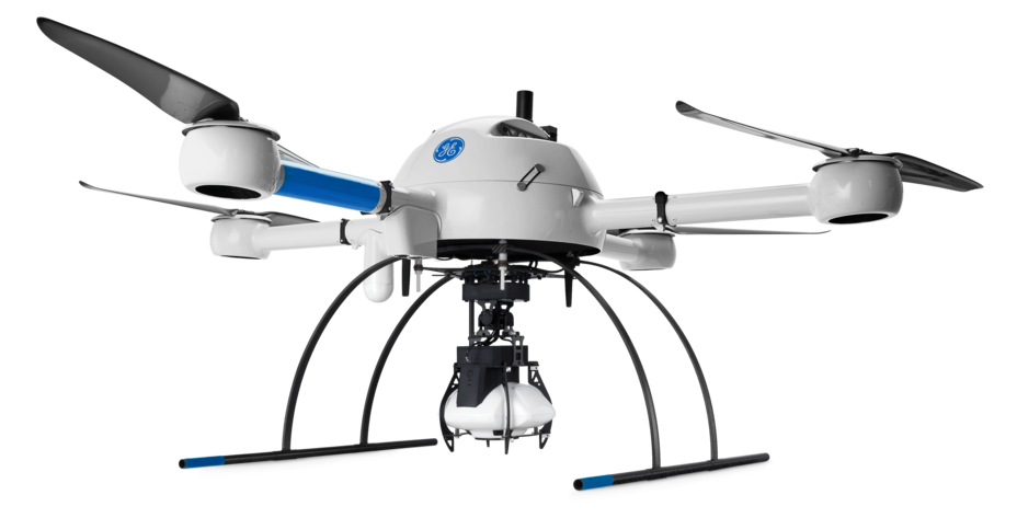
| mdMapper1000DG 3D | ||
|---|---|---|
| 飞行参数 | 覆盖面积 积(飞行高度为 120 米时) (1) | 80 公顷(200 英亩) |
| 相机型号 (2) | Sony 5 (Sony APS-C Sensor) | |
| 图像格式 | RAW + JPEG | |
| Resolution | 120 MP Combined | |
| Field of View | 130° Symetrical | |
| GSD 厘米/像素(飞行高度为 120 米时) | 1.7 厘米 | |
| G.C.P.(地面控制点) | 无 | |
| 重叠率(前向/旁向) | 80% / 40% | |
| 后处理 | 方法 | 优化的空中三角测量/GNSS 惯性解决方案 |
| 方向 | 高精度传感器 (INS) | |
| 位置 | 高精度传感器 (GNSS) | |
| 精度 | 2 – 3 GSD (X,Y) 和 3 – 5 GSD (Z) | |
| 优点 |
|