
Read the full report for Specifications for Using Small Unmanned Aerial Systems to Generate High Accuracy Mapping.
The Division of Research, Innovation and System Information (DRISI) at California Department of Transportation (Caltrans) worked with the Department of Civil and Geomatics Engineering at California State University, Fresno (CSUF) on a research report to deliver a proven set of specifications for using Small Unmanned Aerial Systems (sUAS) to generate high accuracy mapping.
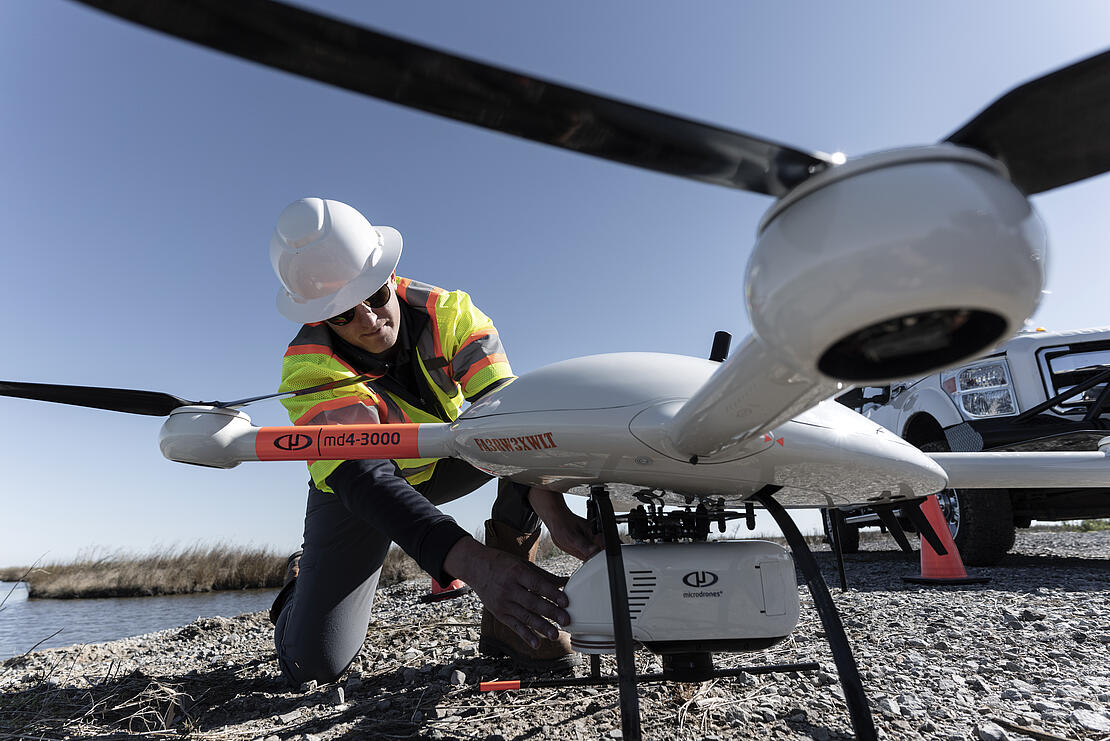
You can CLICK HERE to download a copy of the report which assessed and evaluated seven different LiDAR systems including the mdLiDAR3000DL from the Microdrones expert drone line. We’re pleased to see the conclusions show that the mdLiDAR3000DL provided excellent results which exceed the Caltrans mapping specifications.
Research Notes
Caltrans is responsible for maintaining accurate and up-to-date maps of thousands of miles of highway and transportation routes throughout the state of California. Drone LiDAR and Photogrammetry systems provide a safe and efficient means to collect data for high accuracy mapping. However, there are many variables in the different drone systems used to collect the data, such as camera quality, LiDAR payloads, and system specifications.
Therefore, Caltrans conducted a research project for Specifications for Using Small Unmanned Aerial Systems to Generate High Accuracy Mapping with the Department of Civil and Geomatics Engineering at California State University, Fresno (CSUF.)
This project compared and analyzed a number of photogrammetric digital cameras and LiDAR systems to find the strengths and weaknesses of this technology to help Caltrans determine where it can be used for highway mapping projects.
The results of the research project will help Caltrans develop an established set of specifications for sUAS hardware, camera calibration, and ground control requirements for use in their drone surveying workflow. Furthermore, the findings in this report can also be used by other businesses deploying drone surveying equipment to create highly accurate mapping products or LiDAR pointclouds.
Acknowledgment
The research was performed by the Department of Civil and Geomatics Engineering at California State University, Fresno (CSUF) for the Division of Research, Innovation and System Information (DRISI) at California Department of Transportation.
The contents of this study reflect the views of the authors, who are responsible for the facts and the accuracy of the data presented herein.
Riadh Munjy, Ph.D, PE is a Professor of Civil and Geomatics Engineering at California State University, Fresno.
Jacob Lopez is a graduate student at California State University, Fresno.
Chris Thornton, PLS is Chief—New Technology Systems Advanced Technology, Office of Land Surveys North Region Office of Surveyors, California Department of Transportation, Sacramento, California.
If you’d like more information on how you can add drone surveying technology to your workflow, CLICK HERE to speak with one of our helpful representatives.