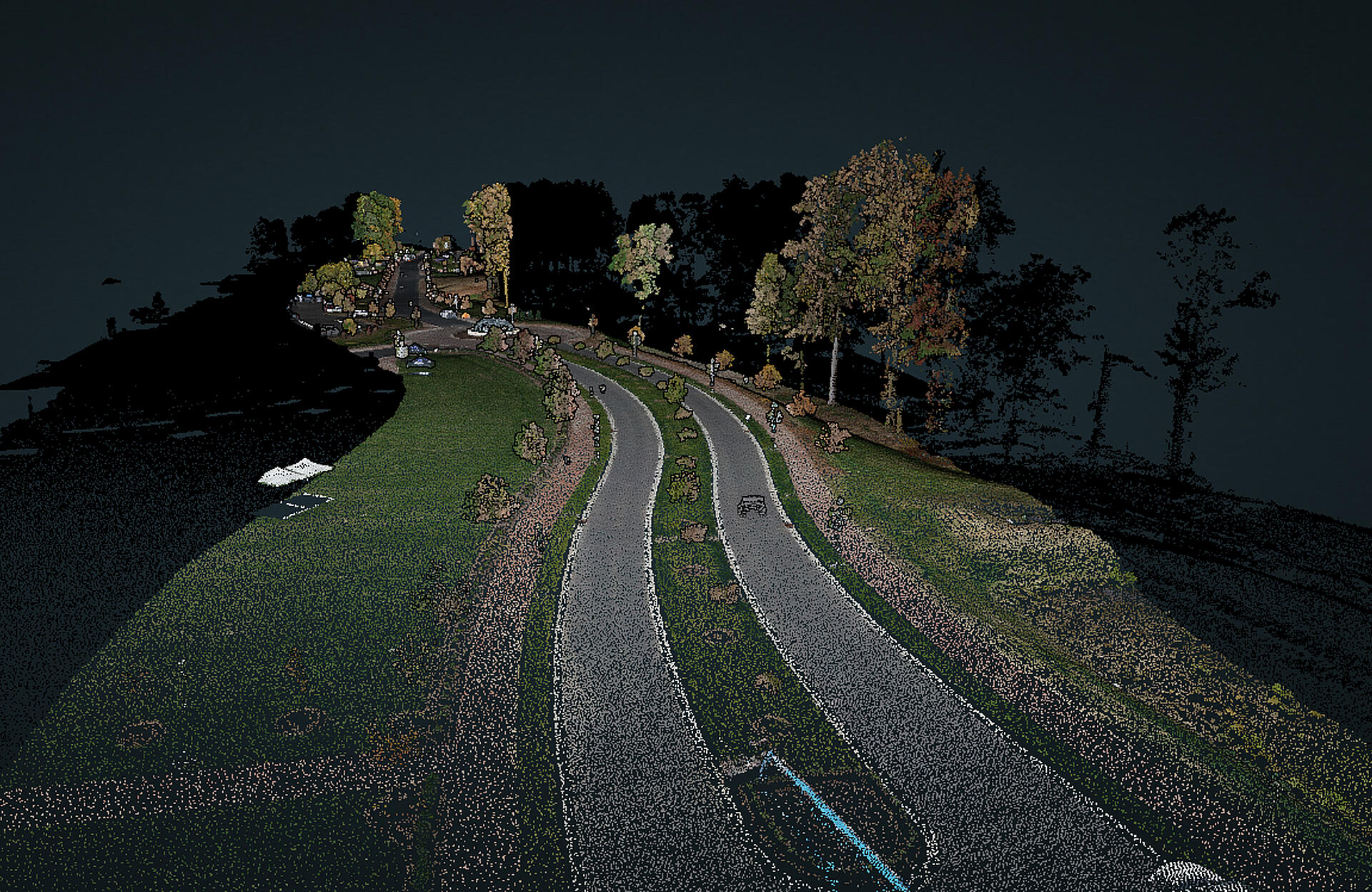
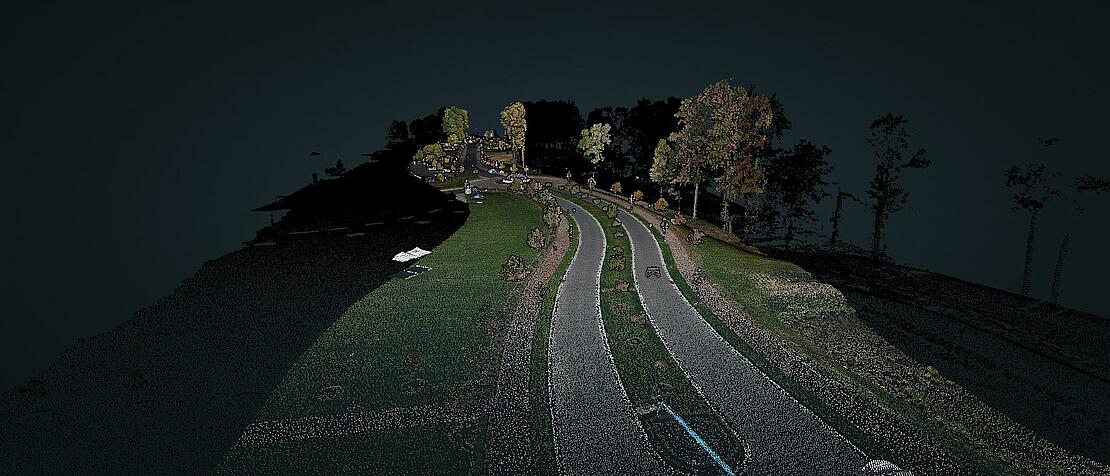
LOOK AT THE DRONE LIDAR POINT CLOUD CREATED FROM THE Spatial Data Consultants As-Built SURVEY PROJECT
The point cloud from this LiDAR data set was provided by Spatial Data Consultants (SDC) from the reality series Down to Earth, Spatial Experts. In these episodes, SDC used drone LiDAR technology to create a highly accurate and precise As-Built Survey of the new entrance at High Point University in North Carolina.
The data collected from the drone Lidar has been processed and is now available to view in an interactive point cloud. The drone LiDAR data was collected using the mdLiDAR3000 flying at a speed of 5.0 meters per second and an altitude of 80 meters. Click the image below to go to the point cloud viewer.
“Down to Earth” is a documentary-style reality series that shows how real surveyors collect data and turn it into real deliverables, despite challenging conditions, hidden dangers, and inclement weather.
Traditionally, the documentation of As-Built construction surveys relied on conventional methods such as total stations and digital photogrammetry. However, the team at Spatial Data Consultants (SDC), an expert geospatial consulting firm in High Point, North Carolina, is using drone LiDAR technology to more efficiently create accurate and precise As-Built Surveys.
In Episode 1, Mark Schall, Owner and Chief Professional Officer at Spatial Data Consultants explains how the company has transitioned from using manned fixed wing and helicopter aircraft to drone surveying systems. Then, Fred Johnson, the UAS Crew Chief, walks through the planning process for an As-Built Survey facilitated with drone LiDAR for the new entrance at High Point University in North Carolina.
Episode 2 sees the SDC team set up and fly a corridor surveying mission at the new entrance to High Point University. “We decided to do a corridor mission because the main focus was the new roadway leading into the campus,” explained Johnson. “I expect all of the details needed for the As-Built Survey to be clearly visible in my point cloud and photography.”
The third episode takes place back at the office of Spatial Data Consultants, where Fred processes the data to visualize the utilities, structures, and other construction features of the project. Using mdInfinity, a complete software solution for Drone LiDAR, and other 3rd party software, Johnson creates the As-Built Survey for the project. The LiDAR point cloud that is visualized is able to feature the planimetrics, topographical features and other construction structures documenting that all of the improvements on Panther Drive were constructed in accordance with the original design specifications.
The Drone LiDAR Flight Plan
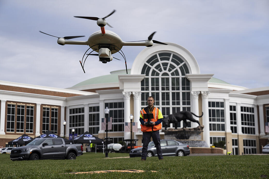
The mdLiDAR3000 uses the lifting power, resilience and efficiency of the Microdrones aircraft platform to carry a perfectly integrated Riegl miniVUX‑3UAV and a Sony RX1R II camera to capture ultra-dense LiDAR data quickly and safely in the field and then turn it into a 3D point cloud.
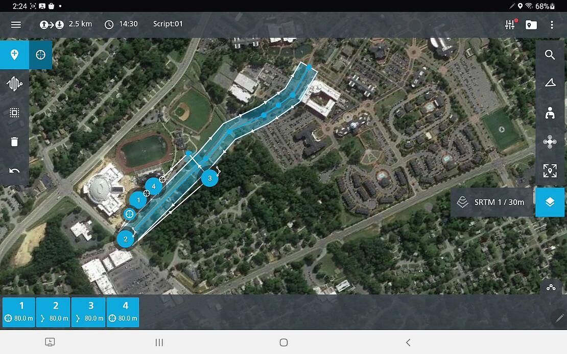
Fred Johnson created the flight plan and piloted the mdLiDAR3000 while Scott Deford, a geomatics technician, acted as a visual observer. Using mdCockpit, Johnson planned 1 flight with 2 strips to cover the 1.6km corridor over approximately 12 acres at High Point University. The altitude was set at 80 meters with a speed of 5.0 meters per second. There was 31% lateral overlap with a total flight duration of approximately 17 minutes.
Process and Visualize
The point cloud was created and processed through a combination of data processing software. The trajectory data was corrected in Pospac and mdInfinity desktop software was used to georeference the raw lidar data. Johnson used Terrascan for final post processing for adjustment of the strips, and Ground Classification. In Global Mapper, he colorized the point cloud with the orthophotos from the project. mdInfinity has all of these data processing modules available, designed to streamline the process for cleaning and refining data collected from drone LiDAR.
The final colorized point cloud can be viewed in the data viewer, similar to how it appears in mdInfinity.
If you would like to learn more about surveying with drone LiDAR speak with one of our friendly representatives.