
An overview of all the modules and how they can provide you with accurate, high-quality deliverables.
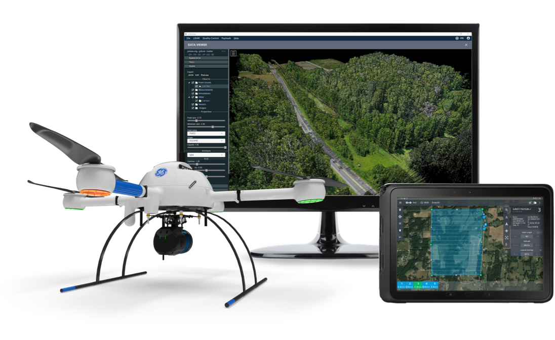
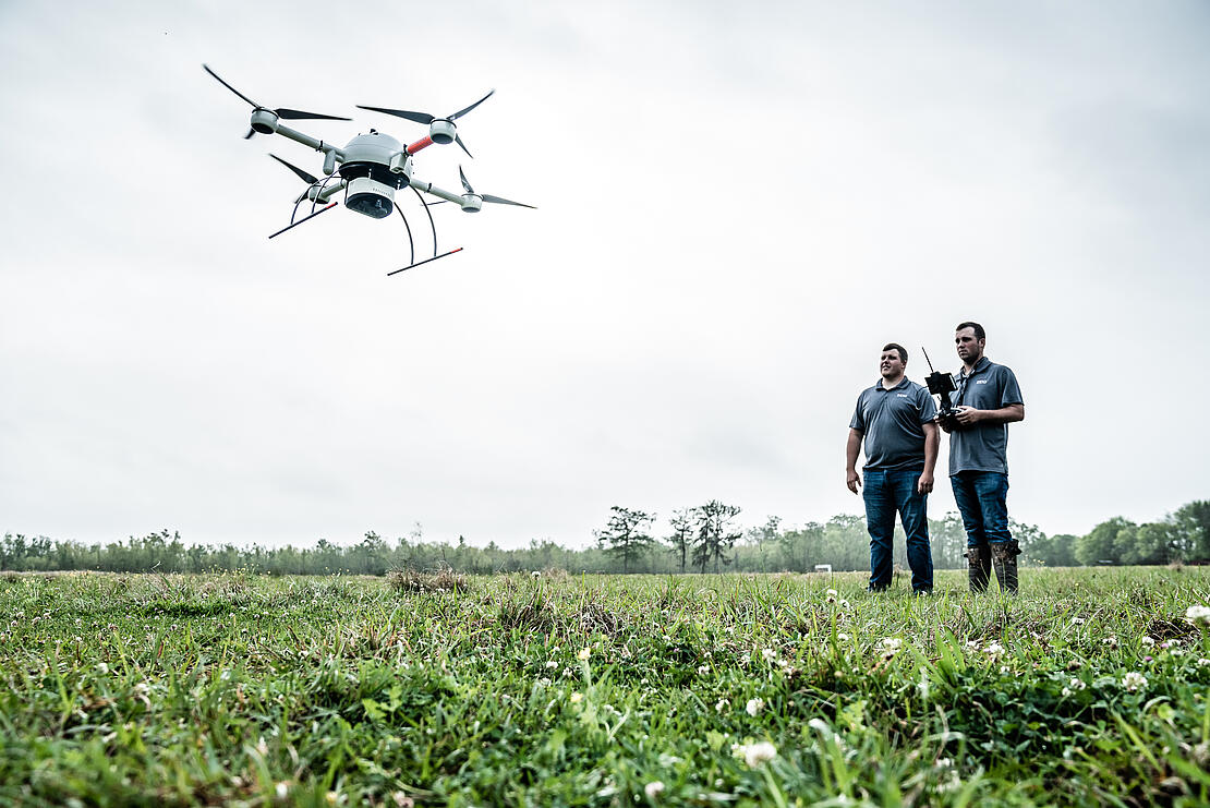
Drone surveying equipment from Microdrones make it possible for surveyors and other professionals to quickly collect accurate information for a variety of applications. They can be reliably deployed in harsh environments and in areas that are difficult to reach—but the benefits these end-to-end solutions provide go well beyond the flights.
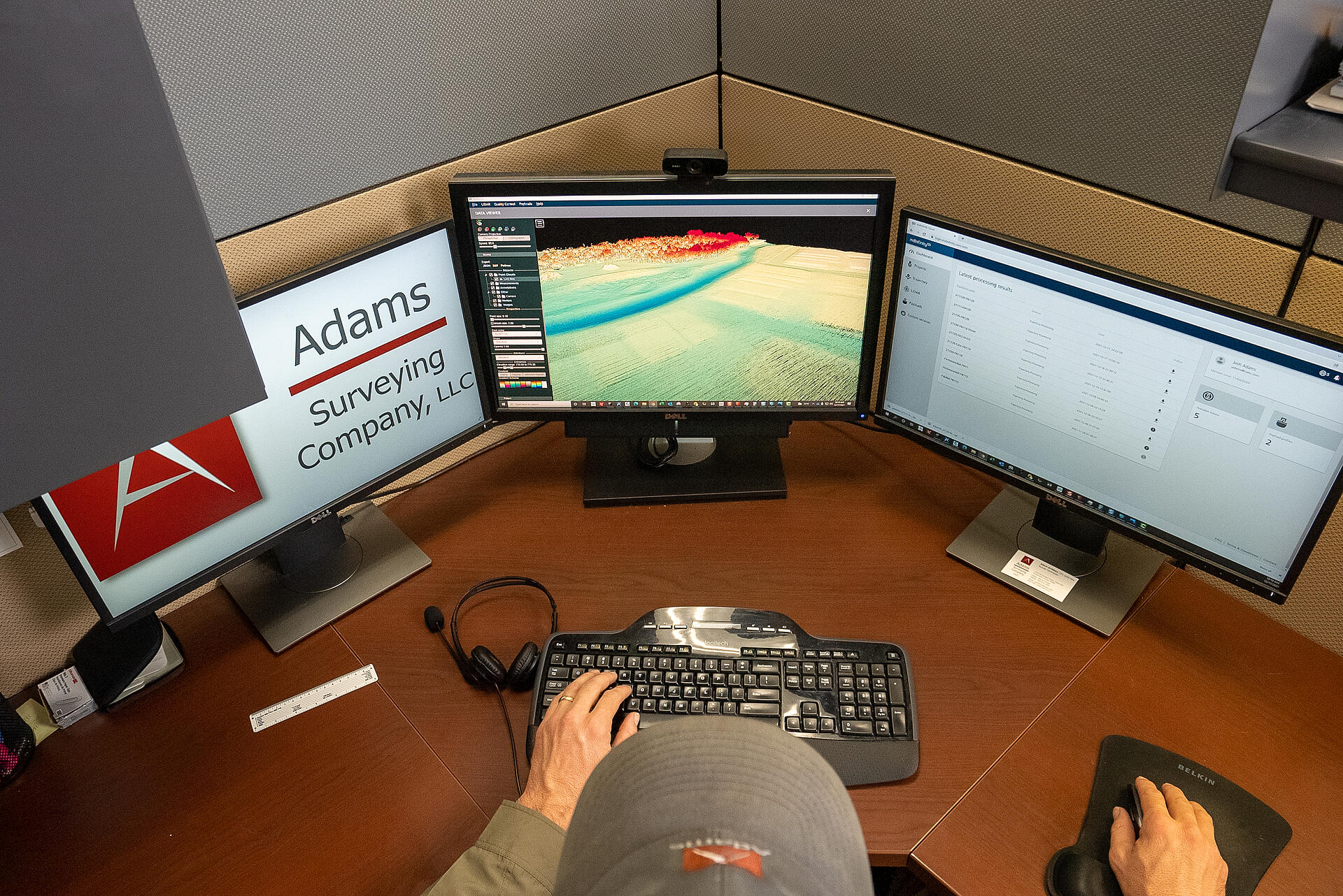
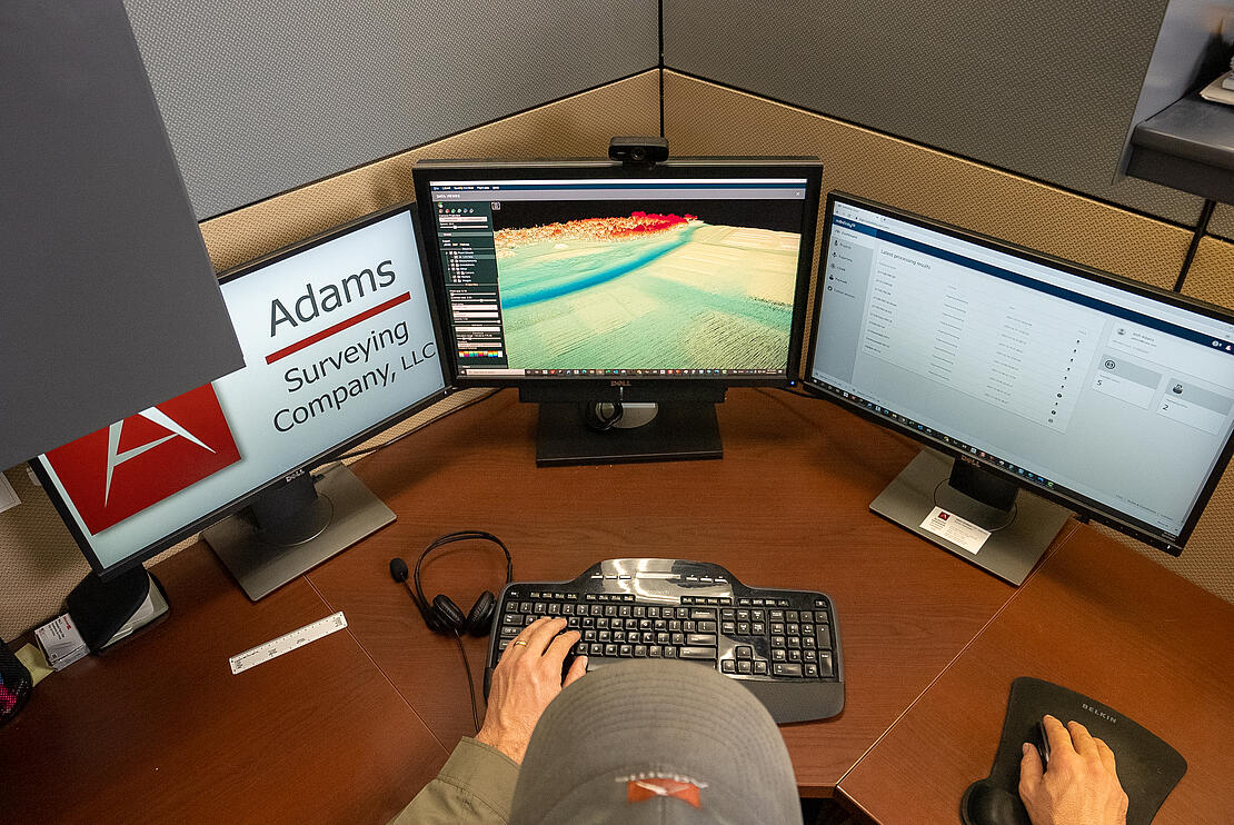
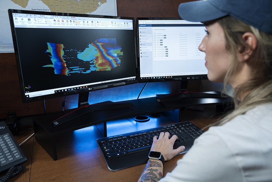
Drone operators need to turn the raw data collected into actionable insights, and that of course happens in the processing stage. The Microdrones mdInfinity software offers a seamless workflow and several different modules to ensure clients get powerful information they can use right away or easily put into a third-party program for further manipulation. With mdInfinity, a once complex workflow involving multiple types of software is simplified. Users quickly get through processing in a few clicks, with results ready in as little as 15 minutes.
mdInfinity is designed to work with Microdrones hardware, so there are no gaps, mdInfinity head of software product management, Stéfanie Van-Wierts said, and that’s a huge benefit.
“The software is tailored to our systems. They’re built in parallel, so they’re meant to support each other,” she said, noting mdInfinity can be used with other systems as well. “Because of that, there are no shortcomings in the software. There are no workarounds.”
The various modules available in mdInfinity clean up and classify the data to ensure customers get the best results possible. For drone users, it’s all about saving time and improving quality, said Gorka Zarauz, chief operations officer for mdInfinity, two elements the Microdrones R&D team has focused on that has led to “stunning” results.
Getting Started
The algorithms that drive the software are proprietary, efficient, optimized for large datasets, and result in better outcomes for a variety of applications including dam surveys, stockpile calculations, and map creation. Users are guided through the process for a simpler, faster workflow.
The complete data software suite is available in desktop and cloud versions and can process both LiDAR and photogrammetry, Zarauz said. The workflow is the same no matter which version customers choose.
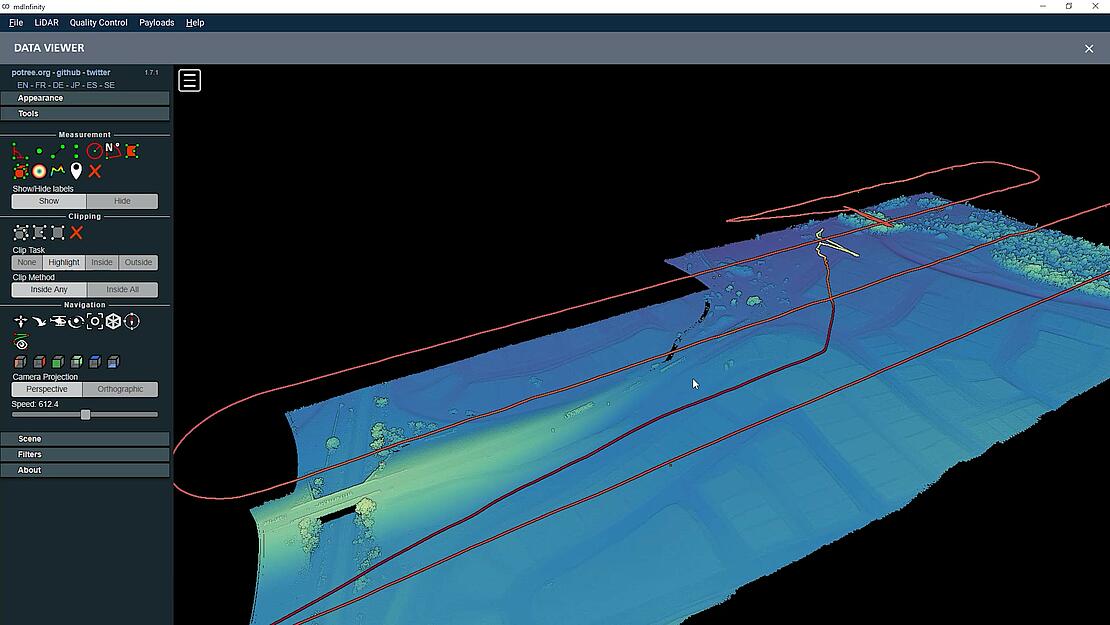
The first module, everyone uses for all projects is Trajectory Processing, Zarauz said. This is where the raw data collected is merged with the base station, providing centimeter accuracy on both position and orientation. The software guides users to ensure they get the right information, generating a file that can be further processed in other modules.
“This module merges the IMU and GNSS data from the inertial navigation system,” Van-Wierts said, “to develop the best estimated trajectory file, which is the path and attitude of the drone during its flight.”
Next, the trajectory processing file is entered into the Geocoding module to create the initial LiDAR point cloud that represents the area surveyed.
These modules serve as the entry point for everything else. Once complete, users can then run data through optional modules to improve the quality of the point cloud or extract analytics out of the data, COO Frank Darmayan said. These modules provide the rich, powerful data needed to create deliverables with superior quality.
“When you’re doing surveying work, you want to make sure the methods you’re using get you the results you’re looking for,” Darmayan said. “We create precise, accurate data with a beginning to end workflow that takes users from planning to processing. By following this process, customers end up with deliverables that are very accurate and precise. We built the workflow to get great results and taking advantage of the different modules will get you there.”
Stéfanie Van-Wierts, mdInfinity head of software product managementThe software is tailored to our systems. They’re built in parallel, so they’re meant to support each other. Because of that, there are no shortcomings in the software. There are no workarounds.
The Modules
Microdrones is constantly refining mdInfinity software based on customer feedback. The software is comprehensive and easy to use, and features tools such as batch processing, automatic file matching, intuitive guided workflow prompts, and customized outputs. Here’s a look at the current modules offered that go beyond the critical but basic information delivered in Trajectory and Geocoding, and when surveyors might want to use them.
Tools that Ensure Precision from the Beginning
Boresight Calibration. While not needed for every application, this module is used before the actual flights to correct the misalignment between the IMU and LiDAR sensor, a common issue that leads to inconsistency in the data collected.
The data might seem clear, but when users get into the details, they often see two lines next to each other because the system is not calibrated, Zarauz said. With the mdInfinity LIBAC (LiDAR -IMU Boresight Automatic Calibration) tool, the misalignment is automatically computed so boresight angles can be applied to georeference the data set without any boresight bias.
“You fly a configuration using mdCockpit and separate the LiDAR and base station files to process the boresight angles you’ll use further down the line for processing,” Zarauz said. “This gives you the opportunity to ensure you have a well calibrated system.”
Trajectory Control. Trajectory Control comes into play before the trajectory file is processed, Zarauz said. Users can quickly test files for accuracy before they’re processed. After uploading the raw files and clicking check, they receive a report that details mission duration, number of events, IMU continuity check, and base station information, ensuring everything was completed correctly before processing begins. From there, the data goes to the Trajectory and Georeferencing modules and beyond.
Modules that Enhance Accuracy, Quality, and Efficiency
LiDAR Coverage Preview. This module allows users to check the quality of the georeferenced point clouds created in the Georeferencing module. How? With the raw LiDAR and raw trajectory files, the module can create a point cloud with the selected FOV in the Geodetic Datum WGS84 that provides just enough information for quality control.
“Imagine you’re in the middle of nowhere and don’t have internet access. You just flew for two hours and want to avoid going back to the office, post processing, and then having to come back to the middle of nowhere and do it all again because of an error,” Zarauz said. “In three or four minutes you can see if there’s black holes or missing information. It gives you a baseline to validate the quality of the point cloud. You can rectify any issues right there so there’s no going back and forth.”
Strip Adjustment. Users can take care of any misalignment between individual strips with this module, Van-Wierts said. GPS units, GNSS receivers, and IMUs all have their limitations that could lead to trajectory errors. That means when individual strips surveyed are compared, there might be areas of separation where there shouldn’t be, say on top of a building.
“Strip adjustment recognizes those areas,” Van-Wierts said, “and refines the data to get rid of errors.”
Lines are adjusted to achieve the best outcome, Zarauz said, and then they’re matched for consistency. This is done automatically, and when the data is geocoded again, it’s geocoded with the correct angles.
How does this module improve the consistency between lines? It uses an advanced optimization engine and a smart tie point selector to adjust the position and angles of the drone through time to get the data to match perfectly.
Clients might use strip adjustment when measuring a pile of aggregates to make sure the point cloud doesn’t have artifacts from a GNSS inaccuracy, Darmayan said.
Precision Enhancement. With this module, users can remove the noise in the data while still retaining the features, Van-Wierts said. Outlier rejection is based on density and morphology, making it possible to isolate points that belong to relevant structures such as poles and cables. With other software, these details would be lost.
“We actually preserve edges of buildings, poles, cables, and any solid structures and also features like trees,” Zarauz said. “We don’t delete any points. We basically move the points for precision enhancement unless the client decides they want the points removed. The reason is when you use LiDAR you want point density. If you start removing points you lose thickness.”
LiDAR GCP Target. Through mdInfinity, users can detect and geocode geometrical centers for ground control point targets. Coordinates from the center of the target computed from the LiDAR point cloud can then be compared to the known ground control point coordinates.
“Historically, LiDAR only looks at the heights and doesn’t verify the XYZ coordinates of the target is accurate,” Darmayan said. “So, we created a 3D target. The algorithm will detect the 3D target within the point cloud. We can tell you the coordinates of the target compared to the onsite measurement to make sure it matches within a few centimeters.” LiDAR GCP Target is still under development and available through mdInfinity Desktop in a Beta Service.
Point Cloud Colorization. mdInfinity makes it possible to colorize LiDAR point clouds without the photogrammetric process. And because it’s not dependent on an orthomosaic, users don’t have to worry about incorrect colors in the point cloud. Light poles, power lines, and other elevated features that stand alone tend to pick up the color of what’s below them and might end up looking like grass, for example, Zarauz said.
“A lot of times for colorization you’re essentially overlaying the LiDAR point cloud over an orthomosaic, and whatever RGB value is closest to wherever the point falls is what it will be. So, it’s colorized based on location to color,” he said. “mdInfinity is able to determine colors based on the orientation of the sensor relative to the data, so it’s able to keep from colorizing areas that wouldn’t be naturally colored.”
FORMap. This tool’s fast, comprehensive photogrammetric workflow creates orthomosaic and dense point clouds in 2-4 sec/image, generating results a few minutes after the drone lands.
“We’re excited about this because it can generate usable orthomosaics in a very short period of time,” Van-Wierts said. “That’s unique compared to most other platforms.” FORMap is still under development and available through mdInfinity Desktop in a Beta Service.
Modules for Improved Analytics
Ground Classification. Once the noise is removed through precision enhancement, users can segment bare-Earth points from objects and vegetation in 3D point clouds to see where the ground is. This module is based on several algorithms, including frontier point analysis, segmentation, and TIN densification, that make it possible to classify ground points in challenging environments. For example, the algorithms can classify steep slopes, proving more true positive ground points to enhance the resolution of ground digital terrain models.
Power Line Classification. This tool is based on a combination of various in-house developed algorithms and has the ability to classify power lines in challenging environments. Power lines are easily segmented from objects and vegetation in 3D point clouds, which is particularly useful for utility clients. Power Line Classification is available through mdInfinity Custom Services.
Road Classification. Once ground classification is complete, this tool can tell users where roads are, Zarauz said, an exciting feature. Using AI, a technology that’s expected to play a bigger role in the software going forward, it can automatically detect the size of the road and where the road is going, which can be tricky. Road Classification is still under development and available through mdInfinity Desktop in a Beta Service.
All three classification tools add intelligence to the point cloud, using either algorithms, AI, or both to classify and detect specific features in the point cloud, Darmayan said.
“Utility companies want to extract power lines and land surveyors want to remove vegetation,” he said. “This tool allows you to produce those products without having to do it manually.”
Use Cases
Professionals use Microdrones solutions for a variety of applications, with some requiring more details than others, Darmayan said. Uses range from stockpile calculations of a construction site to matching the point cloud to original data to check on a power line location to creating a complete digital twin of a mine for inspection purposes. mdInfinity makes it easy for customers to get the level of information they need, no matter the surveying project. The precision enhancement and strip adjustment tools should be used when accuracy matters, for example, and the classification tools when roadways or structures need to be separated.
And because mdInfinity simplifies the workflow, there’s no need to go from one software to another for processing, Darmayan said. The hardware and software are integrated, so mdInfinity knows how the data was collected and can decrease the number of options when processing. So instead of having to answer multiple questions to get to the final result, users only have to answer a few, finishing the entire process in about 15 minutes and getting repeatable results every time.
“Every use case has a different path toward the end,” Darmayan said. “In some cases, the data is used as is and not touched anymore, while in others it’s just the beginning of a long process. What we aim to do is have a good understanding of what the customer is doing so we can provide the tools to make their lives simpler.”
An example of this, Darmayan said, is the ground classification tool. Before, customers were putting the data into another software to obtain that information. Now, it’s incorporated into the workflow, and they’re able to create a model of just the earth without the vegetation in a click of a button.
High-Quality Results
After using drone surveying equipment from Microdrones, surveyors and other professionals can quickly get the accurate results and deliverables they’re after, following an intuitive workflow through mdInfinity software. Everything is designed to work together seamlessly.
“mdInfinity was built to bring the geospatial data workflow from a very complex expert process to something that’s modern and simple,” Darmayan said. “It guides you through the process and the different steps you need to take depending on the product you want to generate. The software makes the process repeatable and helps you avoid potential mistakes so you can always expect a quality result.”
If you would like to add drone surveying equipment and mdInfinity processing software into your workflow, talk to one of our professional sales managers today.