
SIMPLIFYING SURVEYS
SAIN Associates used the Microdrones mdMapper1000DG to quickly gather data for an updated survey and to track progress of a project in Birmingham’s Red Mountain Park.
by Renee Knight
As seen in the August/September 2020 Inside Unmanned Systems
When SAIN Associates first began surveying and engineering work for a project in Birmingham’s Red Mountain Park, they used traditional tools to complete ground surveys of the property- a task the dense vegetation and rough terrain made pretty challenging.
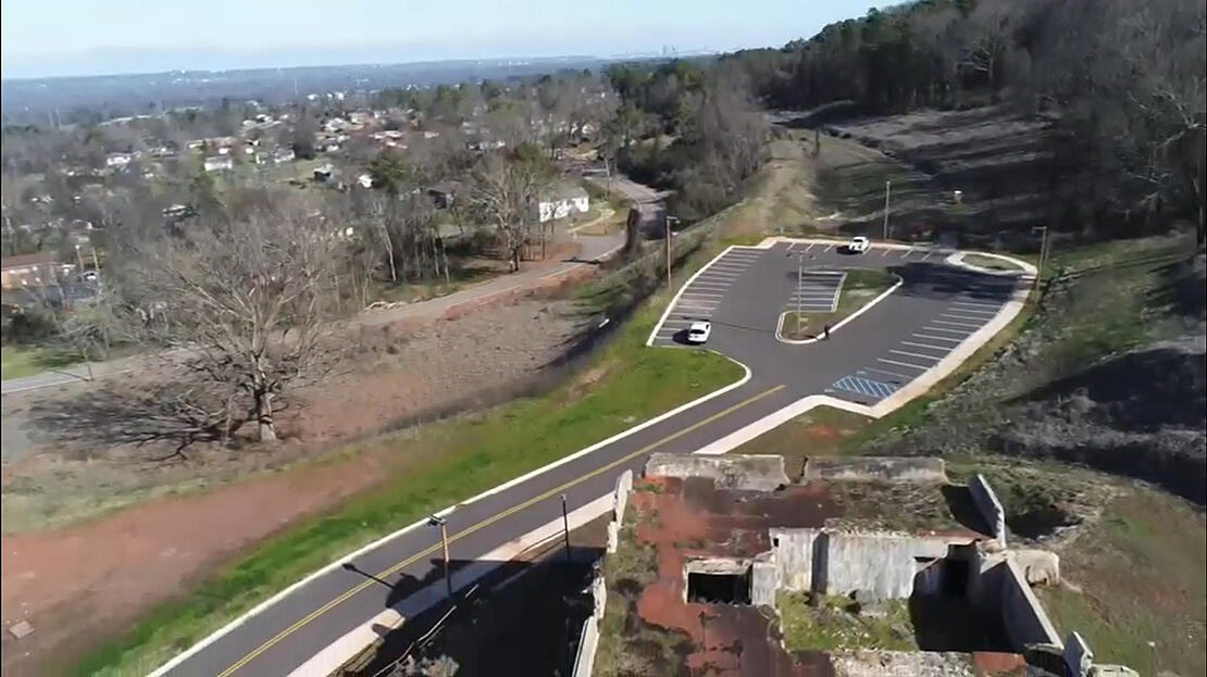
That surveying work for the City of Birmingham project, which consisted of creating an entry way and parking lot as well as a new trail from the parking lot to an existing trail, took months to complete, said Matt Lackey, UAS pilot for SAIN. The engineer team used the map of the corridor, property lines, contours and elevations to determine the best location for what the community now knows as Tiger Trail. They also had to work around historical structures that date back to the early 1900s when designing the trail, adding another layer of complexity.
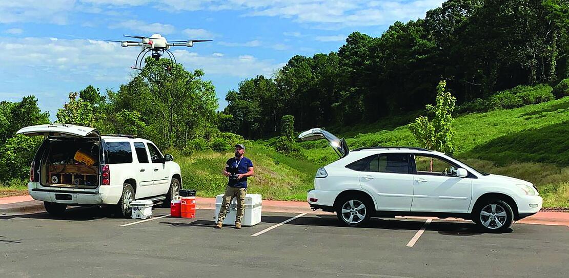
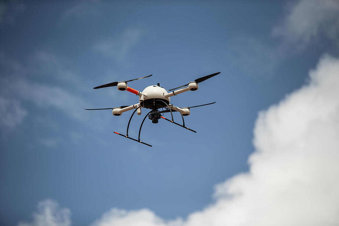
As the project moved along, questions came up about where dirt was being moved, Lackey said. That’s when the mdMapper1000DG from Microdrones was brought in. The team didn’t have this tool at the beginning of the project but knew the system could significantly cut down the time it took to perform the survey.
Matt Lackey, UAS Pilot, SAIN AssociatesOne of the biggest benefits was we were able to show the parties involved a 3D reality of what had been done.
And it certainly did. In two half days of flying in the field, the Microdrones system collected all the data necessary for the new survey. After post processing that imagery, the team had a surface with elevations they could compare to and lay on top of the original survey as well as the construction plans, quickly telling them what dirt had been moved and where it had been moved to.
“One of the biggest benefits was we were able to show the parties involved a 3D reality of what had been done,” Lackey said. “Taking point clouds and turning and manipulating them to show where the banks had been cut going through the hills was significant. Being able to look at everything in a 3D image helped quite a bit.”
The SAIN team also used orthophotos of the construction site to track progress, Lackey said. They flew the drone at the beginning, middle and end of the project, which took about two years to complete once they determined the best path for the trail.
“We could lay the plans on top of a high-resolution image of what was actually going on out there,” he said. “It gives you time lapses of where you’re at throughout the project.”
Improving Safety
Not only did the terrain make the initial ground survey chal-lenging, the park they were working in was built around mines, Lackey said. It was critical to locate those structures and preserve them for historical value, and to ensure no one stumbled into something that could cause an injury.
With the second survey the Microdrones solution completed, that wasn’t an issue.
“You don’t have someone outside on the side of a mountain running from poisonous snakes or tripping or falling or any of that,” Lackey said. “So, there’s also a safety factor that’s really beneficial.”
Safety also plays a huge factor in another application SAIN de-ploys the Microdrones system for, Lackey said. The team uses the drone to fly over a paper mill. When the wood is burned off, the ash gets pumped into a pond, and that pond needs to be surveyed both when itʼs full and empty so the client knows how much has been removed. Before, a person had to go into the pond to collect the needed information as it was being dug out, a difficult task that’s better handled by a drone.
“When you see the pond, it looks like ground but it’s soupy quicksand. You see tracks from deer who walk in but never walk out,” Lackey said. “The drone increases the safety factor and gives a more accurate representation of what’s actually there.”
Why Microdrones
The team at SAIN Associates decided to invest in drones a few years ago because they wanted to be on the leading edge and provide clients with the best technology available, Lackey said.
They knew more and more engineering and surveying firms would start deploying these systems, finding more use cases in the process, and they didn’t want to get left behind.
After doing some research, it became clear the mdMap-per1000DG was the best fit for SAIN, Lackey said. They wanted a durable system that offered longer endurance than a quadcopter but that wasn’t as big as a fixed-wing drone. The Microdrones solution has the endurance to easily handle larger 60, 80-acre projects and is also compact enough to fly smaller areas to get the team the information they need.
“It’s a perfect fit for the tight jobs we typically do,” Lackey said. “And there’s also the reliability. I talked to other firms already using the equipment and asked them for real life examples. It really came down to Microdrones offering a reliable package.”
A new tool for better surveying
For the Red Mountain Park Tiger Trail project, SAIN was there from the very beginning, with the goal of enhancing the park for the community. Lackey was particularly excited to be involved, he said, because it’s a place he spends a lot of his free time.
“To be able to work on something I use and enjoy really meant a lot to me,” he said. “This project was a pretty unique experience. Being on the project from the very beginning with the survey all the way through to when it’s engineered and designed and eventually built allowed us to use different methods of surveying as we went through the project.”
Adding the Microdrones system to their tool kit enhanced and simplified the second survey while the project tracking helped the SAIN team “provide a good product that’s going to be used by the community for a long time to come,” Lackey said.
For more information on simplifying drone photogrammetry in your workflow, CLICK HERE to speak with a Microdrones representative