


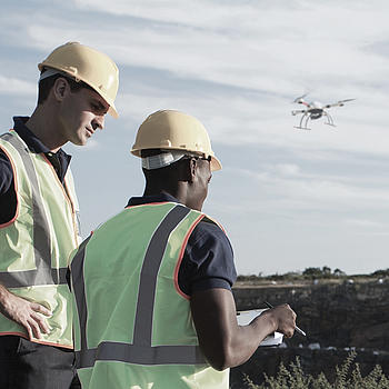
Drones can Lead to Better Worker Safety
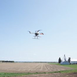
Easily tackle projects in areas that are difficult, dirty or dangerous to access – such as challenging terrain, crumbling structures, high elevations, and areas impacted by natural disasters.
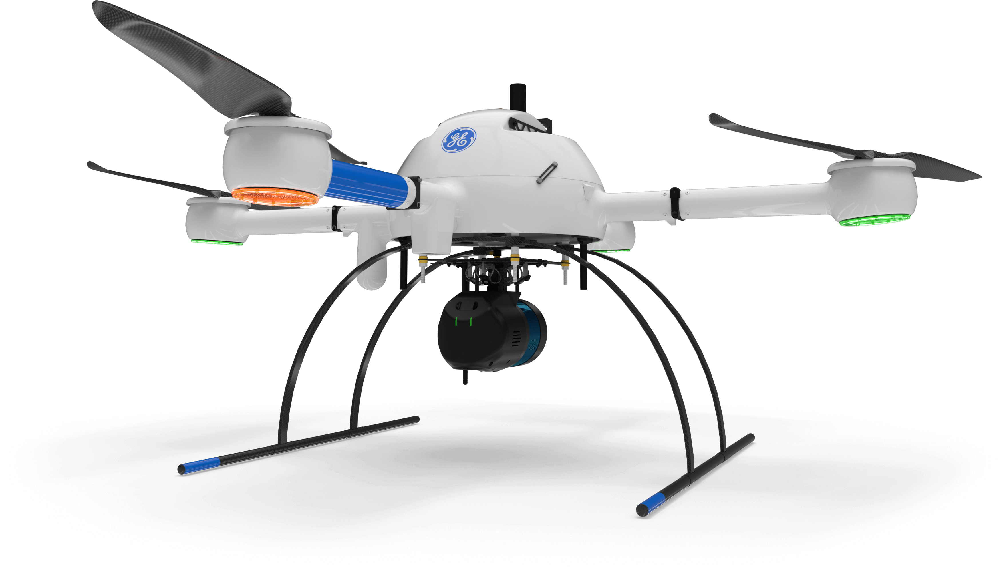
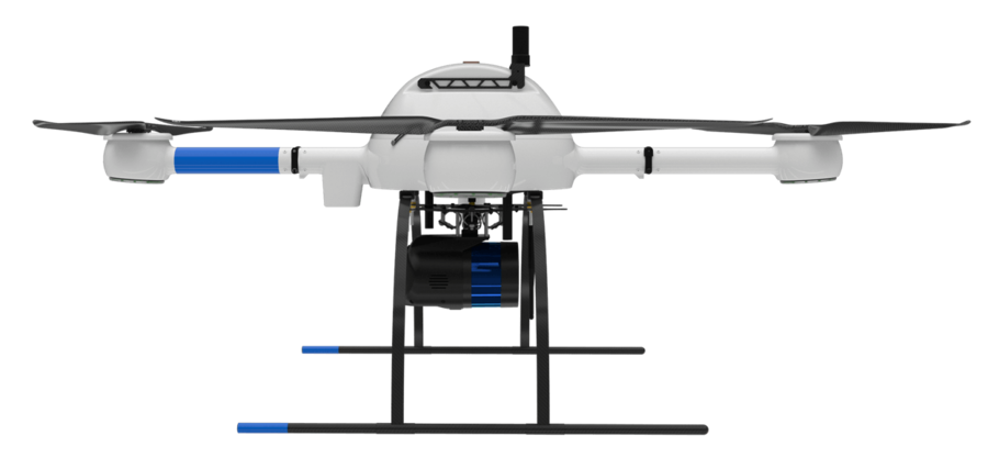
mdLiDAR1000LR means longer range. You'll cover more ground from above. This translates to more efficiency than ever - the survey equipment, software, workflow, training and support that you need to be productive in the field - with convenient mdaaS plans.
من الذين ينبغي لهم أن يفكروا في استخدام هذا النظام:
يجب على المحترفين المسؤولين عن جمع البيانات الجغرافية المكانية التفكير في استخدام نظام mdLiDAR1000LR للمهام التالية.

Frank DarmayanThe mdLiDAR1000LR increases the distance from which details can be captured. It can capture powerline details at 75m for distribution and 90m for transmission, effectively doubling the range of our mdLiDAR1000HR system. Flying at 70m from the powerlines, at 8m/s allows for efficient location of the powerlines with roughly 10 points per linear meter and capturing great detail of the towers.
The mdLiDAR1000LR is also a great tool for scanning large mines and measuring stockpile volumes. Flying at 100m AGL with 20% sidelap, the LR can cover over 1.2 square kilometers in a 30 minute flight, capturing a point density of 150 points per square meter.
Chief Operations Officer
يُعد mdLiDAR1000LR نظامًا متكاملاً تمامًا لإنتاج سحب نقاط ثلاثية الأبعاد محسنة للاستخدام في تطبيقات مسح الأراضي والإنشاء والنفط والغاز والتعدين.
طورت شركة Microdrones حل ليدار شاملاً يجمع بين طائرة مسيرة وحمولة ليدار وسير عمل للبرامج متكامل تمامًا ودعم على مستوى عالمي لتوفير منجزات عالية الجودة باستمرار.
إليكم ما يُقال في القطاع عن mdLiDAR1000LR.
The mdLiDAR1000LR can help streamline your current workflows to become more efficient, while helping you to complete more projects.
Learn more about the benefits and challenges of investing in drone based LiDAR. Click here to review one of our FREE educational UAV LiDAR webinars. In this edition, you can learn how one of Microdrones customers saved over 50% compared to conventional survey methods by implementing a UAV with LiDAR.
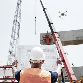
From surveying to mining and construction, professionals are using the power of the mdLiDAR1000LR to streamline their workflow. This new technology is helping them to complete more surveys, see more detail, optimize mining volume analysis and maximize construction monitoring.

Matt RosenbalmFlying LiDAR to create a 3-D pointcloud model before beginning a construction project provides advantages. It can tell workers how much dirt needs to be moved on a site before they get started, for example, enabling them to bring the right amount of resources to the job.
Microdrones Sales Manager for the Southern US

يعد نظام mdInfinity نظامًا اقتصاديا قويًا يُمكنك من معالجة البيانات الجغرافية المكانية بسرعة وكفاءة، مع خيارات دفع ملائمة.
نظام mdInfinity متاح في نسخة تعمل عبر شبكة الإنترنت ونسخة تعمل على أجهزة الحاسبات الشخصية المكتبية.
تعرف على مزيد من المعلومات عن وحدات معالجة البيانات الخاصة بنا.
تلتزم شركة Microdrones بإجراء التطوير المستمر الذي يركز على تلبية احتياجات العملاء. ولذلك نعمل على تطوير أحدث التقنيات المتكاملة التي تتطور بشكلٍ سريع.
بالنسبة إلى طائراتك التي تستخدم نظامًا أقدم، نحن متحمسون لمساعدتك على ترقية نظام Microdrones السابق لديك وفقًا لأحدث المعايير حتى يتسنى لك الاستفادة من الميزات والوظائف الجديدة.
Customers are curious about UAV surveying technology – so providing it demonstrates that a business is an industry leader at the helm. Faster, more efficient data collection differentiates you from competitors and positions you as a subject matter expert in an emerging technology.
وزن اإلقالع للنظام (TOW)
6400g
درجة حرارة تشغيل النظام
-10 °C to 40 °C
14 °F to 104 °F
دقة النظام:
| ارتفاع الطيران فوق مستوى سطح البحر (1) (متر/ قدم) | 30/100 | 40/130 | 50/165 |
|---|---|---|---|
| السرعة (م/ث) | كثافة النقطة ( مركز الرقعة // الحافة) نقطة/م 2(2) | ||
| 2 | 160 | 120 | 95 |
| 3 | 105 | 80 | 65 |
| 4 | 80 | 60 | 50 |
| 5 | 65 | 50 | 40 |
| مسافة العينة األرضية GSD( مم) | 12.9 | 17.2 | 21.4 |
| عرض الرقعة (متر/قدم) في مجال (متر) | 55 | 75 | 95 |
| زمن الرحلة ( دقيقة ) (3) | 25 | 25 | 25 |
| عدد عائدات الليزر | 3 | 3 | 3 |