


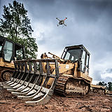
Drones can Lead to Better Worker Safety
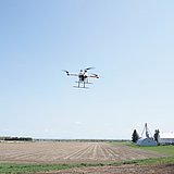
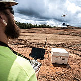
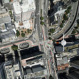
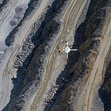
Easily tackle projects in areas that are difficult, dirty or dangerous to access – such as challenging terrain, crumbling structures, high elevations, and areas impacted by natural disasters.
من الذين ينبغي لهم أن يفكروا في استخدام هذا النظام:
كما تتوقع، توفر لك شركة Microdrones الحل الكامل: مارس مهام التخطيط والطيران والمعالجة والتصور. لكنها أكبر.
إنها آلة مهمة لمحترفي الجيوماتكس الجادين في مجال الإنشاءات وتطوير الأراضي والهندسة والمسح والبحث. إنه مجال صعب وجاهز للعمل معك على المهام التالية:

Robert Chrismon, PLSWith the third generation of the mdLiDAR3000 and opening the scanner field of view, you can now fully utilize the potential of the sensor for data collection. By using the configurable field of view option, you are no longer limited to flying above your area of interest.
Manager, Marketing: Voice of Customer

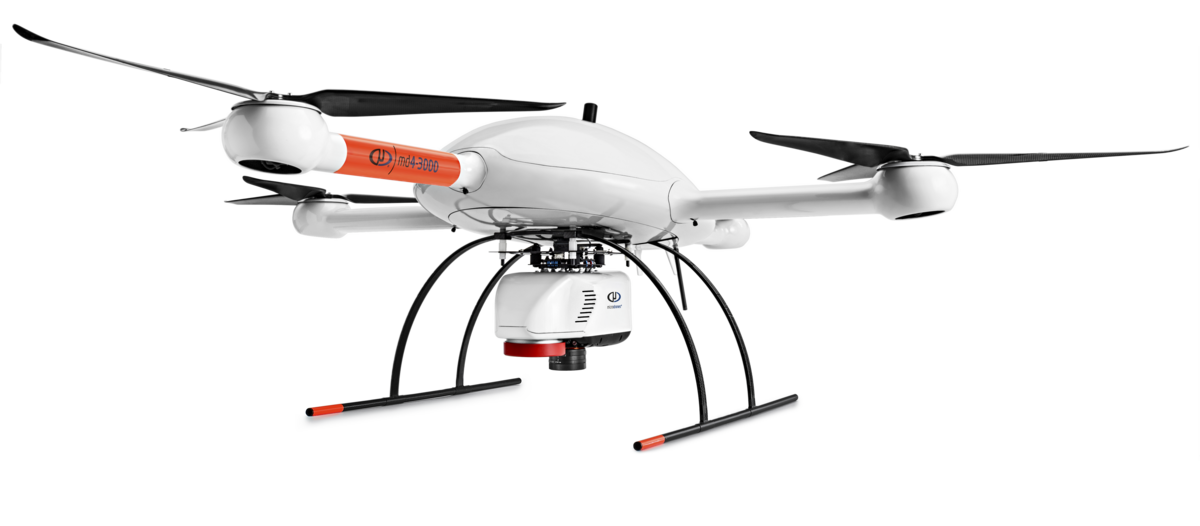
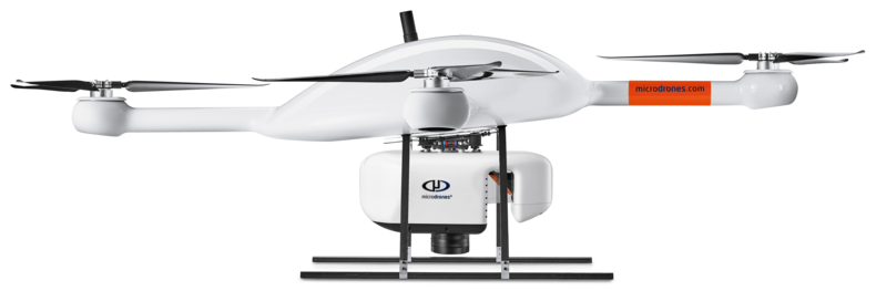
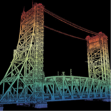
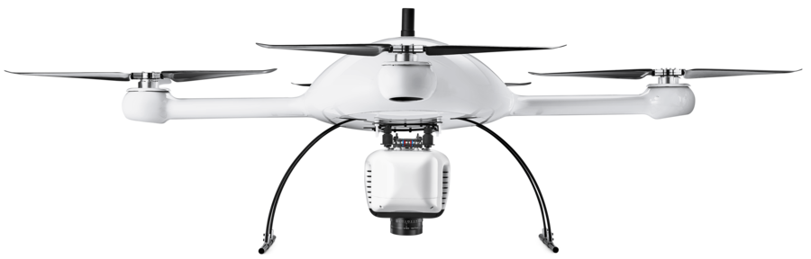
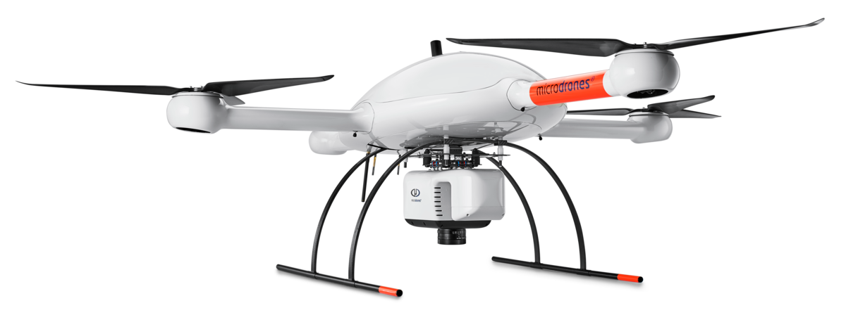
يستخدم النظام mdLiDAR3000 قوة رفع منصة طائرات Microdrones ومرونتها وكفاءتها لحمل الماسحة الليزرية Riegl miniVUX‑3UAV المتكاملة تمامًا وكاميرا Sony RX1R II. ما النتيجة؟ يمكنك الحصول بسرعة على بيانات ليدار دقيقة عالية الكثافة في الموقع وتحويلها بكفاءة إلى سحابة نقاط ملونة ثلاثية الأبعاد في المكتب أو على الكمبيوتر المحمول.
يُعد نظام mdLiDAR3000DL حل شامل من ليدار يجمع بين طائرة مسيرة وحمولة ليدار وسير عمل للبرامج متكامل تمامًا ودعم على مستوى عالمي لتوفير منجزات عالية الجودة باستمرار.
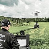
In areas of high vegetation do you spend hours cutting line to topo the site? The mdLiDAR3000 can help streamline your current workflows to become more efficient, while helping you to complete more projects.
Learn more about the benefits and challenges of investing in drone based LiDAR. Click here to review one of our FREE educational UAV LiDAR webinars. In this edition, you can learn how one of Microdrones customers saved over 50% compared to conventional survey methods by implementing a UAV with LiDAR.


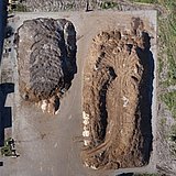
Matt RosenbalmFlying LiDAR to create a 3-D model before beginning construction provides advantages. It can tell workers how much dirt needs to be moved on a site before they get started, for example, enabling them to bring the right amount of resources to the job.
Microdrones Sales Manager for the Southern US
يعد نظام mdInfinity نظامًا اقتصاديا قويًا يُمكنك من معالجة البيانات الجغرافية المكانية بسرعة وكفاءة، مع خيارات دفع ملائمة.
نظام mdInfinity متاح في نسخة تعمل عبر شبكة الإنترنت ونسخة تعمل على أجهزة الحاسبات الشخصية المكتبية.
تعرف على مزيد من المعلومات عن وحدات معالجة البيانات الخاصة بنا.
تلتزم شركة Microdrones بإجراء التطوير المستمر الذي يركز على تلبية احتياجات العملاء. ولذلك نعمل على تطوير أحدث التقنيات المتكاملة التي تتطور بشكلٍ سريع.
بالنسبة إلى طائراتك التي تستخدم نظامًا أقدم، نحن متحمسون لمساعدتك على ترقية نظام Microdrones السابق لديك وفقًا لأحدث المعايير حتى يتسنى لك الاستفادة من الميزات والوظائف الجديدة.
ترجمة: الإنجليزية | الفرنسية | الألمانية | الإسبانية
Customers are curious about UAV surveying technology – so providing it demonstrates that a business is an industry leader at the helm. Faster, more efficient data collection differentiates you from competitors and positions you as a subject matter expert in an emerging technology.
| ارتفاع الطيران فوق مستوى سطح البحر (1) (متر/ قدم) | 40/130 | 60/195 | 80/260 |
|---|---|---|---|
| السرعة (م/ث) | كثافة النقطة ( مركز الرقعة // الحافة) نقطة/م 2 (2) | ||
| 3 | 313 | 209 | 156 |
| 4 | 235 | 156 | 117 |
| 5 | 188 | 125 | 94 |
| 6 | 156 | 104 | 78 |
| مسافة العينة األرضية GSD( مم) | 5.3 | 8 | 10.6 |
| عرض الرقعة (متر/قدم) في مجال at 56° FOV | 42/138 | 63/207 | 85/279 |
| عرض الرقعة (متر/قدم) في مجال at 90° FOV | 80/262 | 120/394 | 160/525 |
| عرض الرقعة (متر/قدم) في مجال at 110° FOV | 114/374 | 171/561 | 229/751 |
| عدد عائدات الليزر | 5 | 5 | 5 |
| تغطية المنطقة بنسبة %20( تداخل هكتار/ فدان)(3) | 18/44.5 | 26/64 | 34/84 |
| تغطية المنطقة بنسبة %50( تداخل هكتار/ فدان)(3) | 11/27 | 17/42 | 21/52 |
(1) ارتفاع الطيران فوق مستوى سطح الأرض (AGL)
(2) متوسط كثافة النقطة. لاحظ أن الحساب لا يعالج خمود الهدف (نسبة الانعكاسية)
(3) مثال على رحلة تستغرق 20 دقيقة في ظل ظروف طيران قياسية
(4) تُحسب تغطية المنطقة بإجراء مسح لمدة 20 دقيقة على سبيل المثال (3 دقائق للإقلاع والهبوط) بسرعة طائرة مسيرة تبلغ 5 م/ث في مجال رؤية 56 درجة