Streamline Your Data Review Process with LP360’s QA/QC Tool: Identifying and Fixing Issues Made Easy
In this Tool Tips video, hosted by Martin Flood, Vice President of Special Projects, discover how LP360’s QA/QC tool streamlines the project review process, making issue identification and resolution a breeze. Say goodbye to disorganized, random quality checking and standardize your data reviews across your team with LP360’s flexible QA/QC tools. Watch below for some very informative tips to take advantage of this powerful tool:
Quality Assurance and Quality Control
In the world of geospatial data analysis, ensuring accuracy and quality is of utmost importance. LP360, a powerful software tool for LIDAR and photogrammetry data processing, provides various functionalities to aid in quality assurance and quality control (QA/QC) processes to effectively organize, review, and identify areas in your project that require fixing.
Understanding the QA/QC Toolbar in LP360:
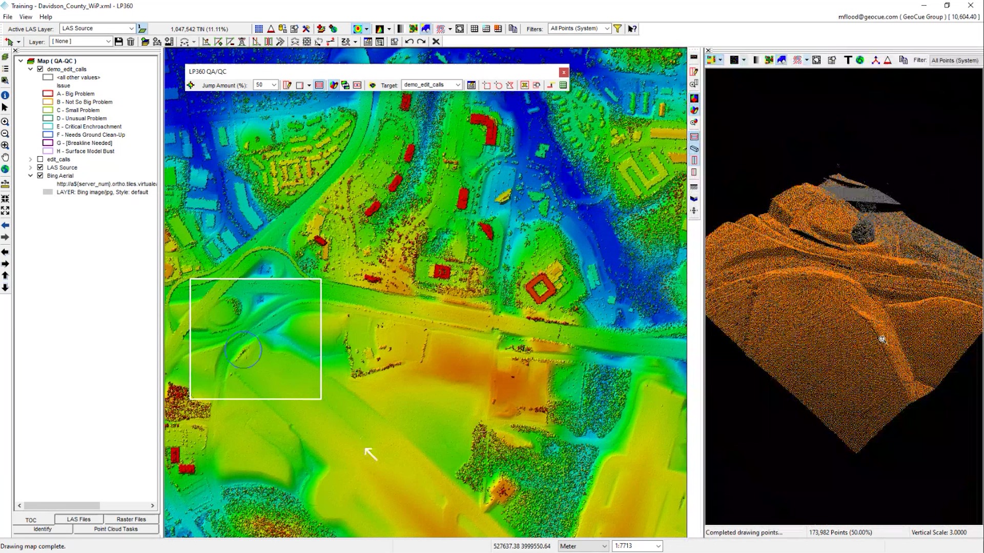
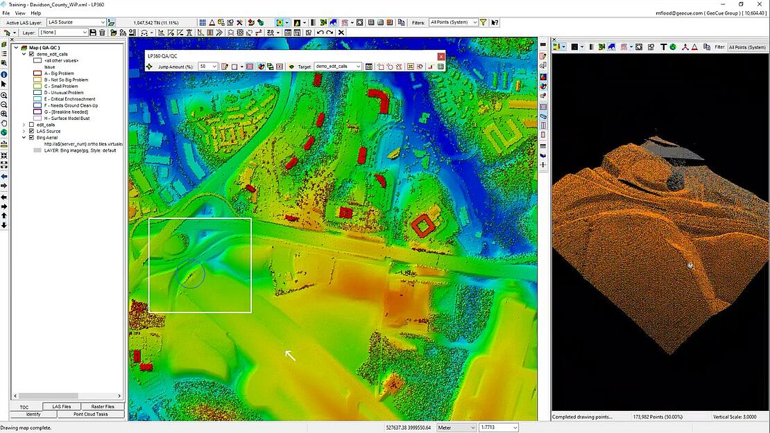
The QA/QC Toolbar in LP360 provides a comprehensive set of tools designed to streamline the review and remediation process of geospatial data. It allows users to define their own custom issues list, making it adaptable to specific project requirements. These issues could range from surface model errors to ground classification problems or vegetation encroachments. The flexibility to create a personalized issues list empowers users to tailor the review process to their project’s unique requirements.
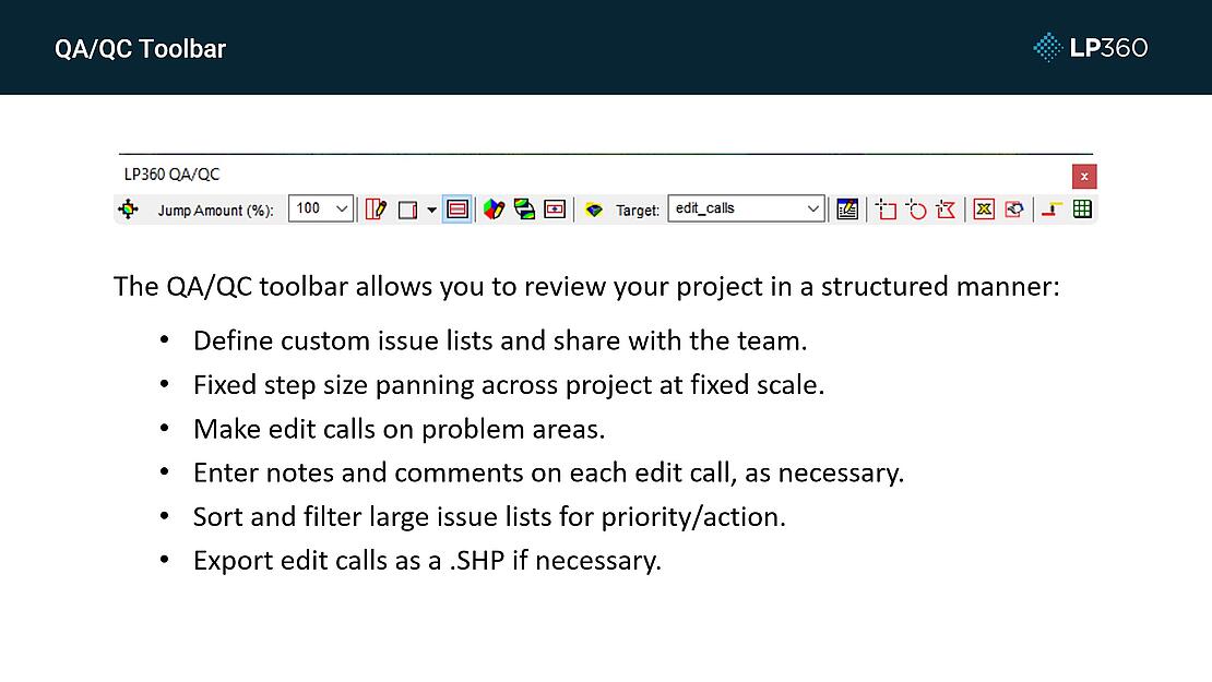
Once the issues list is defined, users can navigate through the project using LP360’s QA/QC Toolbar. The toolbar provides tools to make edit calls and identify areas that require attention. Users can highlight specific areas and add notes and comments to describe the identified issues. LP360 also offers the Feature Analyst Tool, which allows for sorting and filtering the list of identified issues based on specific criteria. This feature becomes invaluable for large-scale projects where numerous areas require remediation or further investigation.
Efficient Issue Management and Navigation:
LP360 ensures that the QA/QC process is conducted systematically by providing features for controlled data navigation. Using the Feature Analyst Tool, reviewers can navigate through the identified issues seamlessly. The software also enables zooming in and out of the data at predefined scales, making it easier to spot errors and anomalies. They can center on specific issues on the map, synchronize perspectives in the 3D window, and even utilize the profile view to gain better insights.
Furthermore, LP360 recognizes the importance of collaboration and seamless workflow integration. Once the QA/QC process is complete, the identified issues can be exported as a shapefile, allowing easy sharing with other stakeholders or downstream workflows. This enables effective communication between the reviewers and technicians responsible for fixing the issues. LP360 promotes interoperability by facilitating data transfer to other software packages if required.
LP360 Streamlines QA/QC
The QA/QC Toolbar in LP360 is a valuable asset for geospatial data analysts and reviewers. By enabling users to define custom issues lists, navigate data systematically, and identify areas in need of fixing, LP360 streamlines the QA/QC process. The software promotes collaboration through data export and integration with other tools. Whether you are working on a large-scale project or require precise data review, LP360’s QA/QC Toolbar is a reliable tool to ensure the accuracy and quality of your geospatial data.
For more information on adding LP360 into your processing workflow, please contact our helpful sales representatives.