As seen in VDV Magazin 02/2018 GeoBüro Mobile:
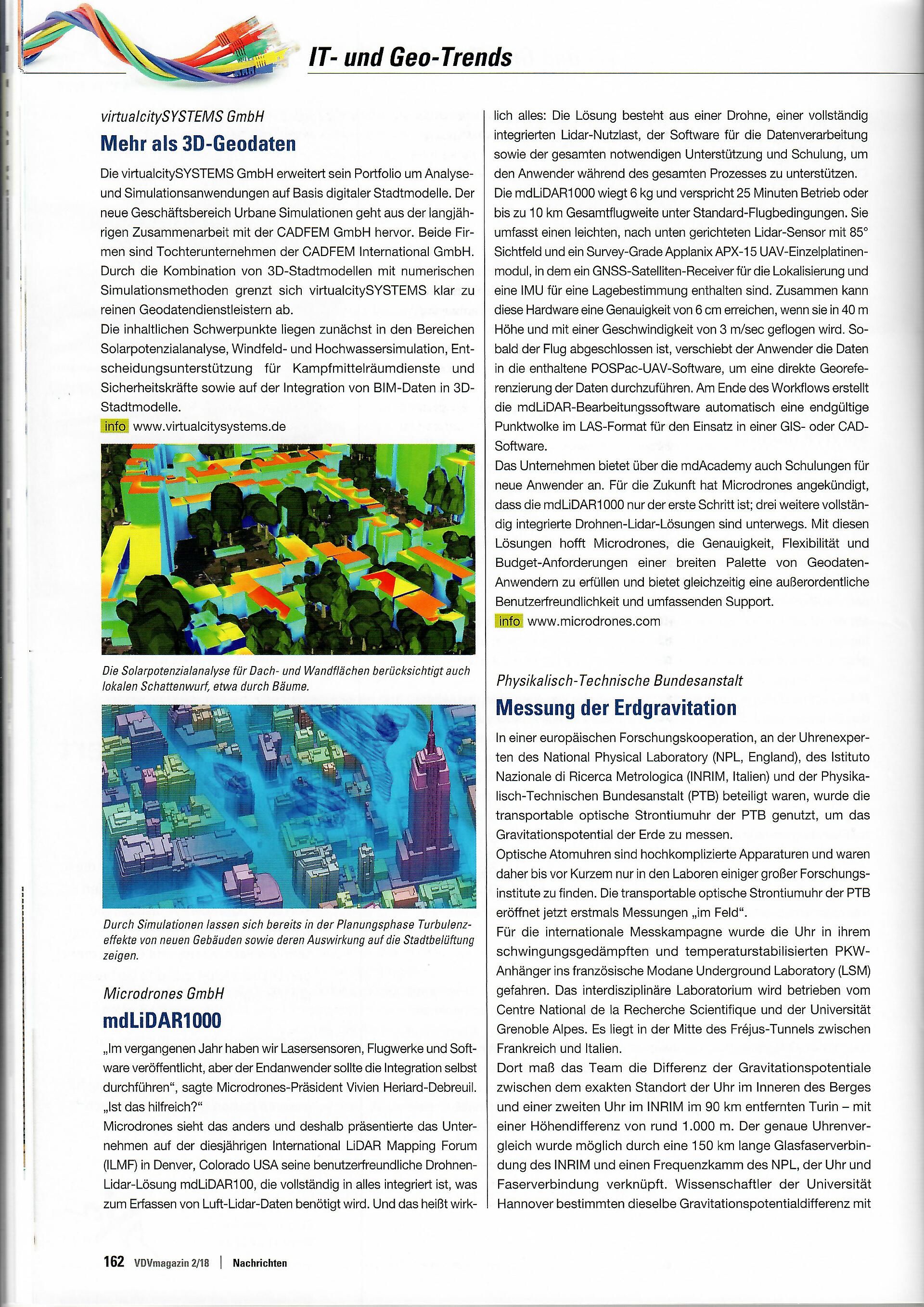
"Last year we saw companies launch laser sensors, UAV platforms and software, but the user was supposed to integrate it all by himself,“ said Microdrones President Vivien Heriard-Dubreuil. “Is that helpful?”
Microdrones thinks differently and thus presented its easy-to-use fully integrated LiDAR solution mdLiDAR1000 with everything that is necessary to collect UAV-LiDAR data at this year’s International LiDAR Mapping Forum (ILMF) in Denver, Colorado, USA. And that really means everything: the solution contains a drone, a fully integrated LiDAR payload, software to process the data as well as training and support during the whole process.
The mdLiDAR1000 weighs 6 kg and promises 25 minutes flight time or up to 10 km flight distance in standard conditions. It contains a lightweight, downward oriented LiDAR sensor that efficiently scans at a 85 degree field of vision as well as a survey-grade Applanix APX-15 UAV single board module with a survey-grade GNSS receiver and a precisely calibrated IMU for mapping. Altogether, the hardware reaches an accuracy of 6 cm, while flying in 40 m height and speed of 3m/sec. Once the flight is finished the user uploads the data in the included POSPac-UAV-Software to process the data with direct georeferencing. At the end of the workflow the mdLiDAR processing software automatically generates a finalized pointcloud in LAS format to use in GIS or CAD software.
The company offers trainings for new users through mdAcademy. For the future Microdrones accounced that mdLiDAR1000 is only the first step; additionally, three fully integrated UAV-LiDAR solutions are in development. With these solutions Microdrones is hoping to achieve the accuracy, flexibility and budget-requirements of the broader range of geospatial users and offers an extraordinary easy-to-use handling and comprehensive support at the same time.
For our German speaking friends, please click the image below.

Interested in using unmanned aerial systems for your applications? Start a conversation with our friendly, helpful team.