In the last two decades, the popularity of drones has expanded tremendously – from the casual backyard pilot to wedding photography to professional commercialization. With the advent of any new technology the first thought is, “How can I monetize this?” In the beginning, people thought they were going to go buy a drone and start printing money. That’s hardly the case.
“One of my colleagues calls it the Wild, Wild West of the geospatial world right now.” Hogan explains. “We have all kinds of people with good intentions getting into the business, but not necessarily understanding what’s happening in the background. Drones actually revolutionized a lot of things we do in collecting data, but as far as the processing and use – it’s all the same thing. If you collect bad data, then you get bad results out of it in the end. So after we get through all the hype, we’re back to basics:
- Why do we collect this data?
- Why do we analyze systems and workflow?
How can we make life easier for geomatics professionals?
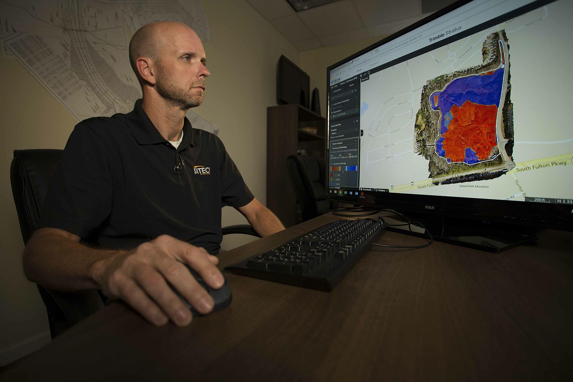
This is why Microdrones develops purpose-built solutions for specific areas of application. For example, with mdLiDAR1000 they’ve streamlined the entire process for producing 3D point clouds by creating an easy end-to-end, 4-step workflow: Plan, Fly, Process and Visualize. Microdrones mdLiDAR1000 empowers professionals to plan a mission, fly the system, process georeferenced data, and create a point cloud visualization in standard ASPRS LAS format usable in any GIS or CAD software environment.
When operating a UAV system, it’s also vital to set parameters and standards for collecting data. According to Hogan, “The biggest challenge we face with new technology is that people haven’t thought carefully enough about the question they want to use it to ask or they don’t know the nature of the answer they want from it. So defining your requirements and defining what you’re trying to achieve is an all too often overlooked part of the problem.”
Microdrones mdSolutions addresses the collecting, analyzing and interpreting of data for all of their UAV packages. Long before any drones are sold, the team from Microdrones has worked closely with the end user to understand what data they are trying to collect, and how they are going to apply it.
Mike says, “Although we’re in the drone business, I often tell people the drone might not be the tool they’re looking for because it just doesn’t make sense. One guy wanted to put a speaker on a drone to be able to talk to someone. I asked why not just use a radio?”
The sales process is collaborative and based on problem solving, not just selling an elaborate system. Microdrones uses their knowledge, technology, and support to ensure that all of their UAV systems are providing the most accurate and complete results while cutting costs, saving time, and completing projects more easily.
If the Microdrones approach to considering drones for professional applications sounds appealing to you, fill out this form today! Our friendly team is happy to help.