DRONE LIDAR KEEPS SURVEYING TEAM SAFE FROM FLOATING MARSH
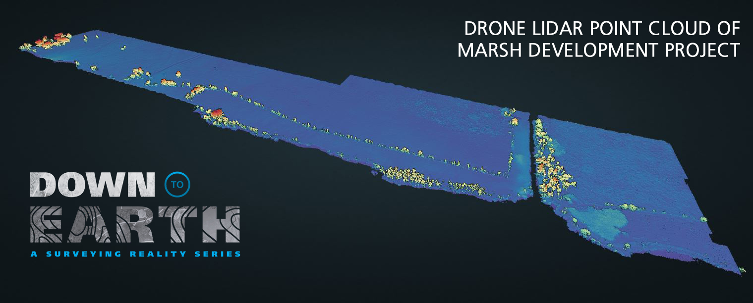
If you've watched Down to Earth: Air Control, be sure to take an interactive look at the point cloud created from the data collected in the marshes of Southern Louisiana, near Houma. This data was collected using the mdLiDAR1000 flying at a speed of 3 meters per second and an altitude of 50 meters. Click the image below to go to the point cloud viewer.

“Down to Earth” is the surveying reality series from Microdrones that shows how real surveyors collect data and turn it into real deliverables, despite challenging conditions, rugged terrain, and possible dangers.
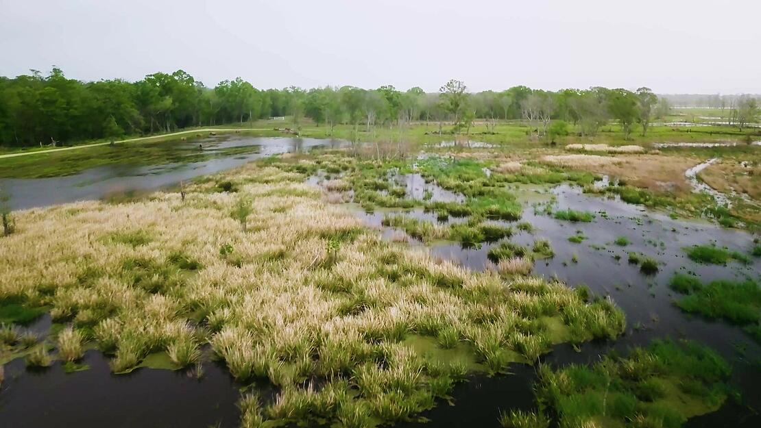
On these episodes of Down to Earth, Duplantis Design Group needs to survey a site for residential, commercial and industrial development. However, the area lies in between a bayou, the Intercoastal Waterway, and a large floating marsh- making traditional surveying methods difficult and treacherous. To expedite the survey, UAV Pilot Justin Schech uses Drone LiDAR to avoid the dangers in the marsh safely from the air above. However, this project is also in close proximity to the Houma-Terrebonne Airport, meaning additional airspace authorization must be obtained to operate the drone.
Episode 2 introduces Corey Macmenamin, the Survey Business Unit Leader for DDG, and he explains why the drone surveying equipment is perfect for this project.
He said, “We wanted to use LiDAR, because a lot of the areas in Houma, up against the Intercoastal Canal specifically, are floating marsh, which is very difficult to access by foot and seemingly the only way to get this job done in a timely fashion was to use the drone LiDAR.”
Safely Survey with Drone LiDAR
The area surveyed in this project was approximately 40 acres of land, floating marsh, and river embankment from the Intercoastal Waterway. Using mdCockpit he planned this 1 flight at an altitude of 50 meters and a speed of 3 meters per second. The duration of each flight was approximately 20 minutes completed in 5 legs with 60% overlap.
Process and Visualize
To create the point cloud for this data set, the data from Air Control was first processed with POSPAC for Trajectory Processing and mdInfinity Georeferencing modules. Then further processing in mdInfinity was conducted which allowed for precision enhancement, removing outliers, and ground classification.
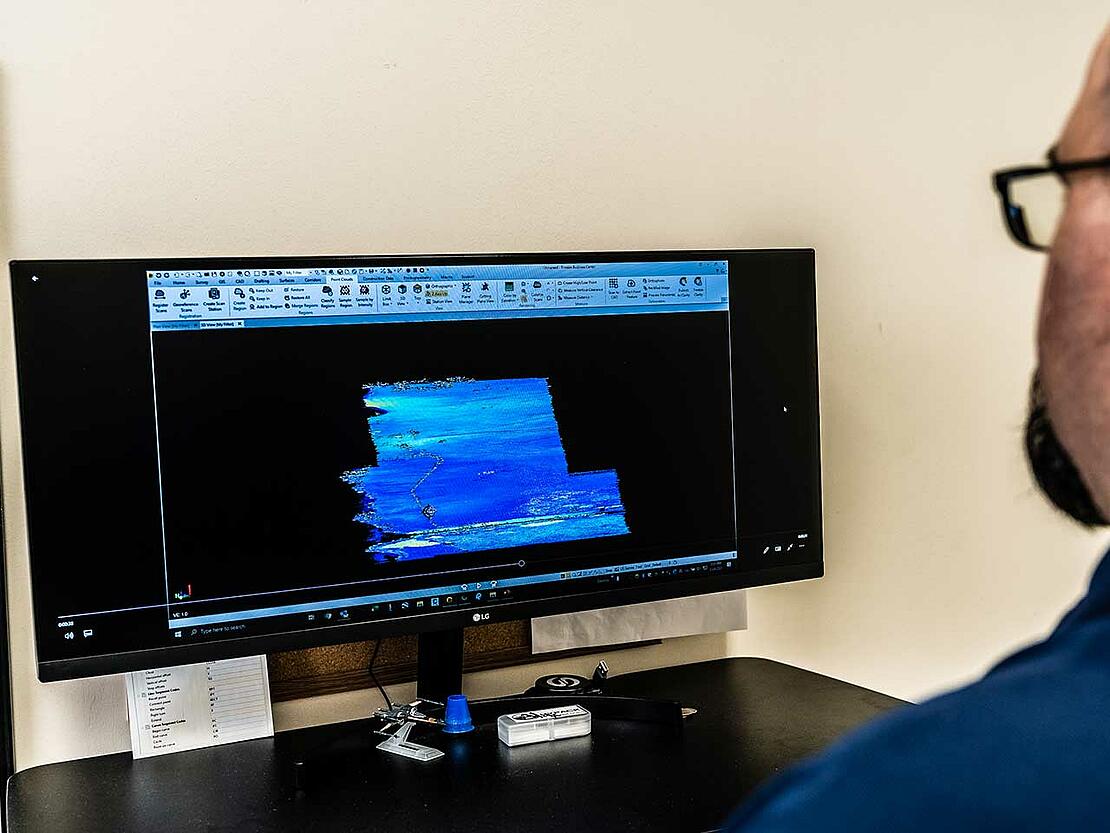
In Episode 3, Brad Villemuer, Draftsman at Duplantis Design Group, uses the data acquired from the mdLiDAR1000 to create the final deliverable using a combination of software from mdInfinity, POSPAC, Trimble Business Center, Pix4d and Civil 3D.
To learn how you can use Drone LiDAR to get jobs down safely and more efficiently, CLICK HERE to speak with one of our representatives.