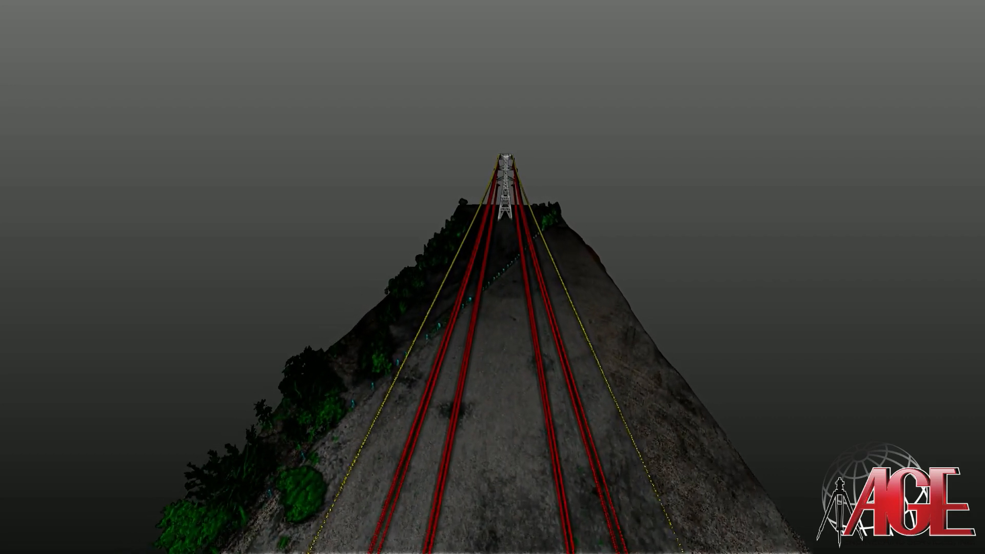
AGE Engineering Services Inc. is a Microdrones customer who is using the mdLidar3000DL for corridor flights and mapping power lines. They recently provided a great video of their mdLidar3000DL in action.
The mdLidar3000DL is the newest LiDAR system from Microdrones. Three years in the making, the system perfectly integrates the heavy lifting md4-3000 drone with a Riegl miniVUX-1DL and a SONY RX1R II camera for rapidly producing colorized pointclouds.
In addition to the video of their mission, the team at AGE Engineering Services has also provided an interactive sample data set of the visualized point cloud from their flight. The data sample allows you to select from a variety of options to view the accuracy and enhanced colorization that the point cloud provides. To view a sample of their data, click the point cloud picture below.
Sample Data:
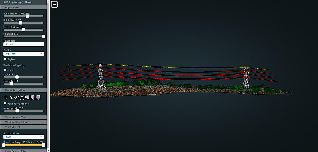
Creating quick and accurate point cloud visualizations, as seen in the data from the link above, is one of the main advantages of the mdLidar3000DL. The system is fully integrated, not only with the LiDAR, and the miniVUX1 DL, but it also comes with the processing software allowing the team at AGE Engineering to process and do a quick visualization of the data captured in the field.
AGE Engineering Services began in 1992. Douglas Gooch left the Kentucky Department of Transportation’s Somerset District Office # 8 where he had spent the previous 4 years in the operations section. Steve Austin brought to the company skills from work as an Engineer for Hitachi Manufacturing. In 2004 Douglas Gooch, having acquired complete ownership of AGE Engineering Services, incorporated the company to become AGE Engineering Services, Inc.
AGE has a current staff of 47 employees. The professional staff consists of 7 licensed Civil Engineers, 5 licensed Surveyors, and 3 EIT’s who are licensed in Kentucky, Virginia, West Virginia, and Tennessee. Currently, their services include engineering, surveying and site modeling for machine control.
To find out how to start processing and visualizing data using drone-based Lidar, CLICK HERE to speak with one of our representatives.