Drone data processing in the construction industry continues to become more integrated and sophisticated.
By Renee Knight
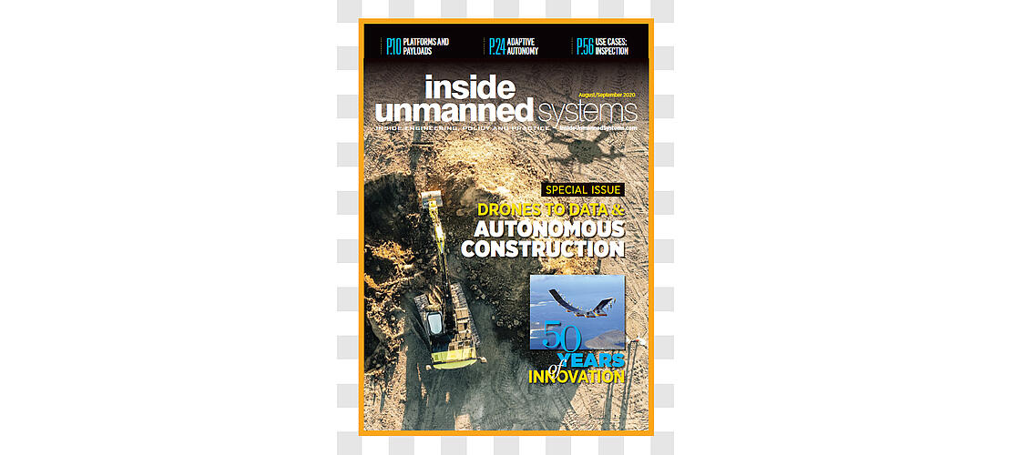
As seen in the August/September issue of Inside Unmanned Systems
Inside Unmanned Systems recently featured a special issue on drones and data on the construction jobsite, an industry where Microdrones is making a big impact. The full article is available here and you can read how data from Microdrones is making contributions to the construction sector below.
Windover Construction recently took on a modular prefabrication project for Phillips Exeter Academy in response to the COVID-19 pandemic. The goal was to build temporary dorms so students at the New Hampshire school could return safely. With drone fast-track Building Information Modeling (BIM) reality capture, the Windover team streamlined the decision-making process and schedule.
In just a few hours, the Beverly, Massachusetts, construction management company captured detailed site topography and created a 3D model of the site, said Amr Raafat, vice president of VDC and technology. Combining drone mapping with Autodesk software BIM workflow provided modular boxes and created animations, both Windover specialties, to expedite on-site construction coordination, unit layout and underground utilities planning.
This represents just one of the many types of projects Windover, and construction companies everywhere, have completed using data collected via drone. These opportunities continue to expand as software advances and the ability to integrate drone data into traditional workflows becomes more streamlined.
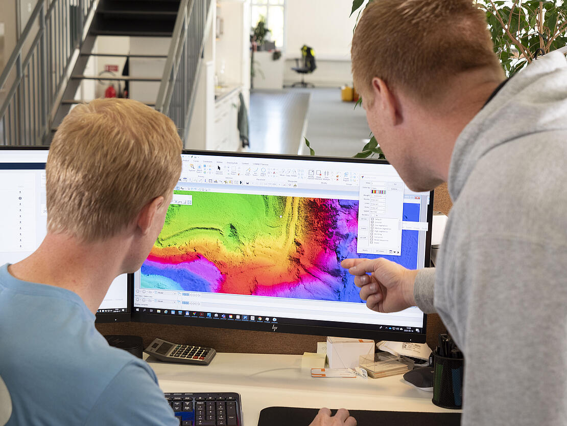
Frank Darmayan, Microdrones COOWhat’s changed for them is their computer and software that used to struggle with half a million points can now digest 80 million points with no problem. Instead of just a sparse point cloud where they can hardly see what they’re looking at, now they have a realistic view.
“The whole vision is to employ today’s technology to offer real-time solutions for challenges on sites to make the team more efficient. When looking at drones, we wanted to not do just pictures or videos; we wanted to embed into the BIM workflow by capturing high-res 3D models and volumetric information we can share visually,” Raafat said. “The biggest thing is to analyze the data and make it useful for our teams, so when we look at it, we get what we need to apply it in the field.”
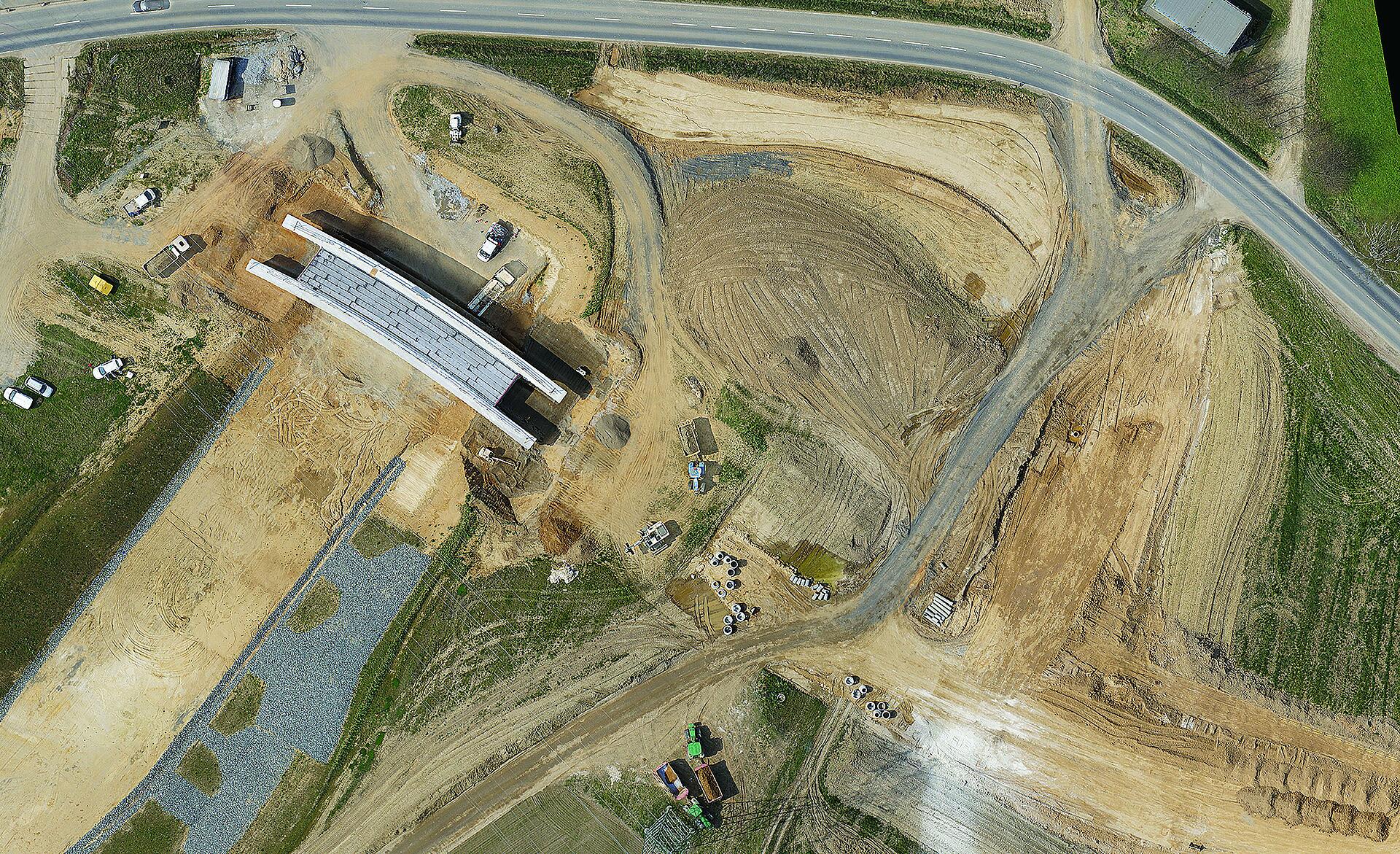
Site monitoring, volumetric stockpile measurements and clash detection are examples of how construction sites leverage drone data. What’s collected is converted into surface meshes, 3D models, orthomosiac maps and other outputs that improve communication and reduce paperwork, long a burden in the industry. Artificial intelligence (AI) and other advanced technologies also play a part, allowing for more sophistication.
While gaining access to data is key, quickly turning it into valuable assets is the secret sauce that’s transforming drones into a must-have technology on construction sites.
DATA CHALLENGES
The amount of data drones provide can be overwhelming, and early on, project managers weren’t sure how to use it, where to store it or how to share it.
“There was so much you could do but not a whole lot of direction, so people were doing everything and saying 'hey, we collected all this data and look how fast and easy and cheap it was.’ That lasted for a few years, where the main value prop was you can collect data cheaper and as often as you want,” said Jeremiah Johnson, global business development, imagery and remote sensing for Redlands, California-based Esri. “Now they realize collecting data isn’t the solution.”
INTEGRATED SOLUTIONS
There are end-to-end solutions that include everything construction clients need to capture drone data, from the platform to the sensor packages to the software. Microdrones offers such platforms, with multiple solutions that meet various construction needs.
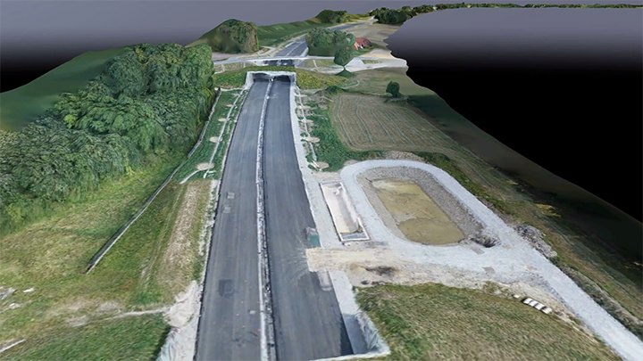
The multinational’s mdLiDAR solutions, for example, create outputs that separate the ground from non-ground points, which is critical during planning, COO Frank Darmayan said. LiDAR cuts through power lines and trees, quickly providing a surface-only model.
Because everything is integrated, the workflow is simple and leads to repeatable results, Microdrones CEO Vivien Heriard-Dubreuil said. The drone knows what to map and the accuracy needed for the final deliverable, whether it’s flying a photogrammetry payload or LiDAR.
Construction clients can still use GIS software to manipulate the data if they choose, Darmayan said, but with higher quality, denoised data.
“What’s changed for them is their computer and software that used to struggle with half a million points can now digest 80 million points with no problem,” Darmayan said. “Instead of just a sparse point cloud where they can hardly see what they’re looking at, now they have a realistic view. They can actually see the drone pilot with the remote control in his hand on the field.”
Data collected is processed through mdInfinity software, which has seven modules and is available in desktop or cloud versions.
Another benefit of an integrated solution? Support, Heriard-Dubreuil said. Everything is designed to work together, meaning customers only need to go to one place for guidance.
mdINFINITY
This ecosystem quickly and efficiently processes drone data and is part of all Microdrones end-to-end solutions that include hardware, sensors and software. mdInfinity’s processing modules include: trajectory processing, georeferencing, boresight calibration, strip adjustment, precision enhancement, point cloud direct colorization, and FORMap.
POST PROCESSING TIME
One advantage of LiDAR is its faster post processing time, Microdrones COO Frank Darmayan noted. LiDAR can provide results in minutes when measuring a pile on a construction site, for example, while it could take hours to get the same information via photogrammetry. With LiDAR, there’s no need to manage the large number of images required for photogrammetry. Of course, there are situations where photogrammetry is the best solution, such as realistic 3D modeling of a building. The key is determining which is best for the project.
If you'd like to learn how to incorporate mdInfinity for processing drone LiDAR or photogrammetry into your construction workflow, CLICK HERE to speak with a representative from Microdrones.