We receive many questions from our Facebook, Twitter, and LinkedIn pages. The goal of our Ask the Experts articles is to share the answers to the most commonly asked questions with our followers.
Have a question you’d like answered here on our blog or social media? Click here to contact us.
Question: What is the accuracy of a Microdrones mdMapper1000DG aerial mapping system?
Answer: The mdMapper1000DG is the most advanced of our complete UAV mapping solutions. The DG in mdMapper1000DG stands for “direct georeferencing.” Direct georeferencing is an extremely efficient method of collecting highly accurate georeferenced data.
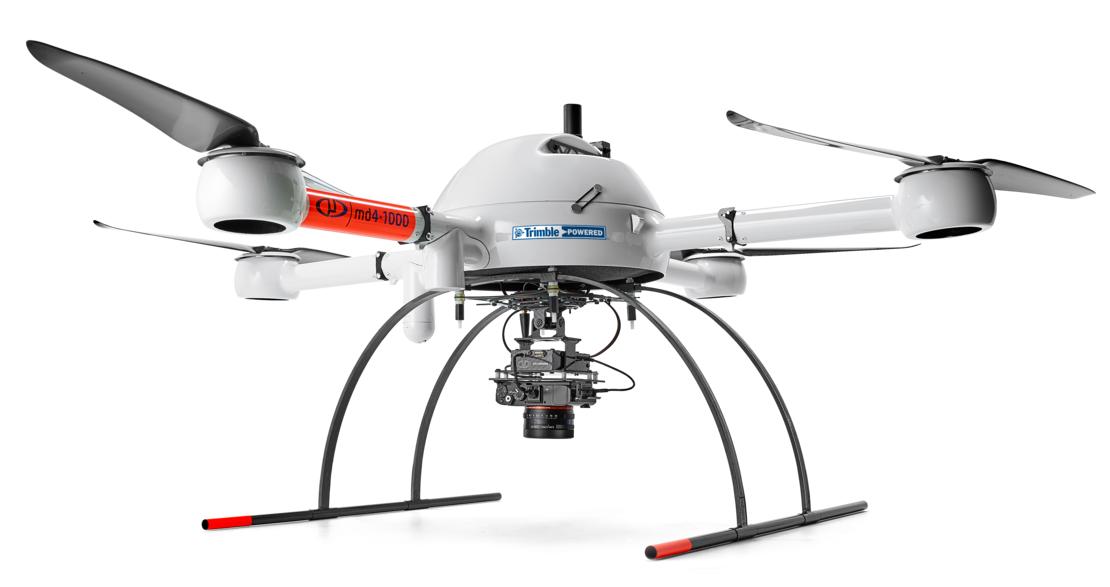
How does it accomplish this? An essential component of this system is the Applanix APX-15 UAV.
The APX-15 combines two key parts:
- A GNSS receiver chip that combines the power of all existing satellite-based positioning systems around the globe (GPS, GLONASS, Galileo, and Beidou), dramatically improving accuracy. This provides superior positioning and increased efficiency, while reducing the risks of breakdown and missed data.
- An inertial measurement unit (IMU) that instantly measures the orientation angles of the aircraft – so this system actually measures X,Y, AND Z for extreme accuracy. It also drastically reduces the amount of time spent on data collection and post-processing.
Because of these components, users of mdMapper1000DG enjoy high levels of accuracy and efficiency without ground control points. The stability and weather-resistance of the Microdrones aircraft and advanced integration with a brushless gimbal also contribute to the accuracy.
The level of accuracy depends on a number of factors: weather conditions, altitude, and use of the system.
However, the system can generally achieve accuracy of 1 – 3 centimeters GSD in X and Y and 3 – 5 centimeters GSD in Z.
| Check Point | Error X [m] | Error Y [m] | Error Z [m] |
|---|---|---|---|
| P1 | -0.045 | 0.003 | -0.086 |
| P2 | -0.171 | 0.002 | -0.105 |
| P3 | -0.051 | -0.029 | -0.09 |
| P4 | 0.003 | 0.03 | -0.045 |
| P5 | 0.047 | -0.006 | -0.07 |
| P6 | 0.054 | 0.017 | -0.063 |
| Mean (m) | -0.027 | 0.003 | -0.077 |
| Sigma (m) | 0.076 | 0.018 | 0.020 |
| RMS Error (m) | 0.081 | 0.019 | 0.079 |
An example of this accuracy: our team was recently featured in an article in xyHt magazine. On a demo in Chile, they were asked to perform an unexpected corridor mapping mission with mdMapper1000DG.
Although this system is outstanding for corridor mapping, the team had no opportunity to prepare for the flight and the software modules for corridor mapping were not yet completed. Despite these challenges, mdMapper1000DG achieved excellent accuracy. (See the chart above.)
The system was used to map a 10km wall. This data was collected in one line with no ground control points.