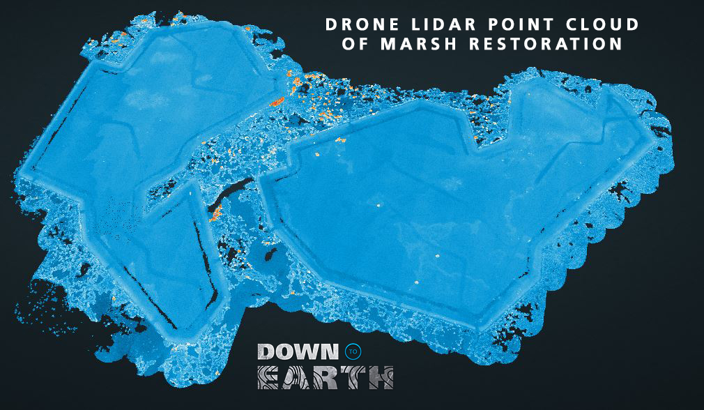
If you've watched Down to Earth: The Marsh, then you might be interested to take an interactive look at the point cloud created from data collected in the remote wetlands of the Cameron-Creole basin in Southern Louisiana. This data was collected using the mdLiDAR3000DL aaS flying at a speed of 6.5 meters per second and an altitude of 75 meters. Click the image below to go to the point cloud viewer.
“Down to Earth” is the surveying reality series from Microdrones that shows how real surveyors collect data and turn it into real deliverables, despite challenging conditions, rugged terrain, and possible dangers.
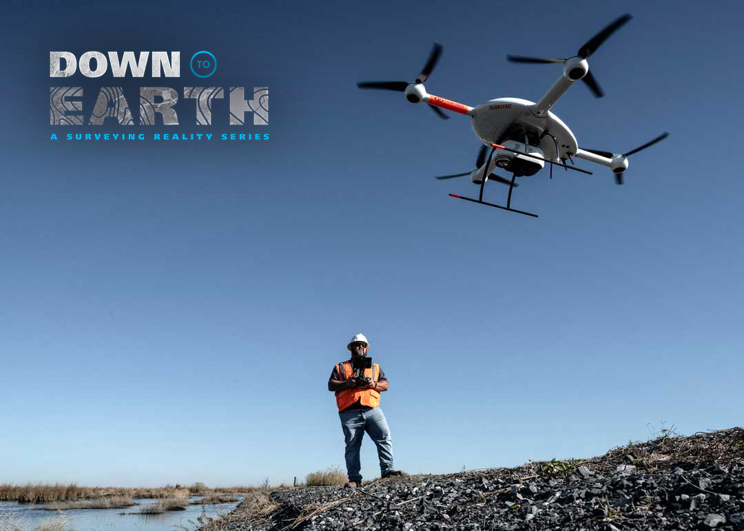
In these episodes of Down to Earth, the Surveying, Engineering, GIS, and Environmental firm of Morris P. Hebert, Inc. was tasked with surveying over 200 acres of a marsh restoration project, with minimal environmental disturbance to analyze pre and postconditions. They’ll need to determine if quantities of fill material meet the design specifications that were set forth for the restoration.
Jonathan Morris, VP Remote Sensing at MPH explained, “The customer contacted us specifically because they knew we were capable of providing UAS LiDAR Services. When you’re surveying these marsh creation areas you don’t want to have too many people on the ground or equipment disturbing what’s been built. So, the best approach is to minimize your impact and with UAS LiDAR you’re able to do that very easily.”
Drone LiDAR
The UAS System that Morris selected for the job was the mdLiDAR3000DL aaS from Microdrones. The system combines a fully integrated Riegl miniVUX‑1DL paired with a Sony RX1R II 42.4 megapixel camera & quick connect mount. In addition, the system uses an Applanix APX-20 UAV IMU, a high performance compact module with a survey-grade GNSS receiver and dual precisely calibrated IMUs for mapping.
“The mdLiDAR3000DL is suited for this type of job because you get the camera and the Lidar payload at the same time,” said Morris. “So, you’re able to capture the photogrammetry and LiDAR in one flight mission.”
The Marsh Point Cloud
The data for the point cloud was captured over 200 acres of a marsh recreation project in the Cameron-Creole basin by the mdLiDAR3000DL aaS over 7 flights. The drone flew at an altitude of 75 meters and a speed of 6.5 meters per second. The duration of each flight was approximately 18-20 minutes completed in 39 legs with 40% overlap.
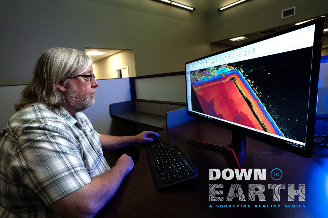
To create the point cloud, the data from the marsh was first processed with mdInfinity Trajectory Processing and Georeferencing modules. Then further processing in mdInfinity was conducted which allowed for precision enhancement, removing outliers, and ground classification.
In episode 3 of Down to Earth, the Marsh, the R&D and Training Coordinator for MPH, Lee Drennan, processed and visualized the LiDAR data to create a point cloud and orthophoto of the marsh restoration project.
“We’ve used the mdLiDAR3000DL for landfills, construction projects, and marsh restoration areas,” Drennan said, “because the LiDAR really lends itself to anything involving volume calculation. Not only can we do the project faster and more efficiently, but we can provide a better product since the LiDAR point cloud is so dense.”
For more information on putting drone LiDAR to work for you, CLICK HERE to speak with one of our friendly representatives.