Eye in the Sky: Crafton Tull is a Leader in Drone Surveying
Dwain Hebda wrote a great article for Arkansas Money & Politics about the surveying job Crafton Tull performed in the Ozarks for the Down to Earth Project. You can see for yourself at this AMP news link or read the text below.
Arkansas is a state of topographical diversity, the beauty of which is rivaled only by the challenge of surveying it for mapping or surveying purposes. Sheer bluffs, rugged timber and unpredictable weather all make charting a new road through the wilderness as potentially dangerous as it has ever been.
But one Arkansas engineering company, Crafton Tull, looked upward for inspiration on how to solve these challenges. Over the past three years, the Little Rock-based company has become a leader in the use of drones to complete surveying tasks in the most challenging of environments.
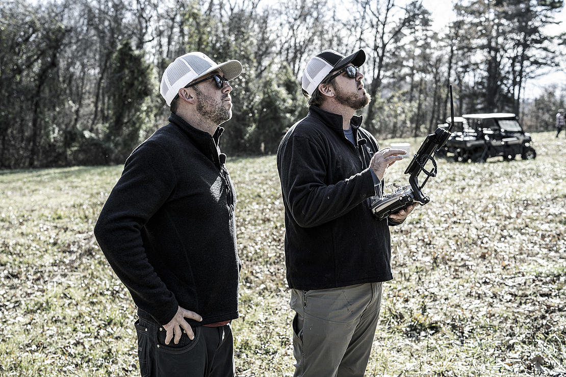
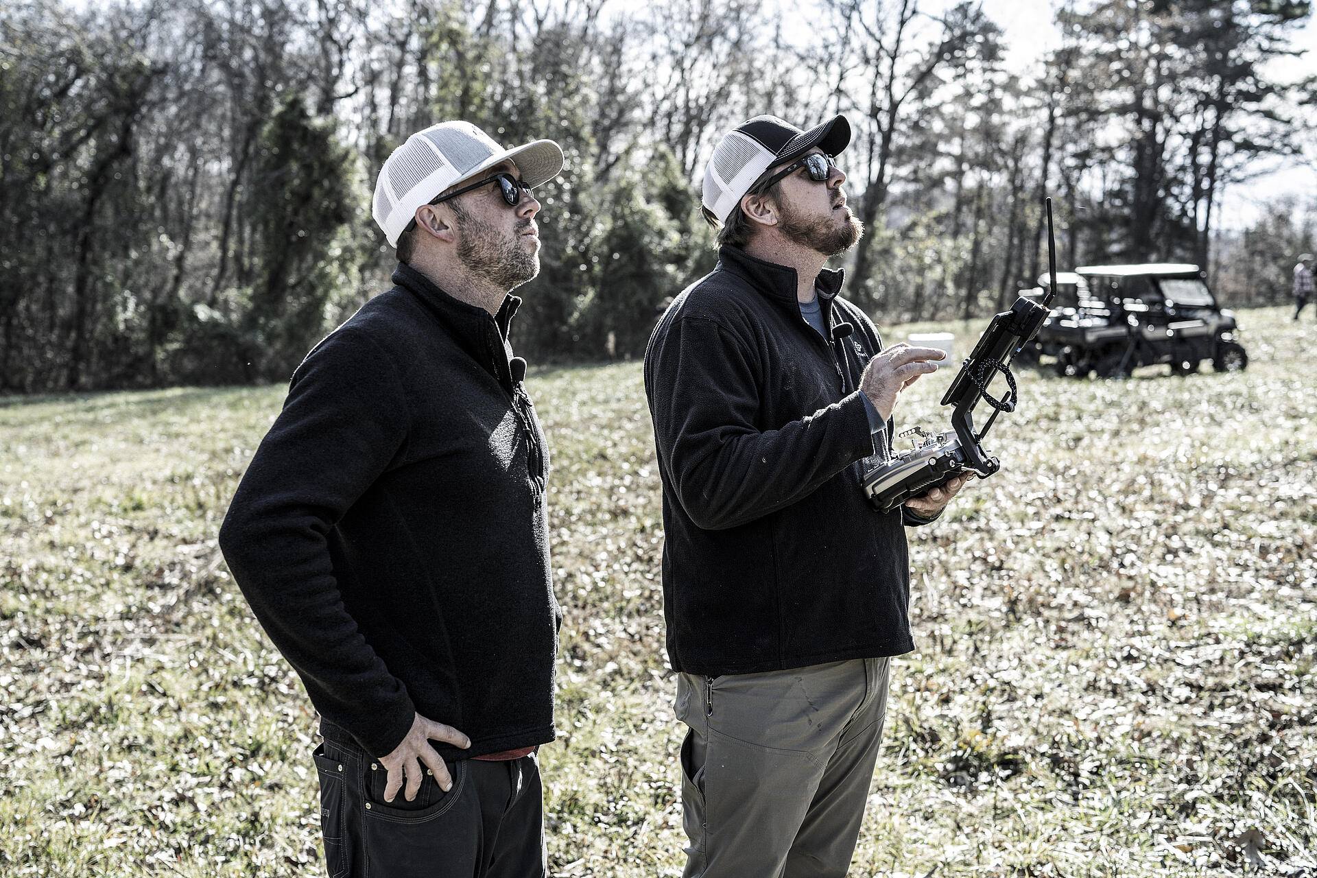
“One of the things Crafton Tull prides themselves on is safety for our field crews,” says Nick Tucker, vice president. “We don’t ever want to put them in a situation that’s unsafe even though we do see a lot of situations where we work in challenging terrain or hazardous conditions.”
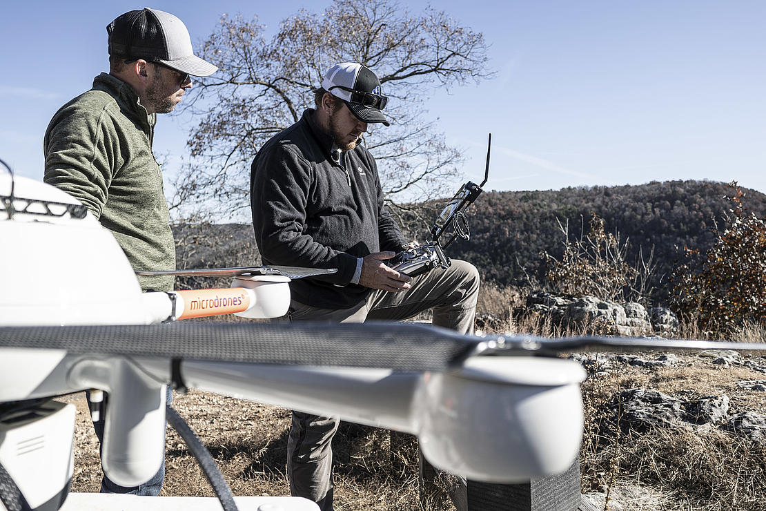
“Right here in Conway, we do quite a bit of oil and gas, powerline, pipeline work and we’ve seen some situations where it may be oil spills or some sort of fire which you really can’t put a crew on the ground.”
“And then most recently a project like Big Creek that we worked with the Russellville office faced very serious terrain issues. You know, 500 feet of elevation change, sheer bluffs and cliffs, things that are typical of the Ozark Mountains that would’ve been hazardous for a survey crew with boots on the ground to do.”
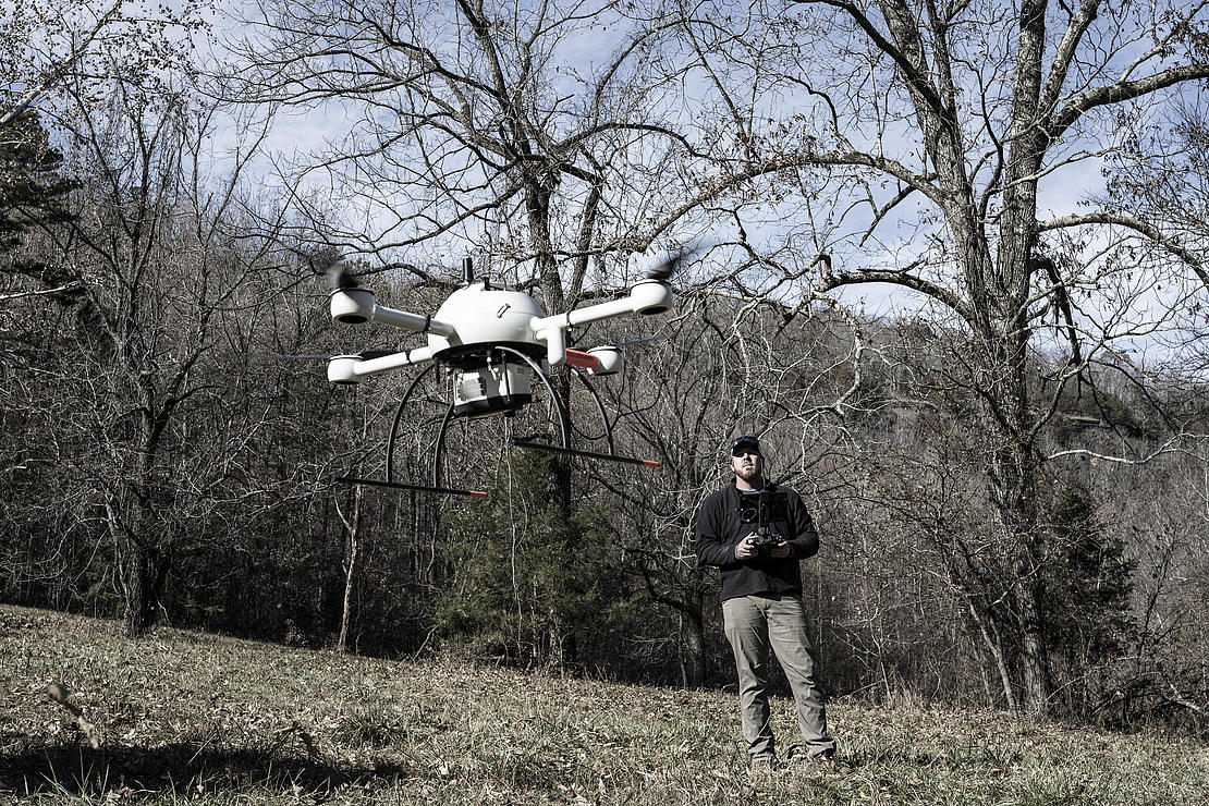
The company’s efforts on the latter job are the subject of a short documentary series, “Down to Earth – The Ozarks” viewable on YouTube and sponsored by drone manufacturer Microdrones. In addition to showing the technical elements of plotting a road through the mountainous area, drones are used to provide the breathtaking visuals of the location itself along Big Creek, a major tributary of the Little Red River.
Drones, or unmanned aerial vehicles (UAV) in aviation lingo, are relatively common now, but a little more than 36 months ago, Crafton Tull found it a hard sell to get clients to buy into the technology.
“Crafton Tull’s always prided themselves on is staying on the leading end of technology,” Tucker says. “But humans are creatures of habit by nature, so if you’ve been doing things one way for so long, trying to convince an old dog about a new trick can be a little cumbersome.”
“We started with just one (UAV) three and a half years ago and struggled to keep it regularly busy because the technology was new. Now that people are coming around, the technology’s more prevalent.”
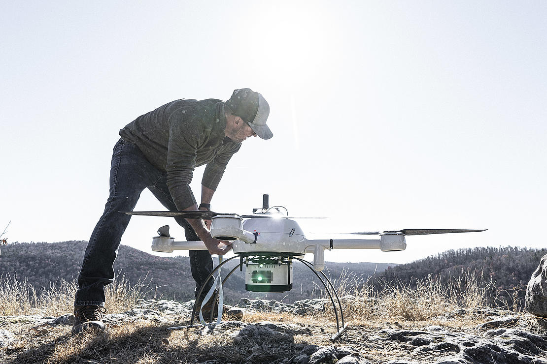
Tucker says the low end of UAV designed for commercial use runs about $30,000 and tops out with models costing more than 10 times that. To boot, such equipment has a functional lifespan averaging three to five years, under commercial conditions. Add to that the ancillary costs of pilot training, salaries and transportation to and from job sites and drone surveying is not an inexpensive business unit to operate.
Still, as the technology has become more accepted, Crafton Tull has found its services in high demand while competitors scramble to catch up.
“Right now, we have a pretty consistent backlog of work; we’re probably teetering on the point of expansion or the need to increase our fleet,” Tucker says of Crafton Tull’s UAV operations which currently includes eight pilots and five different UAV models. “Being on the forefront, getting our drones and our employees trained early, has given us a bit of a competitive advantage over some other companies who are just now getting into the technology.”
The process of mapping an area combines thousands of still digital photos from two sensors with laser scans of the terrain, from which software creates 2-D and 3-D renderings. The highly accurate process, which previously took weeks depending on area size, can be done in a matter of hours much more safely than using human crews. Tucker says future advancements will make the process even more efficient.
“These particular drones and their limitations right now are flight height, flight speed and flight time,” he says. “Our flights are governed by the FAA, and our flight times are regulated by the batteries. So, you can imagine flying a ten-pound bowling ball across the sky and the amount of battery power it takes to propel it against the wind, against conditions.”
“What you’ll see as far as the development of the technology is providing more accurate, more high-resolution sensors, in other words, a bigger camera that takes higher megapixel photos and a faster (laser) sensor that spins faster and collects more data in a short time. In the future, these drones will go for longer flight times at faster speeds while still capturing the same accuracy in our data.”
To see how Drone LiDAR can make a difference in your surveying projects, CLICK HERE to speak with one of our helpful representatives