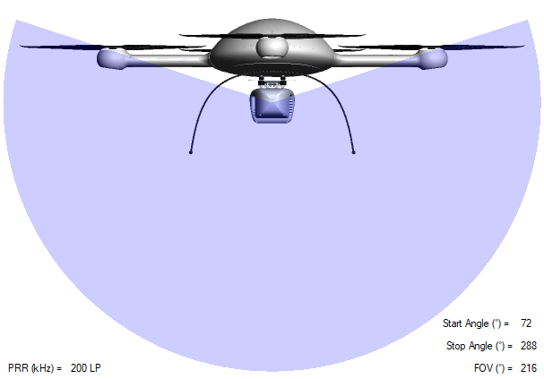
A Wider LiDAR Field of View
Now available for the mdLiDAR3000LR and mdLiDAR3000 is the new Vertical Feature Configurator which provides the ability to scan a wider Field of View (FOV) and collect more data. By opening the scanners FOV you can now fully utilize the area under the drone for data collection and by using the configurable field of view option, you are no longer limited to flying above your area of interest.
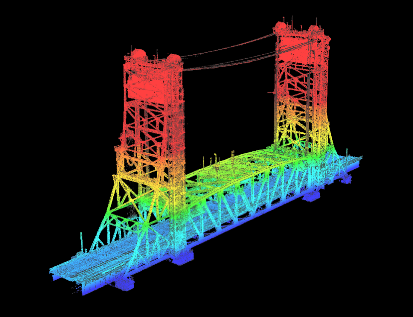
To illustrate this updated feature, Microdrones has provided a Lidar point cloud dataset of a bridge near Montreal, scanned with the mdLiDAR3000 where the Field of View was configured to 216° which is the maximum FOV This new feature allows the drone Lidar to collect a higher volume of data both above and below the bridge, in a shorter amount of time. Click the image below to view the drone LiDAR interactive point cloud.
The Workflow
This project was conducted using the Microdrones workflow of Plan, Fly, Process and Visualize. Most mission and flight preparation details are taken care of offsite. All flight parameters for data acquisition will be reviewed before each flight.
Area of Interest
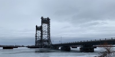
To demonstrate the capabilities of the Vertical Feature Configurator, the area of interest to be scanned was a vertical lift bridge near Montreal Canada to survey both above and below the infrastructure. The dimensions of the bridge were 140m in length by 25m width and 60m in height.
Plan & Fly
Flight planning begins in mdCockpit and is then verified in the field upon closer inspection of the project. When flight planning is complete, the mission can then begin and the user can choose to autonomously fly the project.
The Vertical Feature Configurator has a max field of view of 216° to allow for an increased swath of data collection from the fully integrated Riegl miniVUX‑3UAV.
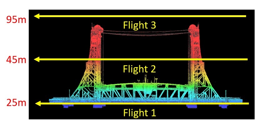
The Data was collected in 3 flights of the mdLiDAR3000, at a speed of 4 m/s, flying at 3 different altitudes to provide complete coverage on all sides of the bridge. Beginning at an altitude of 25m and utilizing the increased Field of View to scan upward, the first flight was able to capture data from underneath the bridge. Flight 2 maintained an altitude of 45m and the final flight was conducted above the entire bridge at a height of 95m.
Process and Visualize
The point cloud was created and processed through the mdInfinity software suite using the following data processing modules: Trajectory Processing, Georeferencing, and Precision Enhancement (+ noise reduction) to insure an accurate and precise point cloud.
If you would like more information on the mdLiDAR3000 and how to take advantage of the increased field of view, CLICK HERE to speak with one of our friendly representatives.