
The team at Spatial Data Consultants (SDC), an expert geospatial consulting firm in High Point, North Carolina, is using drone LiDAR technology to survey the new entrance and road at High Point University in North Carolina. See how they plan their mission, collect data, and overcome many challenges in this 3-minute drone surveying case study.
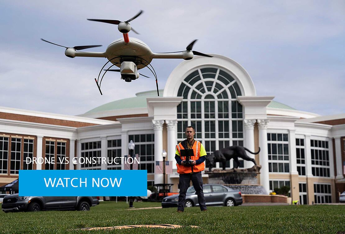
High Point University stayed close to home when they needed an as-built survey to help get a planned, high-profile road project off the ground. They turned to Spatial Data Consultants (SDC), a geospatial consulting firm, to help pave the way for construction of the new Panther Drive entrance. The road straddles the football and baseball stadiums before winding into the heart of the scenic campus.
But High Point didn’t just settle on SDC because the firm’s office was only about a seven-minute drive from the university. They’re known for their experience and professionalism. But owner and chief professional officer Mark Schall is always thinking ahead, too. That way, back in 2018, he started working with Microdrones to supplement their manned aircraft workflow. Now, they’ve transitioned most of their work to drone surveying systems.
For Panther Drive, Fred Johnson, SDC’s director of UAV services, knew that drone LiDAR from Microdrones would be the right tool for the job, along the tree-lined corridor. High Point needed to make sure that any improvements on Panther Drive were in line with original design specifications.
Plus, High Point was coming up on a critical deadline. Johnson trusted the Microdrones platform to get jobs done safely and accurately.
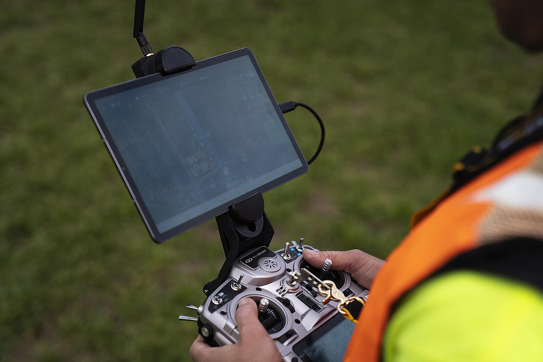
Preparations started the day before arriving on campus. Johnson used mdCockpit to create a flight plan for a corridor about 80 meters wide with two flight lines on either side of the pavement on the outer edges of the current roadway. MdCockpit is the industry-leading app from Microdrones that allows professionals to plan, monitor, change and control flights right from a tablet.
It’s a little overcast on the day of the survey, but the weather is otherwise just fine to send he drone in the air. Johnson is joined by geomatics technician Scott Deford to keep a line of sight and help ensure a safe mission.
One unexpected challenge emerged — the road was still open after they expected it to be closed. Johnson adjusted the flight path to avoid the potential of the drone flying over someone.
After tweaking the plan for the unforeseen traffic, the mission had a green light. It took just 11 minutes to complete and went without a hitch.
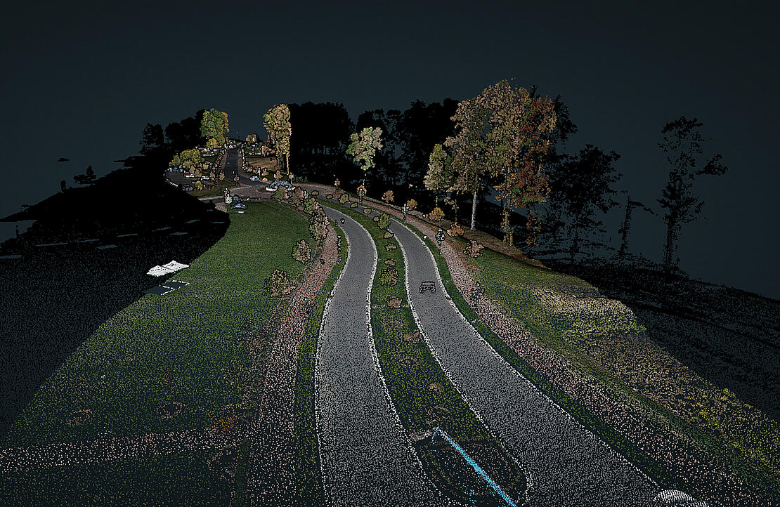
Then, it was back to the office to process the data, where as expected, the results looked good. The final colorized point cloud was so detailed, Johnson could see everything from individual bricks in a brick sidewalk, to vegetation, signs and light poles. They’re the kind of details that planners typically want for this kind of marquee project.
Johnson even added two bonus deliverables for High Point, creating models of just the ground surface alone, and one that included above-ground features. It’s just another example of the kind of success that SDC has had creating As-built surveys with drone LiDAR.
If you would like more information on using Drone LiDAR for your surveying projects, please schedule a time to meet with one of our sales representatives.