LEARN ABOUT THE LEADERS IN LIDAR MAPPING HARDWARE AND SOFTWARE
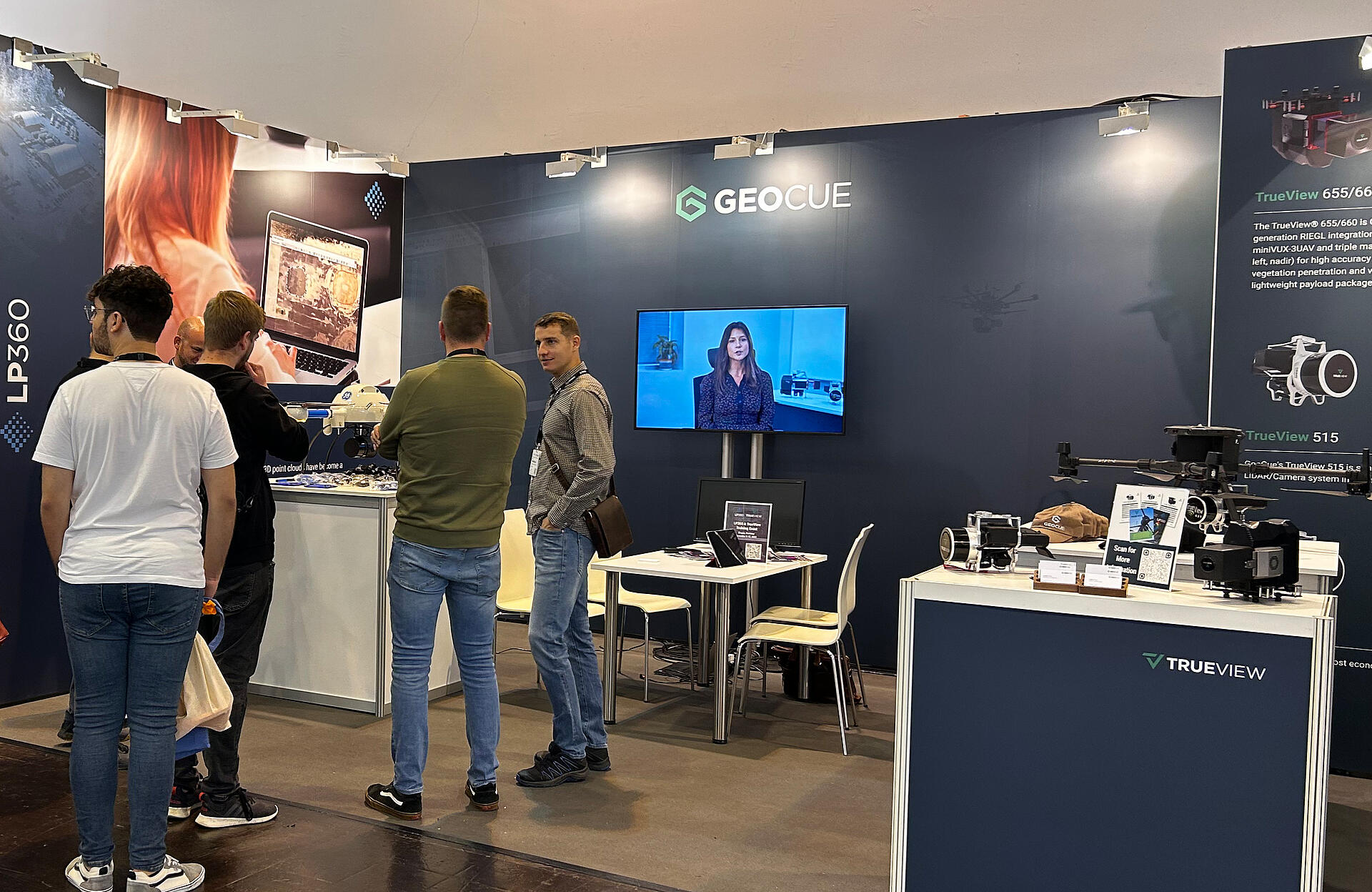
GeoCue and Microdrones are excited to be participating in this year’s Geo Week. Find our team, Drone LiDAR surveying equipment, and LP360 software at booth 737.
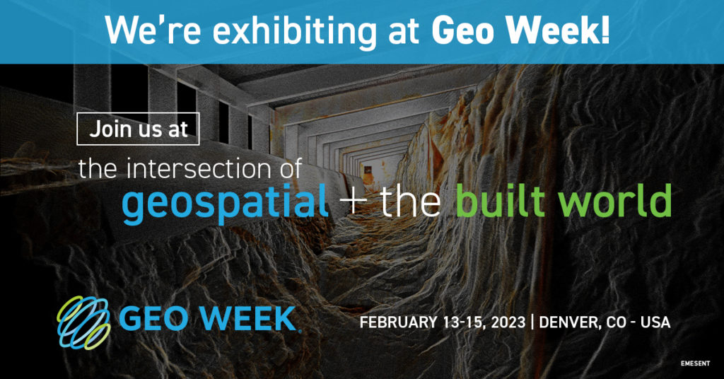
FREE ACCESS
Here’s a special offer to gain access to the conference and visit us at Booth 737. To receive a FREE expo hall pass OR $100 off a Geo Week conference pass, register at geo-week.com and enter GEO2330055 when prompted to enter a promo code.
This year, we have something for everyone. GeoCue and Microdrones have joined together to offer the very best in drone surveying equipment, geospatial software, workflow, training, and support.
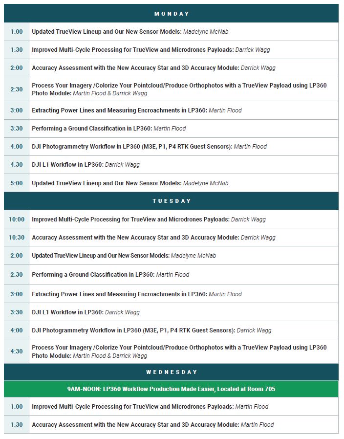
In fact, we’ve expanded our exhibition presence and set up a portion of our booth for 20-minute presentations scheduled throughout each day. Learn about our updated products and new sensor models, improvements in assessing accuracy, and getting the most out of our LP360 data processing software.
If you have questions about drone LiDAR, photogrammetry, and software processing, you can get the answers you need in one of these informative sessions:
Presentation Schedule, Booth 737
Join our Special Presentation Wednesday, February 15th, 9am – Noon in Room 705
In addition to the presentations at our booth, GeoCue and Microdrones will be hosting a special presentation on how to make your workflow production easier with LP360. Join us in Room 705 of the Colorado Convention Center on February 15th, from 9am – Noon.
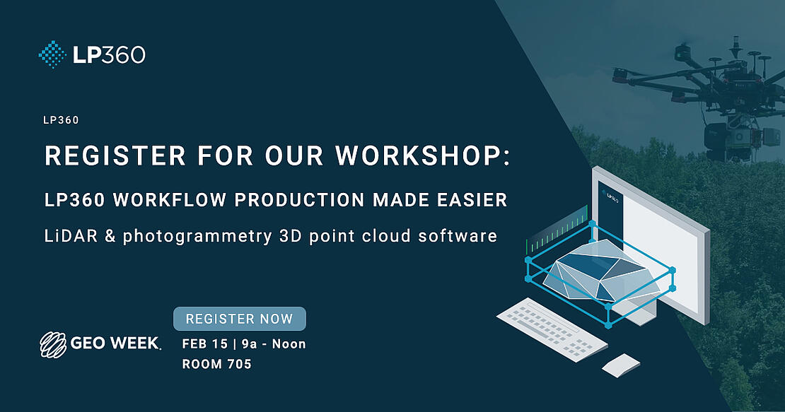
In this workshop, we will explore the best practices for using LP360 to process, analyze, and maximize data, producing valuable information and deliverables. We’ll show you how you can use LP360 to get the most from your data by using the software to:
- Import projects into LP360
- Work with Point Cloud tasks
- Accuracy Assessment. Debias and Deal with Noise
- Data Smoothing
- Automatic Ground Classification
- Ground Cleanup and manual Editing Tools
- Using the Export Wizard to get final products
Building upon the strengths of Microdrones and GeoCue, we can now more than ever meet customers where they are in terms of technology adoption, budget and resources. Be sure to stop by our booth at Geo Week to learn more about our drone LiDAR surveying equipment and software. Our professional sales team is eager to answer your questions.
If you are not attending Geo Week, you can easily schedule a time to talk with one of our representatives to learn more about our powerful family of brands.