Tice Engineering combines drone LiDAR, terrestrial and hydrographic scanning to create comprehensive 3D surface models for river scour surveys
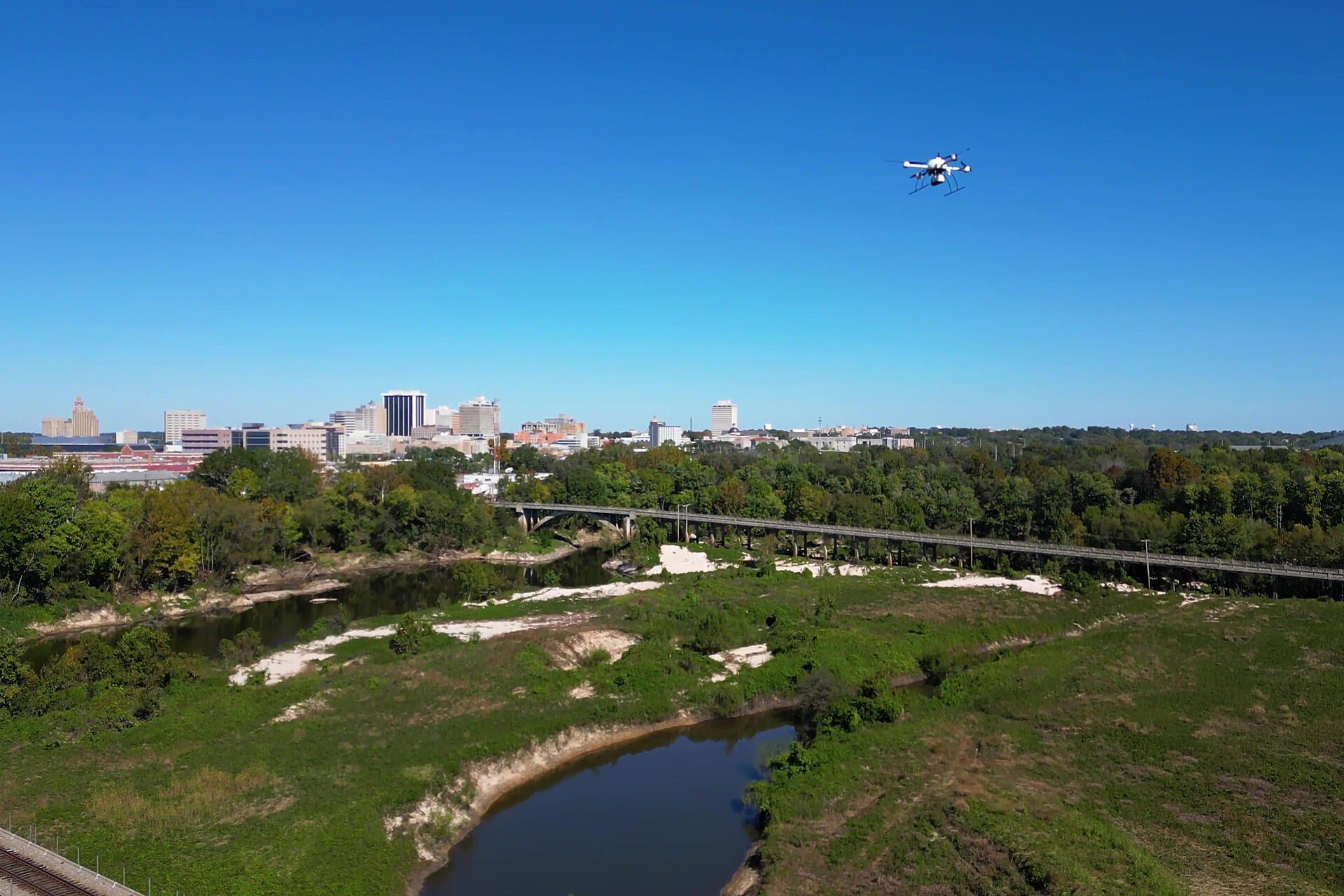
The advantages of using drone LiDAR is well-documented in conventional survey applications, but what about when a project calls for detailed underwater modeling, too? Tice Engineering of Wiggins, Mississippi, conducted a 3D modeling project for the Mississippi State Department of Transportation on the Pearl River, which flows through the heart of Jackson, providing drinking water to hundreds of thousands of people, but also compromising bridges when it floods.
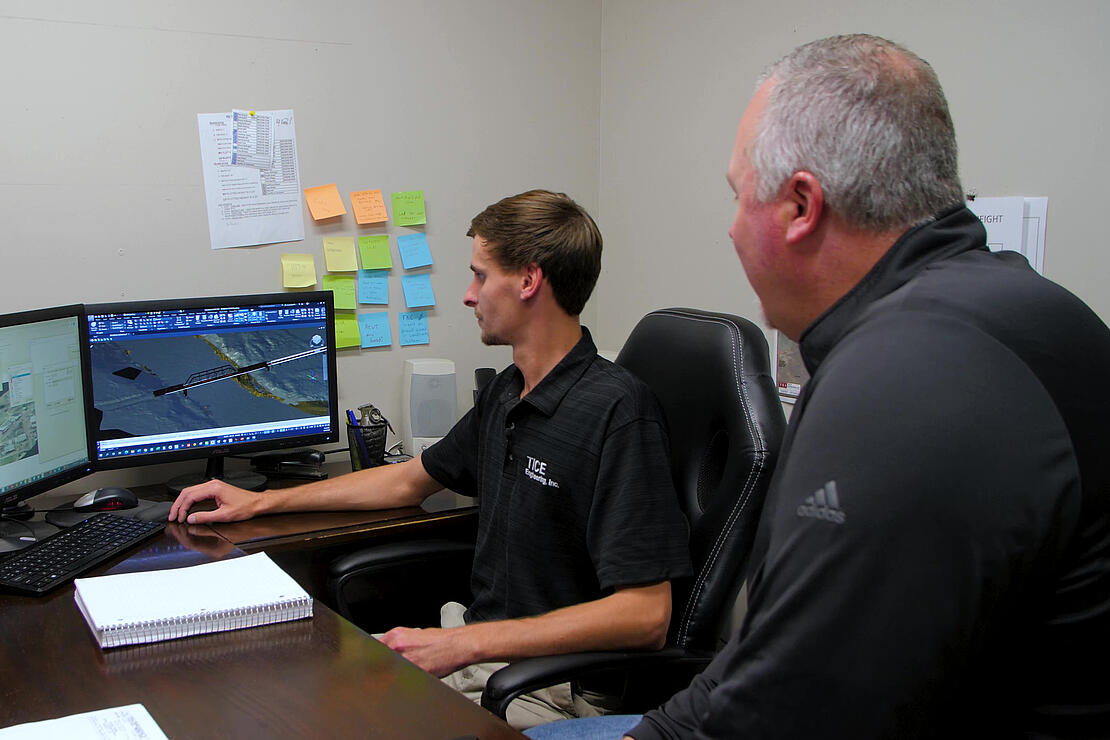
The Tice team incorporated LiDAR data from an mdLIDAR1000HR to cover the entire 150-acre survey area, terrestrial scanning under the bridges, and hydrographic scanning of the underwater bridge structures taken from a Z-Boat along the river. The end result was a 3D model for MDOT that not only mapped the entire topographic area, but also included detailed and dense data-point models of the ground surface, bridge surfaces and structures, and the entire underwater area.
“Tice Engineering was looking for a tool that would help them increase safety and help them increase their productivity,” said Chuck Snow, Eastern United States Manager for Microdrones. “They've already used other tools that create point-cloud data, but they needed something else to help speed up their production. They saw how good the Microdrones products were through their dealer, and how quickly it would help them complete projects – with accuracy, as well.”
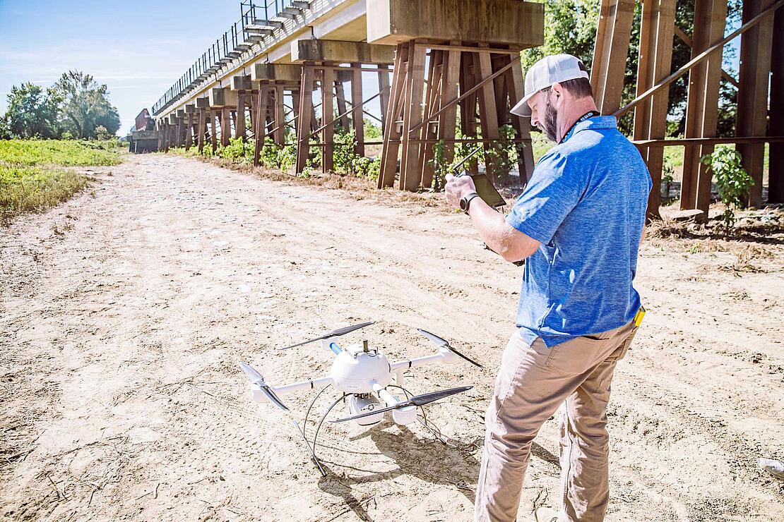
Tice started the project by planning drone flights to cover the entire site. Taking into account the size of the survey area and accessibility challenges, the drone was an essential component in covering large areas efficiently. It is also guaranteed to produce data with high point density essential to creating the final 3D model.
“The mdLiDAR1000HR helps us to access a lot of the areas here much easier than conventional topographic survey methods,” said Colt Ratliff, VP and Survey Manager with Tice.
Even more important than ease of access is safety, especially considering the unstable nature of post-flood riverbeds in the area. While the team did need to access the underside of each bridge in person for terrestrial mapping, the drone allowed Tice to safely cover the entire survey area efficiently – without sacrificing any of the point-cloud density needed for accurate modeling.
“The terrain is uneven and sandy, it slopes and sloughs off when you walk on it, and there’s thick brush,” said Matthew Jones, Professional Surveyor with Tice. “If we did this conventionally, we would have to physically walk across sections probably every 100 or even 250 feet in cross sections, so the data would be very sparse and very spread out. With the drone, we were able to collect very dense data, and we can cut a cross-section wherever we like. It really helps our safety – so now our guys only have to access the bridges for the terrestrial scanning. Whereas we just need a safe place to launch the drone. Other than that, we never have to set foot on the whole site, just the key areas.”
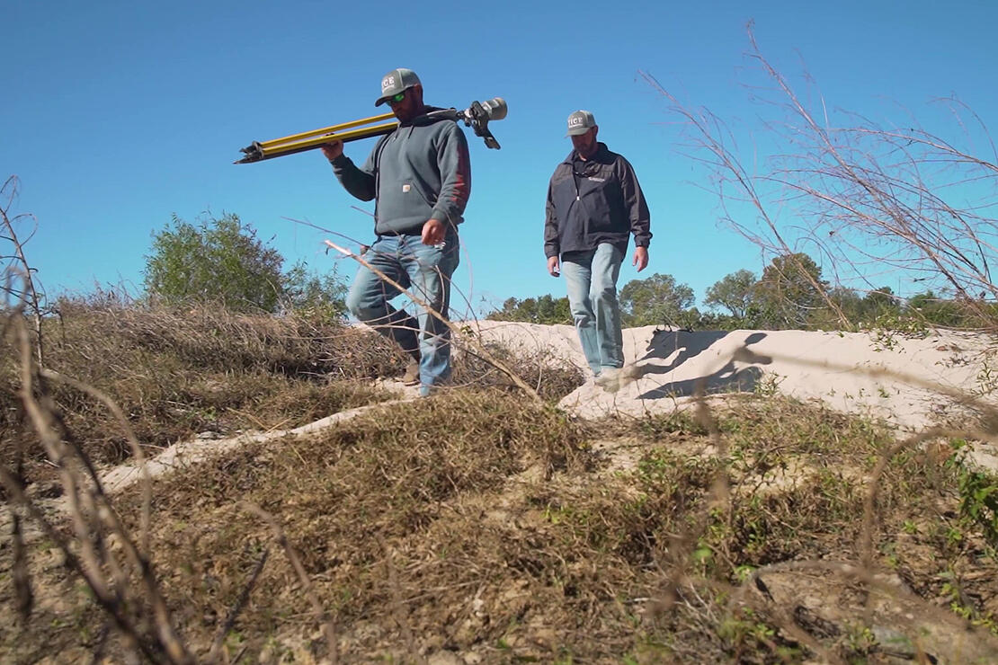
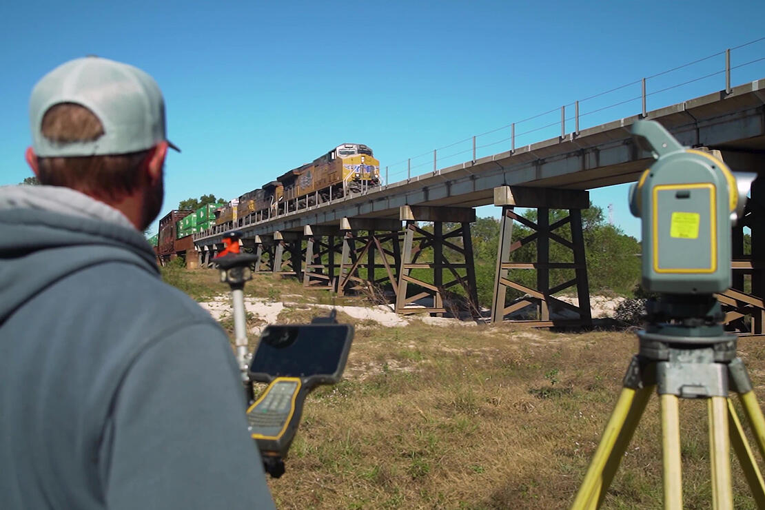
Terrestrial surveys of the area’s bridges followed the drone flights – essential for creating the detailed model.
“The importance of the terrestrial scanning on this particular bridge is that it's a railroad bridge and the Department of Transportation does not have As-builts on this bridge, and this bridge is in in the flood plain,” said Jones. “The terrestrial scanner will pick up all of the structure below, and then with the Drone from above we'll get the bridge deck, railings, and ultimately we'll have a full 3D model of this bridge.”
In numerous locations, the Tice team needed to use their UTV to access the sites and trailer surveying equipment into position. While it was required for the bridge sites, that difficulty of access illustrated the benefit of using the drone to cover larger swaths of territory that didn’t require on-the-ground surveying. The mdLiDAR1000HR ended up being responsible for about 80 percent of the data scanned for the 3D model.
“There's a little bit of an access issue because of the terrain, so we brought our side-by-side,” Jones said. “We loaded all of our equipment on our trailer, then we were able to access the bridge.”
To complete the 3D model, Tice used a Z-Boat for hydrographic scanning of the underwater environment. The water was a bit shallow – a blessing for the terrestrial scans – but not so much that it negatively affected the Z-Boat data collection.
“To be able to collect over 150 acres of data with the mdLiDAR1000HR, along with the hydrographic data, and then to terrestrially scan and do this in two days is a testament to the equipment. We wouldn’t have been able to do so without it,” Ryan Tice, President of Tice Engineering. “The deliverable that we will turn into the Mississippi Department of Transportation will be an ultimate 3D point cloud of the whole project area – the 150 acres that we've surveyed in the past two days here and also a digital terrain model, which is just a 3D surface of everything. Then they can go in and model the river at different flood stages and look for potential scour problems and come up with a mitigation plan for those scour holes.”
Piecing together the final 3D model required a data merge not seen in typical drone-only site surveying. Tice used Trimble Business Center to process terrestrial data, Hypack survey software to process the hydrographic data, and mdInfinity for the drone data. Those three data sets were merged into TopoDOT to generate the final 3D model. The “pretty picture” that Tice was eager to see allowed for inspection of detail in bridge cross sections and cross bracing, road surfaces, and scouring areas.
“I was very pleased marrying three different LAS files from three different scanning technologies: using the mdLiDAR1000HR drone, using terrestrial scanning, and using the Z-Boat to collect the data that's under the water,” Tice said. “To see everything form a complete product is a total success for us. I think MDOT will be very very excited to see that data.”
If you’d like to learn more about adding drone LiDAR into your surveying workflow, contact one of our helpful sales representatives to schedule a meeting today.