
Easy to Use, Compact, Drone LiDAR, Made in the USA
In this 15-minute product preview presentation from Geo Week 2024, Chuck Snow, the southeaster US Regional Sales Manager, reviews the full product portfolio of the EasyOne from Microdrones.
The EasyOne features a significantly smaller operational form factor with the same payload capacity of the md4-1000 platform. In addition to a smaller operational form factor, the EasyOne packs down even smaller, fitting the drone, remote, charger, two batteries and the payload into a protective storage case that’s small and light enough to bring anywhere.
If you were not able to attend the presentation at Geo Week 2024, watch the video below for all the details on our most compacy survey-grade drone LiDAR surveying equipment on the market: EasyOne from Microdrones.
Microdrones EasyOne: Compact Integrated Systems for Efficient LiDAR Surveying
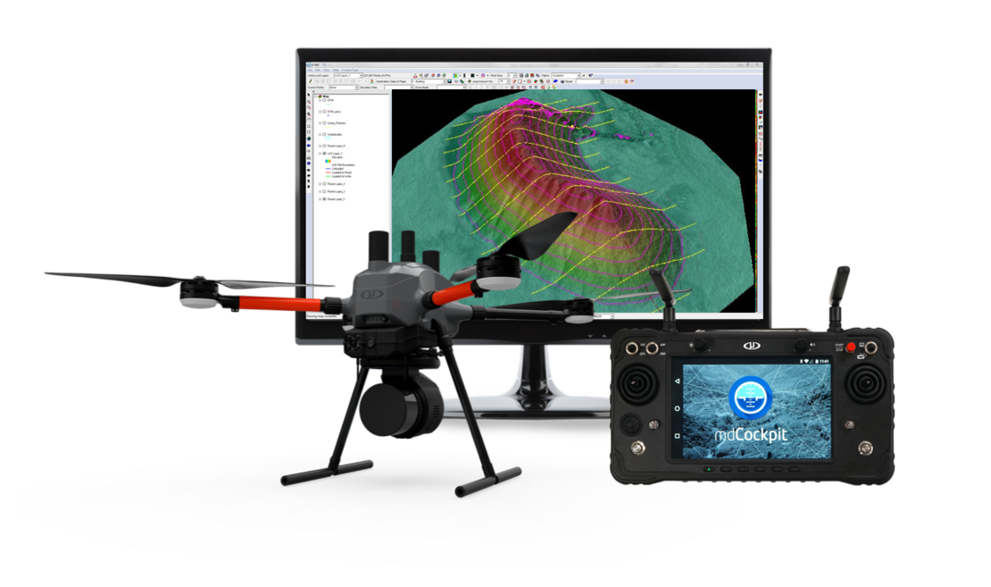
Microdrones offers a cutting-edge solution for efficient and safe data collection with its EasyOne Integrated Systems. Designed to streamline workflows and deliver high-quality data deliverables like 3D point clouds and orthomosaics, these systems are revolutionizing industries such as land surveying, construction, oil & gas, and mining.
The EasyOneLiDARUHR+, EasyOneLiDARUHR, EasyOneLiDARUHR Lite, and EasyOneLiDAR NDAA are fully integrated systems optimized for various applications. With a focus on compactness, safety, and integrated functionality, these systems provide users with improved sensor capabilities, all conveniently packaged in a single transportable box.
Key Features of EasyOne:
Compact Design: The EasyOne platform offers a more compact and lightweight solution compared to competitive drones, making it easy to transport and deploy in the field.
Enhanced Controller: The new controller design provides an intuitive user interface and powerful safety features, including Real Time Terrain Follow. Additionally, the controller integrates with mdCockpit directly on the RC screen, eliminating the need for external tablets.
NDAA Compliant Option: The EasyOneLiDAR NDAA option ensures compliance with US Government regulations, featuring an NDAA-compliant sensor payload, RC, data link, and software.
Improved Sensor Capabilities: Built upon Microdrones' 4th-gen drone technology, the EasyOne systems offer optimized performance, lighter weight, and enhanced efficiency, making data collection and processing easier than ever before.
Experience the Ease of EasyOne:
The EasyOne platform offers unparalleled integration in the drone surveying industry, simplifying the planning, flying, collecting, processing, and visualizing of geospatial data projects. Whether you're a surveyor, construction professional, or industry expert, the EasyOneLiDAR systems provide a comprehensive solution to meet your needs.
Schedule a Consultation:
Ready to harness the power of Microdrones EasyOne for your next project? Contact one of our LiDAR Experts today to schedule a consultation and discover how EasyOne can revolutionize your data collection workflow.