LEARN HOW LP360 CAN MAXIMIZE YOUR LIDAR DATA
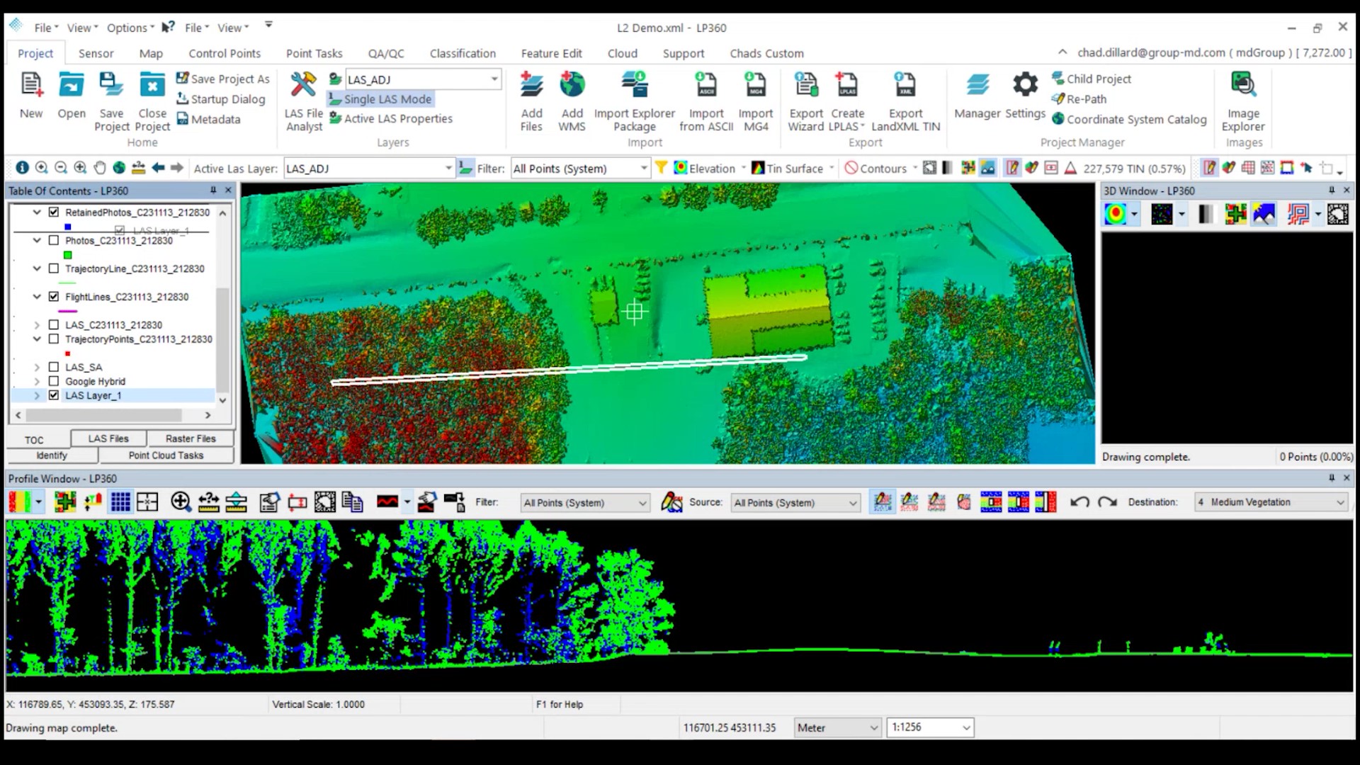
In this informative webinar replay, learn how LP360 can maximize your LiDAR data. We'll provide an overview of LP360 and review some of the latest features. Then, we'll demonstrate how to process a data set collected from the DJI Zenmuse L2 sensor. This highly integrated LiDAR system builds on DJI’s first LIDAR entry, the Zenmuse L1.
This informative webinar replay will:
- Provide a detailed overview of LP360 and learn what to look for in processing software.
- Review the processing workflow, applications, and deliverables.
- Explore new features such as LP360 Cloud, 3D Accuracy Add-Ons, LPLAS files, and PowerSearch.
- Demonstrate how to maximize data collected from the DJI Zenmuse L2 sensor through the LP360 Processing workflow
After watching this informative session please let us know if you have any questions. You can purchase LP360 today or schedule a time to speak with one of our representatives.