
Process LiDAR Data Faster with Multi-Cycle Import from LP360 Drone
When it comes to processing LiDAR and photogrammetric data, GIS professionals have been relying on the 3D High-Performance Point Cloud Processing capabilities of LP360. This advanced LIDAR software makes easy work of extracting information and generating deliverables in an intuitive GIS environment.
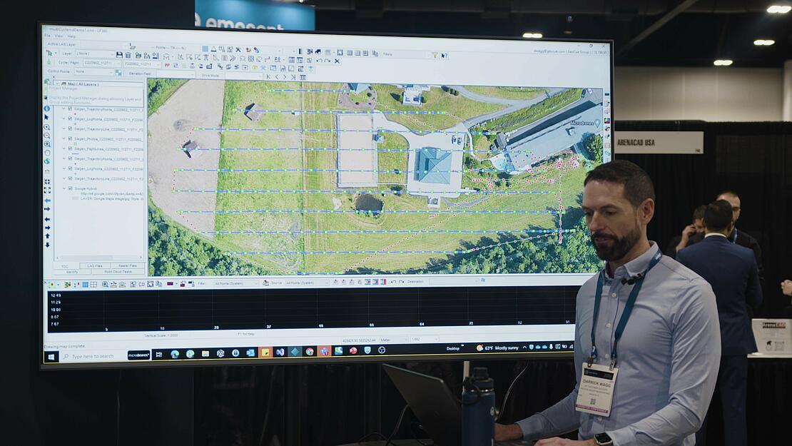
One of the benefits of LP360 is the ability to import multi-cycles (flights) of data from TrueView, Microdrones, and other guest sensors. In the video below, Darrick Wagg, Vice President of Customer Success at GeoCue, demonstrates how to process LiDAR data in LP360 and the improved multi-cycle import processing feature.
Improved Multi Cycle Import Processing
Multi-Cycle Import is available for the full line of TrueView 3D Imaging Sensors, the full line of drone surveying equipment from Microdrones, and other guest sensors. This is the ability to import all of the data and raw information from each LiDAR cycle.
Cycles can be added with base observation and ancillary files, survey nail information, and batch import showing progress and status reporting per cycle. In addition, all base station observation files can be added and LP360 will auto-select the appropriate ones for each cycle.
To assist with the organization of your data, LP360 will automatically generate view groups for each cycle and temporal date. It’s a feature that Darrick highlights in the video. “One of the things we've added in LP360, are some controls on your project display,” he explained. “As you get into a lot of different processing with multiple flights, we give you the ability to create view groups. This gives you a nice, easy way to make the table contents a little bit slimmer, a little bit more defined, so you can see exactly what you’re working with.”
Other features with the Multi-Cycle Import include that the antenna height is read from the RINEX and where possible the T02 base observation files and you can create a survey nail/reference mark from the coordinates found in an archived cycle.
Other time-saving functions of Multi-Cycle import include:
- Create a survey nail/reference mark from the coordinates found in an archived cycle.
- Right-click menu options for setting area, ancillary files, and survey nail/reference mark.
- Support for T02 base observation files for all POSPac-supported trajectory positioning options.
- Automatically generate view groups for each cycle and temporal date.
- POSPac processing updates have also been included with the latest release. Now, instead of needing to know the position a priori, LP360 Drone has added support for deriving the survey nail coordinate using Trimble CenterPoint RTX during POSPac processing.
- The POSPac Cloud installer has also been added to the LP360 installer to support integrated functions that depend on POSPac Cloud.
- Additionally, a QC-Only option in POSPac processing has been added to allow for field checks. Creates rnav/vrms.out and report.pdf files.
“What’s great about processing in LP360 is that you don't have to go into other software,” Wagg said. “You don’t have to pause your work and jump in between programs to figure out all the different processes. LP360 does it for you and the one interface makes it easier for users to get started and not have to learn how to use several different packages.
For more information on putting LP360 Drone to work for your LiDAR Processing workflow, schedule a meeting with one of our informative representatives today.