As seen in Down to Earth- Into the Woods. Click the image above to watch On-Demand
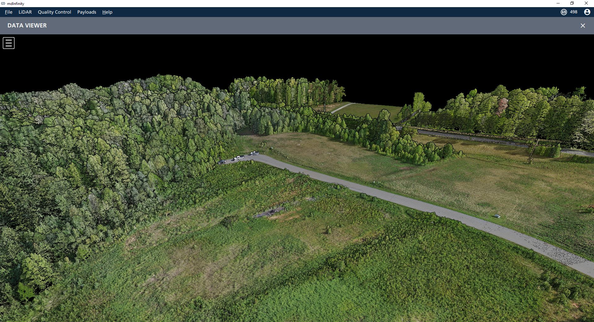
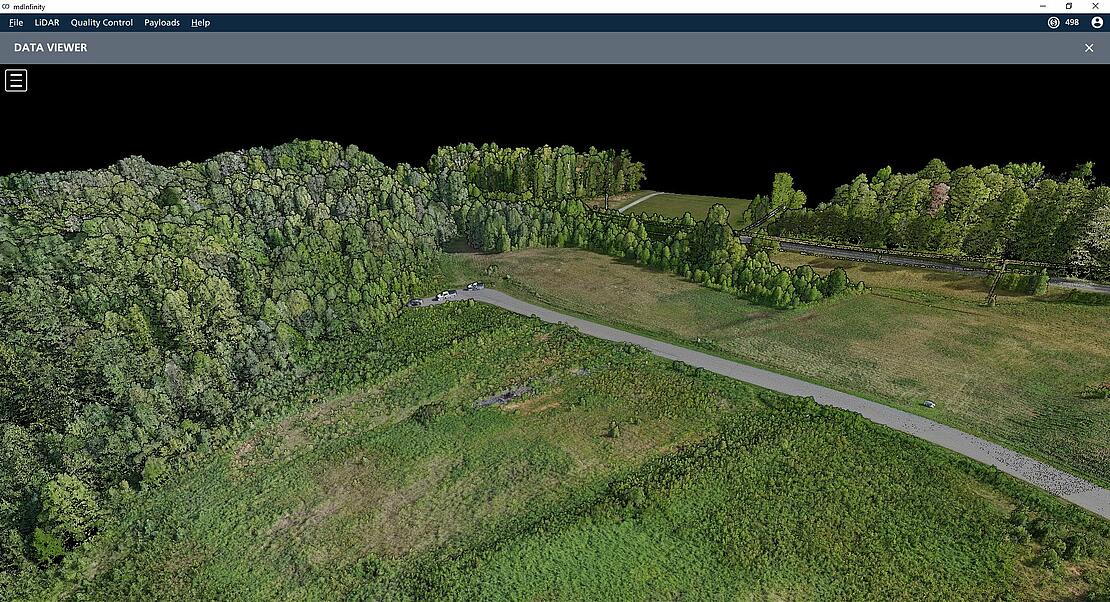
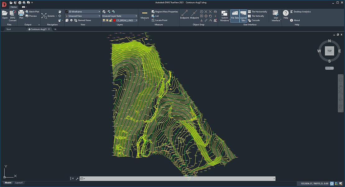
Look at the Drone Lidar Point Cloud created from the Allen Geomatics Design Survey Project
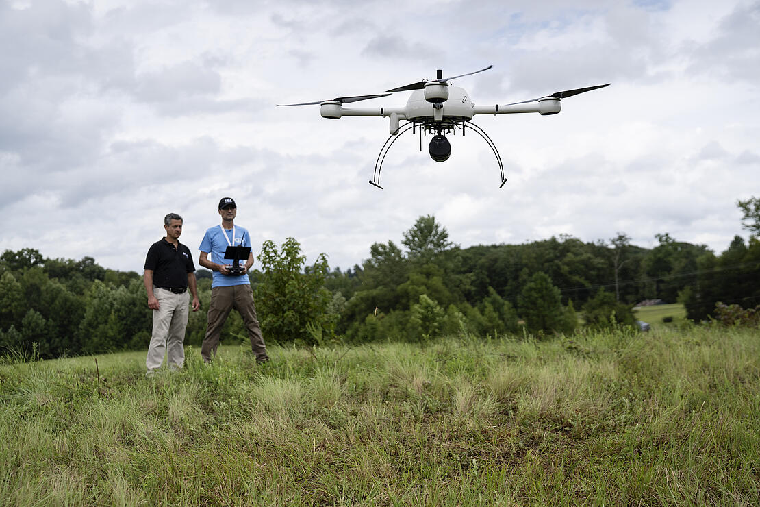
If you’ve watched Down to Earth, Into the Woods, then you know that the episodes compared traditional and drone surveying methods along with the data that was processed. Allen Geomatics, a land surveying and consulting firm located in Advance, NC, invited Microdrones to a design survey for a development project. The Allen team utilized a 3 man crew to collect their ground shots with a Total Station while Robert Chrismon, PLS, flew high in the sky with Drone LiDAR.
The data from the Lidar has been processed and is now available to view in an interactive LiDAR point cloud. The drone LiDAR data was collected using the mdLiDAR1000LR flying at a speed of 4.0 meters per second and an altitude of 80 meters. Click the image below to go to the point cloud viewer.
“Down to Earth” is a reality series that shows how real surveyors collect data and turn it into real deliverables, despite challenging terrain, rough weather, and hidden dangers.
These days, many surveying professionals are considering adding drone surveying equipment to their toolbox. In these episodes of Down to Earth, we meet Jeff Allen, PLS owner of Allen Geomatics P.C., a land surveying and consulting firm located in Advance, NC, who is also curious to see if drone surveying methods can enhance his practice.
That’s why he invited Robert Chrismon, PLS, a former surveying co-worker and early adopter of drone surveying equipment, to survey one of his development projects with drone LiDAR. Together they’ll compare the traditional methods of using a 3 man crew on the ground and Robert’s drone LiDAR system to create a digital map with 1 foot contours as a deliverable.
In episode 1, Robert meets up with Jeff and his crew at the site to assess the project, plan the mission and demonstrate the capabilities of using drone Lidar. Episode 2 sees the duo step into the woods to join the Allen Geomatics 3-man crew as they use a Total Station to collect their shots on the ground. Each surveying method faces challenges in the form of thick vegetation, changes in elevation, river embankments and more.
The Allen Geomatics office is where Episode 3 begins, as Robert and Jeff compare the results and assess the differences between the traditional and drone surveying data. Both the conventional and drone data are able to provide the final deliverables. The series concludes with the fourth episode set in a local restaurant, where Jeff and Robert review the project, workflow, and discuss the changing landscape of surveying technology, all while enjoying a cold beverage.
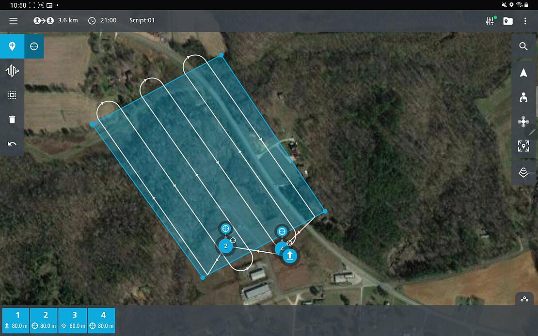
The Drone LiDAR Flight Plan
The mdLiDAR1000LR is a powerful drone LiDAR integrated system and the newest member of the GE industrial drone line that combines the lifting power, resilience, and efficiency of the Microdrones aircraft platform to carry a perfectly integrated Velodyne Ultra PUCK (VLP-32) LiDAR sensor to capture ultra-dense LiDAR data quickly and safely in the field and then turn it into a 3D point cloud.
Robert Chrismon created the flight plan and piloted the mdLiDAR1000LR while the crew from Allen Geomatics was actively surveying the site. Using mdCockpit he planned 1 flight to cover the 15 acre site. The altitude was set at 80 meters with Terrain Following enabled. The speed was 4.0 meters per second with 65% lateral overlap with a total flight duration of approximately 21 minutes and end up covering about 48 acres of the surounding area.
In Episode 2, you’ll see that Robert used the mdInfinity data processing module, trajectory quality control to confirm the validity of the trajectory data. This module exports a simple detailed report including the Mission Duration, the Number of Events, IMU continuity check or Base Station information amongst other information and details.
Process and Visualize
The point cloud was created and processed through the mdInfinity software suite using Trajectory Processing, Georeferencing, Precision Enhancement, Colorization and Ground Classification. Using these mdInfinity data processing modules, vegetation has been removed and the bare earth data can be further processed to develop digital terrain models.
The Main Advantages
As noted in Episode 3, one of the main advantages of using drone Lidar is the amount of time saved in the field. Robert’s flight was just over 20 minutes. Combine preparation and set-up, a job like this can be scanned in a few hours compared to 5 days on the ground collecting shots with a Total station.
The mdLiDAR1000LR system also provides a higher level of detail and better canopy penetration thanks to the large 90° horizontal LiDAR field of view and 32 layers of data being collected. This leads to millions of points of data collected as can be viewed in the interactive point cloud.
Data processing modules applied in mdInfinity create a unique layer per layer calibration process to enhance point cloud precision along with the ability to filter LiDAR data for point cloud quality enhancement resulting in best-in-class point cloud accuracy and precision.
If you would like to learn more about surveying with drone LiDAR CLICK HERE to speak with one of our friendly representatives.