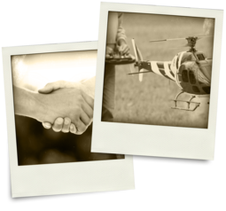
Integration. Aviation. Innovation. (and Friendship.) – The Story of Microdrones
The history of Microdrones is a story of friendship, tenacious innovation, and true passion for aviation. It’s also a story about integration – Microdrones’ greatest strength – and how we’ve brought together all the best pieces and put them together so that the whole is greater than the sum of its parts.
Catch a brief history of Microdrones and GeoCue and how these pioneering companies are coming together to help lead the digitalization of geospatial industries with powerful software, equipment, workflow and support that helps make drone LiDAR and photogrammetry easier to adopt.
The Runway
Vivien Heriard-Dubreuil, Microdrones president, developed his love of aviation as a young child. Trips to the Paris Air Show at Le Bourget, an uncle in the helicopter business, and hours spent building kites and rockets all fueled his interest in flying machines.
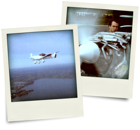
He knew from a young age that he wanted to work in aviation, eventually earning his pilot’s license and going on to engineering school. There, Vivien worked with his good friend on a project that involved forming a small company and building, testing, flying, and selling a two-seater airplane.
That youthful avocation provided the runway for years of professional work at major aviation companies including CAC Systems (now a subsidiary of Airbus) and SAGEM (now SAFRAN), among others.
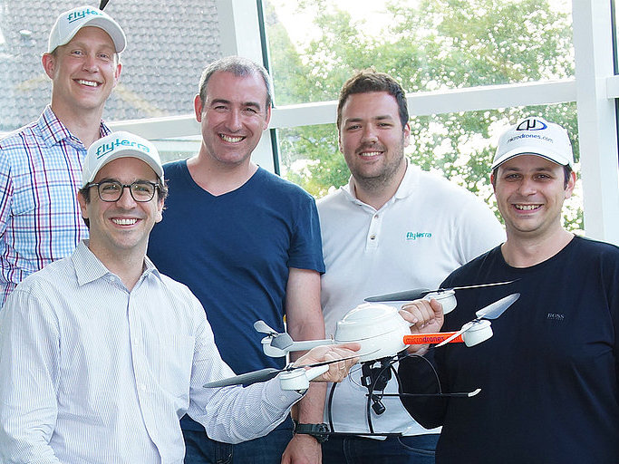
In this aviation work, Vivien saw the future opportunity for commercial drones and professional mapping applications. In early 2013, he acted on those insights and moved to the United States to start a drone services company in North America. Flyterra was born.
At the time, Canada had more relaxed laws regarding commercial use of drones, so Vivien opened the first Flyterra office in Quebec near the Center for Drone Excellence in Alma. By providing companies with the drone services they needed to produce good, usable data, Flyterra was able to gain in-depth insight into the needs of professional users.
They soon learned that to be able to provide truly effective services, they needed to be able to modify the platform to best fit the needs of each application. To do that, they would need to partner with manufacturers.
A Bet Among Friends Becomes a Globally Trusted Company
Meanwhile, in Germany, another innovator had been developing what would become the backbone of our company: the Microdrones unmanned aerial vehicle.
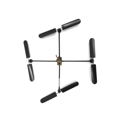
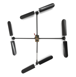
Like many tech companies, Microdrones began in a basement. The location was Siegen, Germany; the person was Udo Juerss, the inventor that would create the world’s first commercial quadcopter. But the catalyst for this achievement was a friendly bet.
A long-time family friend named Willi shared Udo’s enthusiasm for model aircraft. He often acquired expensive new models for his hobby fleet. One day, Willi excitedly showed Udo a pricey new titanium aircraft he had imported from Japan. He eagerly asked Udo what he thought. Udo collected model aircraft, but always suspected a 4-rotor design would perform better.
“Well, Willi . . . I think it’s the same rubbish you always show me!” said Udo. “Another neat gadget based on the same old concept: one main rotor plus one rear motor for stability. But it does not generate boost!”
“How would you propose they do that, Udo?” asked Willi.
“I assume a quadcopter would do much better,” Udo replied.
“And how exactly would you make such a thing fly, Udo?” Willi demanded.
“I bet you,” Udo declared, “that I can make a quadcopter and that I will make it fly.”
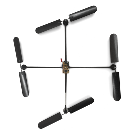
Udo dove into the subject of vertical take-off and landing (VTOL) aircraft, furiously reading and researching. He purchased a three-rotor platform and investigated. While he found the machine very interesting, he stuck with his idea that a quadcopter would perform better.
What began as a casual bet quickly became an obsession for Udo. He spent every spare moment in his basement working on his first drone and then outdoors in places like his grandmother’s garden testing his aircraft.
Siegener Nerd Builds UFO
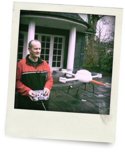
A curious neighbor who worked at a regional newspaper spotted the UAV in the sky and was excited to write about it. Soon after, the newspaper ran a story on Udo’s drone with the headline “Siegener Nerd Builds U.F.O”.
Others began to take notice of the aircraft. More and more, industry professionals started to approach Udo, asking if his drone could be used for specific applications. He became quickly aware of the value his machine held for commercial use.
From roof tilers to infrastructure engineers to academic researchers, when word got out about Udo's drone, people from many industries approached him asking if it could be used for applications in their industries. This demonstrated to Udo the market viability of his invention.
Convinced of the great potential for professional markets, Udo sought out others to build a company with him. He soon found Jan Wendel, algorithmic master, and Daniel Schübeler, aerodynamic expert. Together, they founded Microdrones in 2005.
In 2007, Udo’s son Sven Juerss joined Microdrones. Sven grew up with the company, flying drones over fields in the German countryside from a young age. Sven was integral in maintaining the company’s steady growth.

The company sold thousands of drones that achieved rave reviews from customers for their stability, payload capacity, endurance in rough weather, and long flight times.
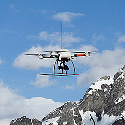
In the summer of 2013, Microdrones accomplished another feat: successfully crossing the Alps.
A Microdrones md4-1000 UAV became the first drone to cross the Alps, traveling a total distance of 12 kilometers or about 7.5 miles. Audiences were especially impressed that the md4-1000 flew in GPS Waypoint mode for this journey, so the flight route was completely automated.
More and more, the international community was taking notice of Microdrones and the aircraft they were producing. It was quickly becoming apparent to industry professionals that the company was producing rugged, reliable vehicles that could help them perform tasks more safely and efficiently.

From the Best Commercial Quadcopter to Complete Professional Solutions
Back in the United States and Canada, Vivien and the Flyterra team began delving into their goal of developing custom solutions for specific industrial applications. They knew that getting the best possible results meant integrating the best possible sensors and aircraft in the smartest configuration with the best software.
To produce these complete, application-specific solutions, they had to start with extraordinary aircraft that would be the basis for each package. They began to look for drone manufacturers with whom they could partner.
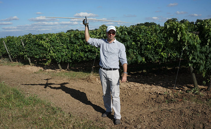
“Being from France, we first started looking at French manufacturers,” explained Vivien. “We were very interested in working with the French fixed-wing UAV company Delair-Tech. To us, their drones were clearly the best and we felt they had the most potential. The team investigated their options and in 2013 they forged an agreement with Delair-Tech and began using, modifying, and selling their drones.
But Flyterra would also need vertical take-off and landing (VTOL) aircraft. “Quadcopters offer outstanding flexibility and ease of use,” explained Vivien. “We wanted to be able to offer a complete line-up of solutions to best suit the needs of industry professionals.
After researching many manufacturers, they determined Microdrones was the clear choice.
“The technology was very, very good,” said Vivien of the drones’ endurance, payload capacity, stability, and resistance to tough environmental challenges. “I was excited to hone their system.”
Vivien began investing in Microdrones and Delair-Tech under the company name ProDrones and continued to provide UAV services under the name Flyterra. They started a third company, Avyon, to sell the drone systems to those customers who preferred to own and operate their own aircraft, rather than to hire out services.
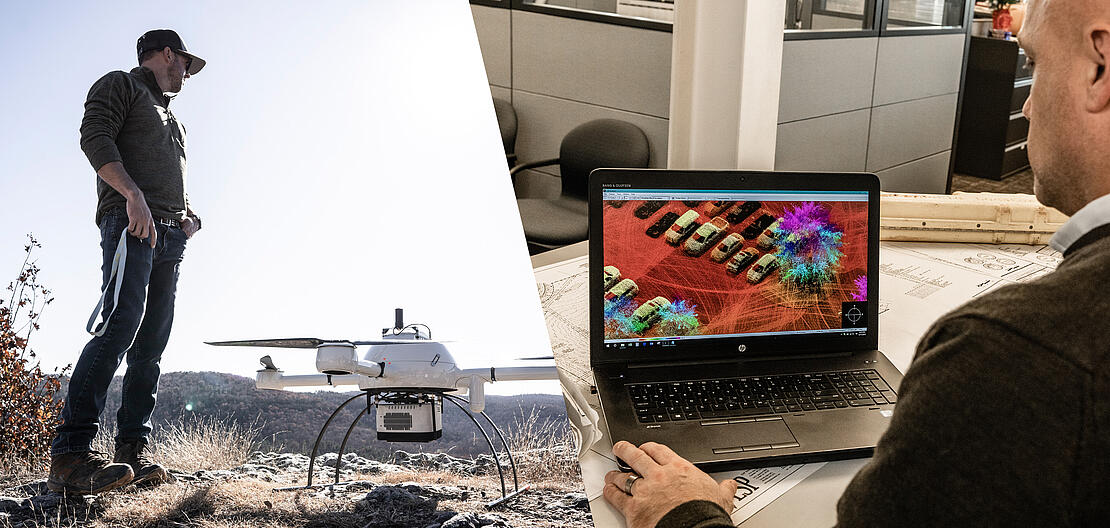
All of these companies benefitted from Flyterra’s continued field experience as they gained important knowledge of key markets. Having tested the drones extensively with various payloads in the field, Vivien knew the importance of developing very specific integrations for every application and of incorporating just the right software to make sure the data was usable.
“For the drones to do their job, we had to make sure we had all the pieces just right,” said Vivien. “We focused on selecting the best aircraft as the basis of our platforms, and then identifying the best payloads and configurations to meet the needs of users for specific applications. Then we used them extensively in providing services for customers to fine-tune our offering. This is why our mapping packages are the best available today.”
The Marriage of Payloads and Platforms
Over time, Avyon helped to build Microdrones’ business throughout North America by implementing successful solutions and services that incorporated Microdrones aircraft.
The company offered complete solutions that integrated Microdrones aircraft with the right payloads for specific commercial applications like surveying, mapping, inspection, mining, construction, and precision agriculture.
In 2016, Microdrones and Avyon merged, keeping the name Microdrones.
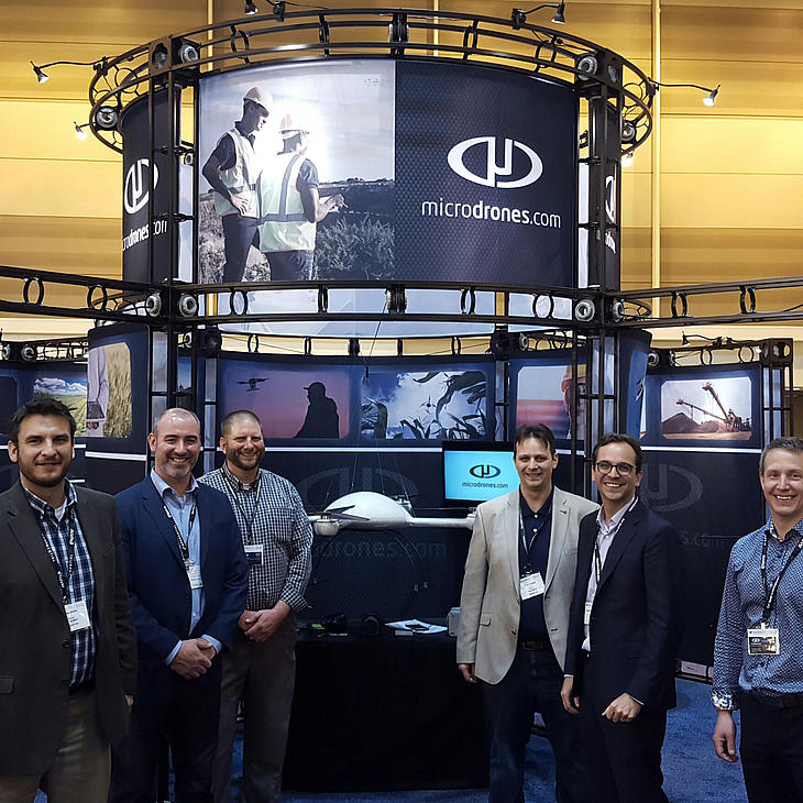
Dedicated, Talented People, Elevating the Way Work Gets Done.
With a powerful sales, support and distribution network, Microdrones continues to lead the commercial drone industry with fully integrated systems.
Quick History
2001
Udo Juerss invents the first modern quadcopter in Siegen (Germany).

2005
Udo Juerss, Jan Wendel and Daniel Schübeler found Microdrones and begin production of the md4-200.
2012
Vivien Hériard-Dubreuil cofounds Avyon in North America to develop payloads and software for drone based applications.

2016
Avyon merges its operations in North America into Microdrones and shifts the strategy from a UAV manufacturer to a fully integrated professional solutions provider.
Focus on becoming a leader in Surveying / Mapping. Partnership with Trimble.
2018
Navmatica ME acquisition to expand to Middle East.
Schübeler Technologies acquisition results in reinforcing R&D capabilities and gaining critical expertise in key components of our platforms.
By the end of 2016, geospatial giant Trimble and Microdrones forged a world-wide distribution agreement, making Microdrones and Delair-Tech Trimble’s preferred providers of quadcopter and fixed wing UAVs, respectively.
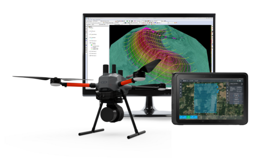
In 2016 Microdrones launched its aerial mapping solutions – complete packages including everything professionals need for applications like surveying, area mapping, corridor mapping, inspection, volumetrics, precision agriculture monitoring, construction, mining, and much more.
In 2017, the md4-3000 aircraft officially became available for sale. Microdrones’ largest aircraft yet, md4-3000 can carry up to 11 lbs and fly up to 45 minutes, depending on payload and conditions.
In 2018 Microdrones completed the first phase of an ambitious expansion by adding a new 2080 sqm. (22,000 sq. ft.) facility in Siegen, Germany, as well as a satellite office in Toulouse, France.
In 2018 the global expansion continued with mergers and acquisitions including geomatics service provider Navmatica in Dubai, which helps Microdrones establish a foothold in the promising market for commercial drones in the Middle East.
Meanwhile, Microdrones expanded the depth of their integrated solutions product line with the launch of three new systems: mdLiDAR3000, mdMapper1000PPK and mdMapper1000+. The expanded lineup allows their customers to match the most acceptable solution to their needs.
During late 2018, Microdrones also merged with Schübeler Technologies, providing access to a full lineup of robust turbo fans, jets, compressors, pumps, electric motors, carbon fiber and aluminum composites to further distinguish their advanced UAV systems.
In 2019, Microdrones continued to expand its global footprint by adding distributors to its network worldwide. As the use of drone LiDAR technology proliferated, more geospatial professionals sought to add drone surveying equipment to their toolbox.
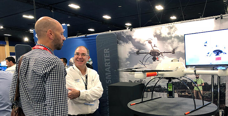
To help support the growth, Microdrones launched a global events initiative targeting local, regional, and more intimate conferences and events to expand their support network and target new prospects. This Events World Tour kicked off in January and continues to engage with key user communities and prospective customers all around the globe.
Microdrones continued to refine and strengthen its core lines in 2019 and did so while ensuring clients could upgrade within the system – knowing that clients deserved easy, integrated access to the latest tech available in the drone surveying space.
In 2020 Microdrones launched mdInfinity marking a new era in drone data processing efficiency. mdInfinity is the next phase in the development of Microdrones, becoming the backbone of the product ecosystem, providing customers with several data processing modules to process geospatial data easily, quickly, and efficiently.

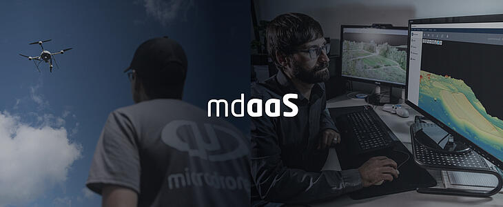
The company also created a solution to one of the biggest challenges in the drone surveying market: access. Fully capable drones that meet the extensive needs of surveyors and geomatics professionals were costly. With that in mind, Microdrones introduced Microdrones as a Service (mdaaS) which featured drone surveying solutions, including everything needed to do drone LiDAR and surveying the right way, with convenient hardware and software packages and affordable monthly payment options.
Microdrones as a Service helped propel the industry and expand the market from innovators and early adopters to make drone surveying equipment widely available. Clients were able to configure their equipment needs, service, and integrated software according to changing business needs and anticipated usage via reasonably priced options in a subscription model.
In early 2021, building upon the momentum of mdaaS, Microdrones unveiled the next generation of industry-leading drone LiDAR surveying equipment, the mdLiDAR1000HR. HR means high-resolution pointclouds and increased coverage is made easier and more accessible than ever, allowing more of the surveying community access to a quality UAV LiDAR solution.
A transformative partnership between GE and Microdrones was announced in July of 2021, which led to the development of the GE industrial drone line based on the existing Microdrones 1000 series but featuring numerous improvements to efficiency and safety. The partnership will accelerate the deployment of Microdrones survey equipment as an essential tool for the creation and maintenance of digital twins, digital terrain models, maps, and other geospatial products.
The mdLiDAR1000LR system helps professionals collect data from a longer range, (especially helpful when working in steep or treacherous terrain) while covering more area per flight.
In addition to the GE partnership, Microdrones also added an impressive new product to their existing technology portfolio. The mdLiDAR1000LR system helps professionals collect data from a longer range, (especially helpful when working in steep or treacherous terrain) while covering more area per flight.
With the continued development of its product line and increased access for all clients, as well as the remarkable opportunities presented by a partnership with GE, 2021 marks a turning point toward an expanding future in the drone survey equipment and software industry for Microdrones.
In 2022 and beyond, Microdrones will continue to offer best-in-class R&D, manufacturing, software, sales, service, and support to transform customer needs into effective, efficient, end-to-end systems for professionals.
What began as a shared passion and a bet among friends is now a rapidly emerging global technology, providing complete and reliable mapping systems specifically developed for the surveying, mining, construction, oil & gas, and precision agriculture industries. All of these qualities – plus a proven track record of performance and customer service – are why more and more professional users rely on Microdrones to transform raw data collected in the field into valuable high-quality survey-grade data.