A GNSS receiver chip that combines the power of all existing satellite-based positioning systems around the globe (GPS, GLONASS, Galileo, and Beidou), dramatically improving accuracy. This provides superior positioning and increased efficiency, while reducing the risks of breakdown and missed data.
Complete Drone LiDAR and Photogrammetry Systems for Surveying, Mapping, and GIS
Not just drones. Microdrones products include everything professionals need for aerial surveying, mapping, and other geospatial applications.
Everything You Need for Drone Surveying and Mapping
Aerial surveying is not just about the aircraft. It’s about total UAV systems, complete with drone surveying equipment, software, workflow, training and support.
Our EasyOne packages integrate high-performance drones with advanced TrueView LiDAR sensors and LP360 data processing software. They’re designed for quick learning and easy use, so you can get your UAV services off the ground immediately.
Why Use Drones for Surveying?
Surveying and mapping professionals are quickly turning to unmanned solutions to perform work better. Microdrones mdLiDAR packages help you to:
- Be more efficient and save time. Spend less time in the field collecting data.
- Stay competitive. UAVs are becoming an industry standard. Customers are asking for UAV surveying – and smart companies are preparing to deliver. Providing UAS mapping services shows that a business is an industry leader at the forefront of technology.
- Be safer. Easily complete projects in areas that are difficult or dangerous to access – such as challenging terrain, crumbling structures, high locations, and areas effected by natural disasters.
- Survey operating worksites. You’ll no longer have to stop work and equipment to collect the data you need.
- Expand your offering. By incorporating various payloads and technologies into your system, you can increase the number of services and deliverables you can provide for clients.
- Slash your post-processing times. Our DG systems enable you to post-process data in a fraction of the time.
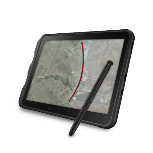
The Industry’s Best UAS for Corridor Mapping
The majority of surveying and mapping jobs are corridor mapping projects involving roads, railways, powerlines, and other linear structures and locations.
Our systems are ideal for corridor mapping. They deliver exceptional results and avoids the wasted images and risks involved in using a fixed wing solution.
Envision achieving incredible accuracy in one line with no ground control points.
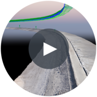
LOOK AT ALL OF THESE BEAUTIFUL DRONE SURVEYING DATASETS!
See what your industry peers are doing!
The number one question we get asked about our direct georeferencing solutions is:
So, what is direct georeferencing?
Direct georeferencing is a highly accurate and efficient method of collecting georeferenced data. While traditional surveying methods (aerial triangulation), RTK, and PPK all require some of the data to be calculated, DG systems actually measure X, Y, and Z in real time – yielding superior results that will save you significant time on the job.
How does it do this?
While the exceptional results from these systems are due to the entire combination of integrated components, one is of elevated importance: the Applanix APX-15 UAV.
APX-15 combines two key parts:
An inertial measurement unit (IMU) that instantly measures the orientation angles of the aircraft – so, unlike other methods, this system measures X, Y, AND Z for extreme accuracy. It also drastically reduces the amount of time spent on data collection and post-processing.
No GCPs Needed
Say goodbye to the hassle of ground control points. With direct georeferencing, GCPs are no longer needed, so you can complete jobs more quickly and safely – especially in dangerous, hard-to-reach places.